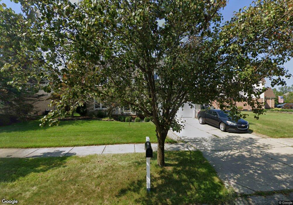
44948 Seabrook Dr Canton, MI 48188
Estimated Value: $538,782 - $576,000
4
Beds
3
Baths
2,500
Sq Ft
$225/Sq Ft
Est. Value
About This Home
This home is located at 44948 Seabrook Dr, Canton, MI 48188 and is currently estimated at $563,446, approximately $225 per square foot. 44948 Seabrook Dr is a home located in Wayne County with nearby schools including Bentley Elementary School, Canton High School, and Plymouth High School.
Ownership History
Date
Name
Owned For
Owner Type
Purchase Details
Closed on
Jul 1, 2009
Sold by
Lasalle Bank National Association
Bought by
Navarrete Leah
Current Estimated Value
Purchase Details
Closed on
Sep 25, 2008
Sold by
Mortgage Electronic Registration Systems
Bought by
Lasalle Bank Na
Purchase Details
Closed on
Aug 20, 2008
Sold by
Joseph William E and Joseph Kim D
Bought by
Mortgage Electronic Registration Systems
Create a Home Valuation Report for This Property
The Home Valuation Report is an in-depth analysis detailing your home's value as well as a comparison with similar homes in the area
Home Values in the Area
Average Home Value in this Area
Purchase History
| Date | Buyer | Sale Price | Title Company |
|---|---|---|---|
| Navarrete Leah | $190,000 | None Available | |
| Lasalle Bank Na | -- | E Title Agency Inc | |
| Mortgage Electronic Registration Systems | $245,000 | None Available |
Source: Public Records
Tax History
| Year | Tax Paid | Tax Assessment Tax Assessment Total Assessment is a certain percentage of the fair market value that is determined by local assessors to be the total taxable value of land and additions on the property. | Land | Improvement |
|---|---|---|---|---|
| 2025 | $3,340 | $259,800 | $0 | $0 |
| 2024 | $3,245 | $235,500 | $0 | $0 |
| 2023 | $3,094 | $215,600 | $0 | $0 |
| 2022 | $6,700 | $191,600 | $0 | $0 |
| 2021 | $6,138 | $177,800 | $0 | $0 |
| 2020 | $6,062 | $171,600 | $0 | $0 |
| 2019 | $5,950 | $166,220 | $0 | $0 |
| 2018 | $2,480 | $157,120 | $0 | $0 |
| 2017 | $6,009 | $153,000 | $0 | $0 |
| 2016 | $5,474 | $150,200 | $0 | $0 |
| 2015 | $13,800 | $145,270 | $0 | $0 |
| 2013 | $13,371 | $139,460 | $0 | $0 |
| 2010 | -- | $123,590 | $58,686 | $64,904 |
Source: Public Records
Map
Nearby Homes
- 45169 Middlebury Ln
- 43935 Marne Ct
- 1550 Valentine Ct
- 43761 Yorktown St
- 2210 Woodmont Dr W
- 46501 Killarney Cir
- 2053 Brookfield St
- 2545 Woodmont Dr E
- 1752 Thistle Dr
- 1632 Bennington Ct Unit 1632
- 407 Fairfield Ct
- 43552 Karli Ln
- 43486 Fredericksburg St
- 2131 Vine Way Dr Unit 97
- 0000 W Denton Rd
- 1849 Wentworth Ct
- 802 Cherry Stone Dr
- 2428 Cabot St
- 43880 Cherry Grove Ct W
- 321 Cherry Grove Rd
- 44974 Seabrook Dr
- 44900 Seabrook Dr
- 1583 Glengarry Blvd
- 44876 Seabrook Dr
- 44957 Seabrook Dr
- 44941 Seabrook Dr
- 44870 Seabrook Dr
- 44973 Seabrook Dr
- 44909 Seabrook Dr
- 1535 Glengarry Blvd
- 44893 Seabrook Dr
- 44864 Seabrook Dr
- 44877 Seabrook Dr
- 1606 Glengarry Blvd
- 1584 Glengarry Blvd
- 1493 Glengarry Blvd
- 1562 Glengarry Blvd
- 44845 Seabrook Dr
- 45005 Seabrook Dr
- 1538 Glengarry Blvd
Your Personal Tour Guide
Ask me questions while you tour the home.