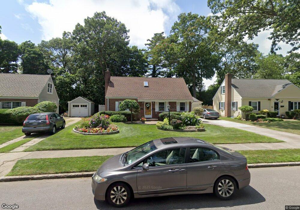
45 Brixton Rd Merrick, NY 11566
Estimated Value: $764,753 - $807,000
4
Beds
2
Baths
1,575
Sq Ft
$499/Sq Ft
Est. Value
About This Home
This home is located at 45 Brixton Rd, Merrick, NY 11566 and is currently estimated at $785,877, approximately $498 per square foot. 45 Brixton Rd is a home located in Nassau County with nearby schools including Merrick Avenue Middle School, Sanford H Calhoun High School, and Sacred Heart School.
Ownership History
Date
Name
Owned For
Owner Type
Purchase Details
Closed on
Oct 23, 2020
Sold by
Heaney Regina
Bought by
Heaney Trust
Current Estimated Value
Purchase Details
Closed on
Aug 13, 2015
Sold by
Calabro Anthony and Calabro Gina
Bought by
Heaney Arthur and Heaney Regina
Home Financials for this Owner
Home Financials are based on the most recent Mortgage that was taken out on this home.
Original Mortgage
$120,000
Interest Rate
3.22%
Mortgage Type
New Conventional
Create a Home Valuation Report for This Property
The Home Valuation Report is an in-depth analysis detailing your home's value as well as a comparison with similar homes in the area
Home Values in the Area
Average Home Value in this Area
Purchase History
| Date | Buyer | Sale Price | Title Company |
|---|---|---|---|
| Heaney Trust | -- | None Available | |
| Heaney Arthur | $475,000 | Westcor Land Title Ins Co |
Source: Public Records
Mortgage History
| Date | Status | Borrower | Loan Amount |
|---|---|---|---|
| Previous Owner | Heaney Arthur | $120,000 |
Source: Public Records
Tax History
| Year | Tax Paid | Tax Assessment Tax Assessment Total Assessment is a certain percentage of the fair market value that is determined by local assessors to be the total taxable value of land and additions on the property. | Land | Improvement |
|---|---|---|---|---|
| 2025 | $13,556 | $472 | $189 | $283 |
| 2024 | $3,427 | $471 | $189 | $282 |
Source: Public Records
Map
Nearby Homes
- 1261 Meadowbrook Rd
- 1817 Gardenia Ave
- 1481 N Meadow Rd
- 1165 Meadowbrook Rd
- 1425 Jerusalem Ave Unit 7
- 1844 Old Mill Rd
- 9 Aster Ave
- 25 Old Mill Rd
- 1415 Rhode Ave
- 204 Maeder Ave
- 840 Jerusalem Ave
- 20 Iris Ave
- 1719 William St
- 1277 Jerusalem Ave
- 1259 Jerusalem Ave
- 966 Tyrus Ct
- 1526 Rhode Ave
- 35 Roydon Dr N
- 165 Little Whaleneck Rd
- 614 Bond Ct
Your Personal Tour Guide
Ask me questions while you tour the home.