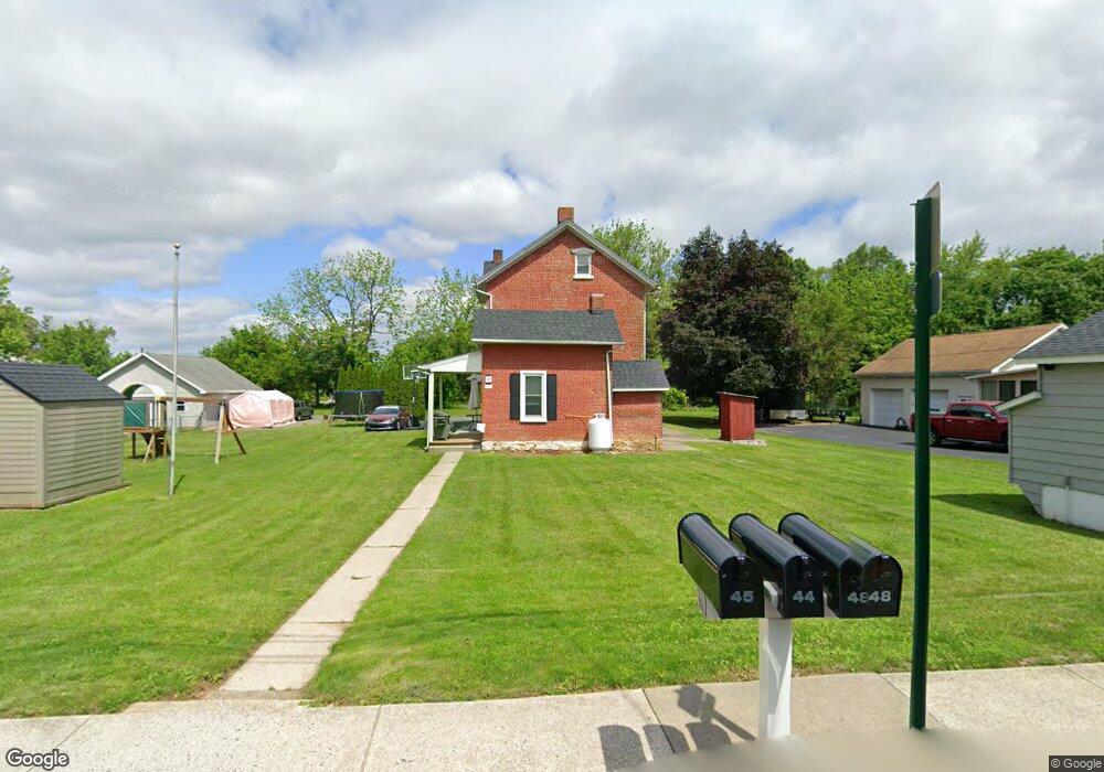
45 E 2nd St Alburtis, PA 18011
Estimated Value: $254,000 - $338,000
3
Beds
2
Baths
1,170
Sq Ft
$264/Sq Ft
Est. Value
About This Home
This home is located at 45 E 2nd St, Alburtis, PA 18011 and is currently estimated at $309,186, approximately $264 per square foot. 45 E 2nd St is a home located in Lehigh County with nearby schools including Alburtis Elementary School, Lower Macungie Middle School, and Emmaus High School.
Ownership History
Date
Name
Owned For
Owner Type
Purchase Details
Closed on
Nov 21, 2019
Sold by
Leman Michael A and Leman Kelly L
Bought by
Derr Donald J
Current Estimated Value
Purchase Details
Closed on
Sep 9, 2016
Sold by
Ruff Daniel C and Ruff Andrea L
Bought by
Leman Michael A and Leman Kelly L
Home Financials for this Owner
Home Financials are based on the most recent Mortgage that was taken out on this home.
Original Mortgage
$155,000
Interest Rate
3.48%
Mortgage Type
New Conventional
Purchase Details
Closed on
May 20, 1994
Sold by
Oels Fay B
Bought by
Ruff Daniel C and Ruff Andrea L
Create a Home Valuation Report for This Property
The Home Valuation Report is an in-depth analysis detailing your home's value as well as a comparison with similar homes in the area
Home Values in the Area
Average Home Value in this Area
Purchase History
| Date | Buyer | Sale Price | Title Company |
|---|---|---|---|
| Derr Donald J | -- | None Available | |
| Leman Michael A | $155,000 | None Available | |
| Ruff Daniel C | -- | -- | |
| Ruff Daniel C | -- | -- |
Source: Public Records
Mortgage History
| Date | Status | Borrower | Loan Amount |
|---|---|---|---|
| Previous Owner | Leman Michael A | $155,000 |
Source: Public Records
Tax History
| Year | Tax Paid | Tax Assessment Tax Assessment Total Assessment is a certain percentage of the fair market value that is determined by local assessors to be the total taxable value of land and additions on the property. | Land | Improvement |
|---|---|---|---|---|
| 2026 | $4,826 | $159,800 | $39,700 | $120,100 |
| 2025 | $4,692 | $159,800 | $39,700 | $120,100 |
| 2024 | $4,572 | $159,800 | $39,700 | $120,100 |
| 2023 | $4,360 | $159,800 | $39,700 | $120,100 |
| 2022 | $4,269 | $159,800 | $120,100 | $39,700 |
| 2021 | $4,189 | $159,800 | $39,700 | $120,100 |
| 2020 | $4,153 | $159,800 | $39,700 | $120,100 |
| 2019 | $4,131 | $159,800 | $39,700 | $120,100 |
| 2018 | $4,084 | $159,800 | $39,700 | $120,100 |
| 2017 | $4,022 | $159,800 | $39,700 | $120,100 |
| 2016 | -- | $159,800 | $39,700 | $120,100 |
| 2015 | -- | $159,800 | $39,700 | $120,100 |
| 2014 | -- | $159,800 | $39,700 | $120,100 |
Source: Public Records
Map
Nearby Homes
- 22 Front St
- 112 Front St
- 122 Front St
- 428 Thomas St
- 442 Franklin St
- 226 Front St
- 195 Maple Ct
- 317 W 2nd St
- 314 Ridgeview Dr
- 52 W 5th St
- 7707 Racite Rd
- 7719 Barrow Dr
- 3797 Chestnut Rd
- 7524 Scenic View Dr
- 8014 Heritage Dr
- 1863 Aster Rd
- 0 Clauss Hunt Knight Dr Unit 10 Units
- 2301 Goldenrod Dr
- 7699 Catalpa Dr
- 3889 Fire Brick Rd
Your Personal Tour Guide
Ask me questions while you tour the home.