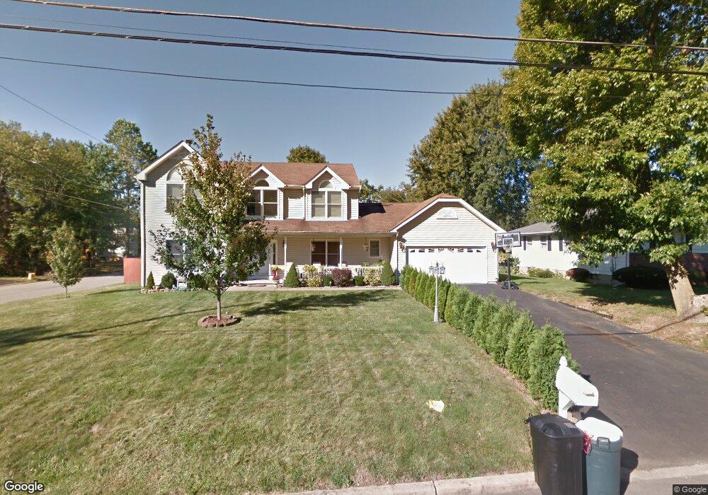
45 Rhodes Ave Ewing, NJ 08638
Braeburn Heights NeighborhoodEstimated Value: $506,644 - $609,000
Studio
--
Bath
2,328
Sq Ft
$237/Sq Ft
Est. Value
About This Home
This home is located at 45 Rhodes Ave, Ewing, NJ 08638 and is currently estimated at $551,161, approximately $236 per square foot. 45 Rhodes Ave is a home located in Mercer County with nearby schools including Ewing High School, Paul Robeson Charter School For The Humanities, and Trenton Stem-To-Civics Charter School.
Ownership History
Date
Name
Owned For
Owner Type
Purchase Details
Closed on
Jul 25, 2007
Sold by
Douglas Le S and Douglas Lesean Douglas
Bought by
Cooke Dalton and Whittaker Cookeshani
Current Estimated Value
Home Financials for this Owner
Home Financials are based on the most recent Mortgage that was taken out on this home.
Interest Rate
6.73%
Purchase Details
Closed on
Dec 18, 2001
Sold by
Ashton Dev Inc
Bought by
Douglas Lesean
Home Financials for this Owner
Home Financials are based on the most recent Mortgage that was taken out on this home.
Original Mortgage
$202,112
Interest Rate
6.72%
Purchase Details
Closed on
Sep 14, 2001
Sold by
Alaska Seaboard Partners Lp
Bought by
Ashton Development Inc
Purchase Details
Closed on
May 20, 1996
Sold by
Decd Joseph Speciale
Bought by
Ford Gregory and Ford Joyce
Home Financials for this Owner
Home Financials are based on the most recent Mortgage that was taken out on this home.
Original Mortgage
$26,000
Interest Rate
7.77%
Create a Home Valuation Report for This Property
The Home Valuation Report is an in-depth analysis detailing your home's value as well as a comparison with similar homes in the area
Home Values in the Area
Average Home Value in this Area
Purchase History
We collect this data history from publicly available records. To have your information removed, we recommend requesting removal directly through your county’s website.
| Date | Buyer | Sale Price | Title Company |
|---|---|---|---|
| Cooke Dalton | -- | -- | |
| Douglas Lesean | $212,750 | -- | |
| Ashton Development Inc | $80,000 | -- | |
| Ford Gregory | $33,000 | -- |
Source: Public Records
Mortgage History
We collect this data history from publicly available records. To have your information removed, we recommend requesting removal directly through your county’s website.
| Date | Status | Borrower | Loan Amount |
|---|---|---|---|
| Closed | Cooke Dalton | -- | |
| Previous Owner | Douglas Lesean | $202,112 | |
| Previous Owner | Ford Gregory | $26,000 |
Source: Public Records
Tax History
| Year | Tax Paid | Tax Assessment Tax Assessment Total Assessment is a certain percentage of the fair market value that is determined by local assessors to be the total taxable value of land and additions on the property. | Land | Improvement |
|---|---|---|---|---|
| 2025 | $11,744 | $298,600 | $51,500 | $247,100 |
| 2024 | $11,039 | $298,600 | $51,500 | $247,100 |
| 2023 | $11,039 | $298,600 | $51,500 | $247,100 |
| 2022 | $10,741 | $298,600 | $51,500 | $247,100 |
| 2021 | $10,478 | $298,600 | $51,500 | $247,100 |
| 2020 | $10,329 | $298,600 | $51,500 | $247,100 |
| 2019 | $10,060 | $298,600 | $51,500 | $247,100 |
| 2018 | $9,513 | $180,100 | $39,000 | $141,100 |
| 2017 | $9,734 | $180,100 | $39,000 | $141,100 |
| 2016 | $9,603 | $180,100 | $39,000 | $141,100 |
| 2015 | $9,475 | $180,100 | $39,000 | $141,100 |
| 2014 | $9,450 | $180,100 | $39,000 | $141,100 |
Source: Public Records
Map
Nearby Homes
- 140 Crescent Ave
- 104 King Ave
- 1 Sussex St
- 201 Inland Ave
- 36 Browning Ave
- 158 Woodland Ave
- 40 Arden Ave
- 100 Carnine Ave
- 10 Hawthorne Ave
- 360 Hollowbrook Rd
- 37 Central Ave
- 50 Groveland Ave
- 24 Keswick Ave
- 20 Steinway Ave
- 45 Central Ave
- 16 Bittersweet Rd
- 27 Walton Ave
- 23 Sundew Dr
- 1005 Terrace Blvd
- 126 Rutledge Ave
Your Personal Tour Guide
Ask me questions while you tour the home.