Estimated Value: $206,000 - $236,962
About This Home
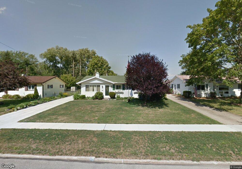
This home is located at 450 Laurel Dr, Berea, OH 44017 and is currently estimated at $222,991, approximately $147 per square foot. 450 Laurel Dr is a home located in Cuyahoga County with nearby schools including Grindstone Elementary School, Berea-Midpark Middle School, and Berea-Midpark High School.
Ownership History
We collect this data history from publicly available records. To have your information removed, we recommend requesting removal directly through your county’s website.
Purchase Details
Purchase Details
Purchase Details
Purchase Details
Home Values in the Area
Average Home Value in this Area
Purchase History
We collect this data history from publicly available records. To have your information removed, we recommend requesting removal directly through your county’s website.
| Date | Buyer | Sale Price | Title Company |
|---|---|---|---|
| -- | Attorney | ||
| -- | Attorney | ||
| -- | -- | ||
| -- | -- |
Tax History
We collect this data history from publicly available records. To have your information removed, we recommend requesting removal directly through your county’s website.
| Year | Tax Paid | Tax Assessment Tax Assessment Total Assessment is a certain percentage of the fair market value that is determined by local assessors to be the total taxable value of land and additions on the property. | Land | Improvement |
|---|---|---|---|---|
| 2025 | $3,423 | $68,985 | $12,390 | $56,595 |
| 2024 | $3,434 | $68,985 | $12,390 | $56,595 |
| 2023 | $2,919 | $51,240 | $10,010 | $41,230 |
| 2022 | $2,929 | $51,240 | $10,010 | $41,230 |
| 2021 | $2,902 | $51,240 | $10,010 | $41,230 |
| 2020 | $2,671 | $43,400 | $8,470 | $34,930 |
| 2019 | $2,600 | $124,000 | $24,200 | $99,800 |
| 2018 | $1,293 | $43,400 | $8,470 | $34,930 |
| 2017 | $2,506 | $39,910 | $7,250 | $32,660 |
| 2016 | $2,488 | $39,910 | $7,250 | $32,660 |
| 2015 | $2,509 | $39,910 | $7,250 | $32,660 |
| 2014 | $2,509 | $42,000 | $7,630 | $34,370 |
Map
- 449 Birchwood Dr
- 403 Barrett Rd
- 340 Hickory Dr
- 889 Grayton Rd
- 369 Fern Dr
- 82 Stonesthrow Dr
- 270 Riveredge Pkwy
- 105 Limestone Ct
- 106 Clay Ct
- 108 Clay Ct
- 108 Yellowstone Ct
- 6407 Parkland Ave
- 106 Pebble Ct
- 6574 Burton Dr
- 111 Slippery Rock Ln
- 119 River Rock Way
- 21 Lincoln Ave
- 145 Edgewood Dr
- 0 River Rd Unit 5169658
- 221 Mulberry St
Ask me questions while you tour the home.