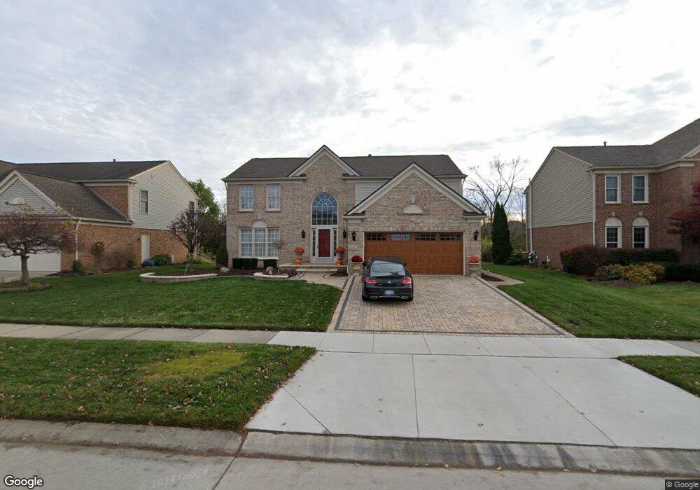
45069 Seabrook Dr Canton, MI 48188
Estimated Value: $494,126 - $594,000
Studio
3
Baths
2,477
Sq Ft
$225/Sq Ft
Est. Value
About This Home
This home is located at 45069 Seabrook Dr, Canton, MI 48188 and is currently estimated at $558,032, approximately $225 per square foot. 45069 Seabrook Dr is a home located in Wayne County with nearby schools including Bentley Elementary School, Canton High School, and Plymouth High School.
Ownership History
Date
Name
Owned For
Owner Type
Purchase Details
Closed on
Jun 27, 2025
Sold by
Rouillard Martin P
Bought by
Rouillard Martin P and Kochis-Rouillard Mary Ellen
Current Estimated Value
Purchase Details
Closed on
Dec 10, 2003
Sold by
Marcuccilli Linda C
Bought by
Rouillard Martin P
Purchase Details
Closed on
Aug 28, 2003
Sold by
Marcuccilli Linda C
Bought by
Rouillard Martin P
Purchase Details
Closed on
Jun 23, 1995
Sold by
Pulte Homes Of Michigan
Bought by
Marcuccilli Martin and Marcuccilli Linda
Create a Home Valuation Report for This Property
The Home Valuation Report is an in-depth analysis detailing your home's value as well as a comparison with similar homes in the area
Home Values in the Area
Average Home Value in this Area
Purchase History
We collect this data history from publicly available records. To have your information removed, we recommend requesting removal directly through your county’s website.
| Date | Buyer | Sale Price | Title Company |
|---|---|---|---|
| Rouillard Martin P | -- | None Listed On Document | |
| Rouillard Martin P | -- | -- | |
| Rouillard Martin P | -- | First American Title Ins Co | |
| Marcuccilli Martin | $224,215 | -- |
Source: Public Records
Tax History
| Year | Tax Paid | Tax Assessment Tax Assessment Total Assessment is a certain percentage of the fair market value that is determined by local assessors to be the total taxable value of land and additions on the property. | Land | Improvement |
|---|---|---|---|---|
| 2025 | $3,128 | $248,400 | $0 | $0 |
| 2024 | $3,039 | $229,000 | $0 | $0 |
| 2023 | $2,897 | $212,700 | $0 | $0 |
| 2022 | $6,285 | $189,000 | $0 | $0 |
| 2021 | $6,097 | $184,200 | $0 | $0 |
| 2020 | $6,018 | $178,100 | $0 | $0 |
| 2019 | $5,907 | $169,090 | $0 | $0 |
| 2018 | $2,461 | $158,960 | $0 | $0 |
| 2017 | $5,966 | $154,900 | $0 | $0 |
| 2016 | $5,367 | $150,200 | $0 | $0 |
| 2015 | $13,523 | $143,820 | $0 | $0 |
| 2013 | $13,100 | $142,350 | $0 | $0 |
| 2010 | -- | $125,910 | $57,855 | $68,055 |
Source: Public Records
Map
Nearby Homes
- 2210 Woodmont Dr W
- 46501 Killarney Cir
- 1675 S Sheldon Rd
- 345 Canton Center Rd
- 2481 Woodmont Dr E
- 1752 Thistle Dr
- 1774 Thistle Dr
- 2053 Brookfield St
- 43948 Fredericksburg St
- 1849 Wentworth Ct
- 1891 Vine Way Dr Unit 33
- 1921 Vine Way Dr Unit 35
- 1921 Vine Way Dr Unit 36
- 1921 Vine Way Dr Unit 41
- 1632 Bennington Ct Unit 1632
- 44125 Michigan Ave
- 0000 Inkster Rd
- 0 Barr Rd Unit 20261015295
- 0 Haggerty Unit 23129906
- 2131 Vine Way Dr Unit 97
- 45085 Seabrook Dr
- 45053 Seabrook Dr
- 45101 Seabrook Dr
- 45037 Seabrook Dr
- 45066 Seabrook Dr
- 45021 Seabrook Dr
- 45117 Seabrook Dr
- 45042 Seabrook Dr
- 45108 Seabrook Dr
- 44911 Weymouth Dr
- 44923 Weymouth Dr
- 44899 Weymouth Dr
- 44967 Weymouth Dr
- 45133 Seabrook Dr
- 45124 Seabrook Dr
- 1606 Glengarry Blvd
- 45005 Seabrook Dr
- 44887 Weymouth Dr
- 1563 Kensington Dr
- 44979 Weymouth Dr
Your Personal Tour Guide
Ask me questions while you tour the home.