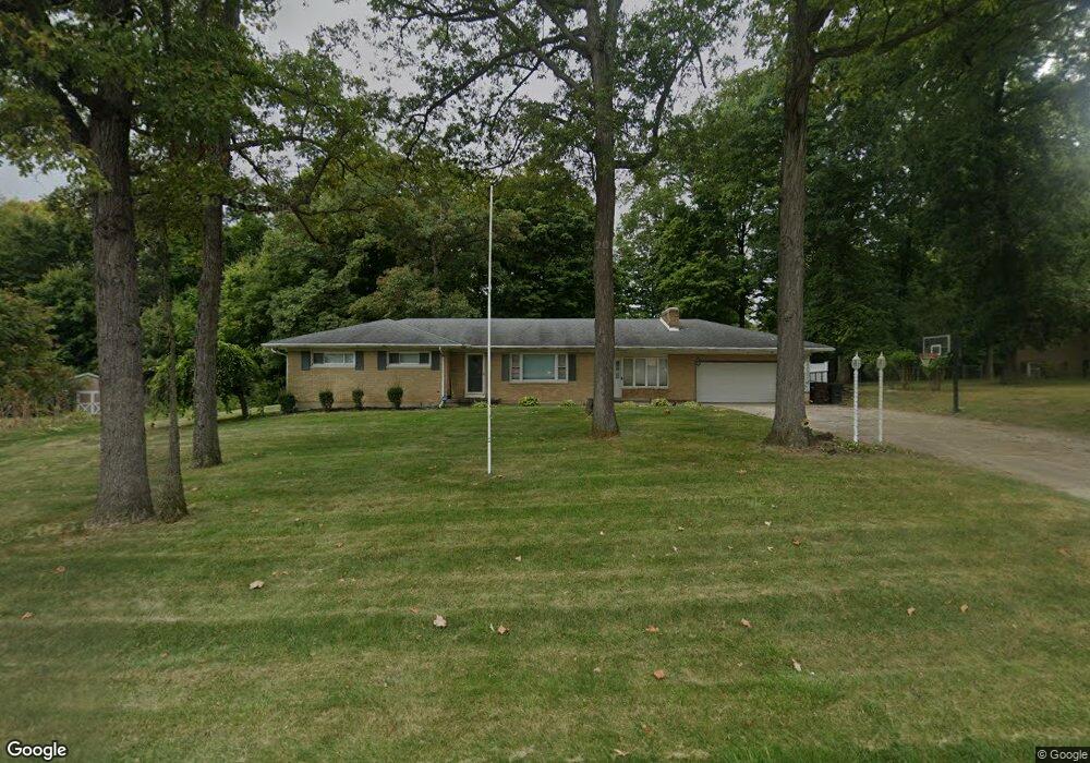
4509 Derr Rd Springfield, OH 45503
Estimated Value: $321,246 - $387,000
About This Home
This home is located at 4509 Derr Rd, Springfield, OH 45503 and is currently estimated at $352,562, approximately $190 per square foot. 4509 Derr Rd is a home located in Clark County with nearby schools including Northridge Elementary School, Kenton Ridge Middle & High School, and Emmanuel Christian Academy.
Ownership History
We collect this data history from publicly available records. To have your information removed, we recommend requesting removal directly through your county’s website.
Purchase Details
Purchase Details
Home Financials for this Owner
Home Financials are based on the most recent Mortgage that was taken out on this home.Purchase Details
Purchase Details
Home Financials for this Owner
Home Financials are based on the most recent Mortgage that was taken out on this home.Purchase Details
Home Financials for this Owner
Home Financials are based on the most recent Mortgage that was taken out on this home.Purchase Details
Home Financials for this Owner
Home Financials are based on the most recent Mortgage that was taken out on this home.Home Values in the Area
Average Home Value in this Area
Purchase History
We collect this data history from publicly available records. To have your information removed, we recommend requesting removal directly through your county’s website.
| Date | Buyer | Sale Price | Title Company |
|---|---|---|---|
| $2,470 | None Available | ||
| $170,000 | Ohio Real Estate Title | ||
| $82,081 | Attorney | ||
| $148,000 | None Available | ||
| $154,900 | -- | ||
| $130,000 | -- |
Mortgage History
We collect this data history from publicly available records. To have your information removed, we recommend requesting removal directly through your county’s website.
| Date | Status | Borrower | Loan Amount |
|---|---|---|---|
| Previous Owner | $145,793 | ||
| Previous Owner | $145,713 | ||
| Previous Owner | $148,262 | ||
| Previous Owner | $117,000 |
Tax History
We collect this data history from publicly available records. To have your information removed, we recommend requesting removal directly through your county’s website.
| Year | Tax Paid | Tax Assessment Tax Assessment Total Assessment is a certain percentage of the fair market value that is determined by local assessors to be the total taxable value of land and additions on the property. | Land | Improvement |
|---|---|---|---|---|
| 2025 | $3,057 | $84,010 | $14,380 | $69,630 |
| 2024 | $2,957 | $69,870 | $11,160 | $58,710 |
| 2023 | $2,957 | $69,870 | $11,160 | $58,710 |
| 2022 | $2,968 | $69,870 | $11,160 | $58,710 |
| 2021 | $2,891 | $57,670 | $9,150 | $48,520 |
| 2020 | $2,893 | $57,670 | $9,150 | $48,520 |
| 2019 | $2,948 | $57,670 | $9,150 | $48,520 |
| 2018 | $2,712 | $50,910 | $8,470 | $42,440 |
| 2017 | $2,324 | $50,905 | $8,467 | $42,438 |
| 2016 | $2,328 | $51,342 | $8,904 | $42,438 |
| 2015 | $2,238 | $47,614 | $8,904 | $38,710 |
| 2014 | $2,241 | $47,614 | $8,904 | $38,710 |
| 2013 | $1,095 | $47,614 | $8,904 | $38,710 |
Map
- 858 Trent Close
- 797 Hiser Ave
- 4528 W Ridgewood Rd
- 4841 Ridgewood Rd W
- 1341 Student Ave
- 4818 Cornell St
- 4239 Midfield St
- 4430 Ridgewood Rd E Unit 11
- 1167 Old Farm Ln
- 4709 Chippendale Dr
- 1415 Montego Dr
- 4890 Highlander Ln
- 4444 Reno Rd
- 1820 Sierra Ave
- 4345 Tulane Rd
- 4732 Lehigh Dr
- 4253 Nevada Rd
- 0 Moorefield Rd
- 1500 Kingsgate Rd Unit 19430
- 1502 Kingsgate Rd Unit 19432
- 4501 Derr Rd
- 4525 Derr Rd
- 4514 Dunnwood Ln
- 4522 Dunnwood Ln
- 4504 Dunnwood Ln
- 4534 Dunnwood Ln
- 4545 Derr Rd
- 954 Forest Edge Ave
- 1018 Cheyenne Ave
- 1024 Cheyenne Ave
- 932 Sawmill Ct
- 925 Sawmill Ct
- 4505 Dunnwood Ln
- 1032 Cheyenne Ave Unit 1032
- 1036 Cheyenne Ave
- 1036 Cheyenne Ave
- 927 Forest Edge Ave
- 1040 Cheyenne Ave Unit 1040
- 928 Sawmill Ct
- 921 Sawmill Ct
Ask me questions while you tour the home.