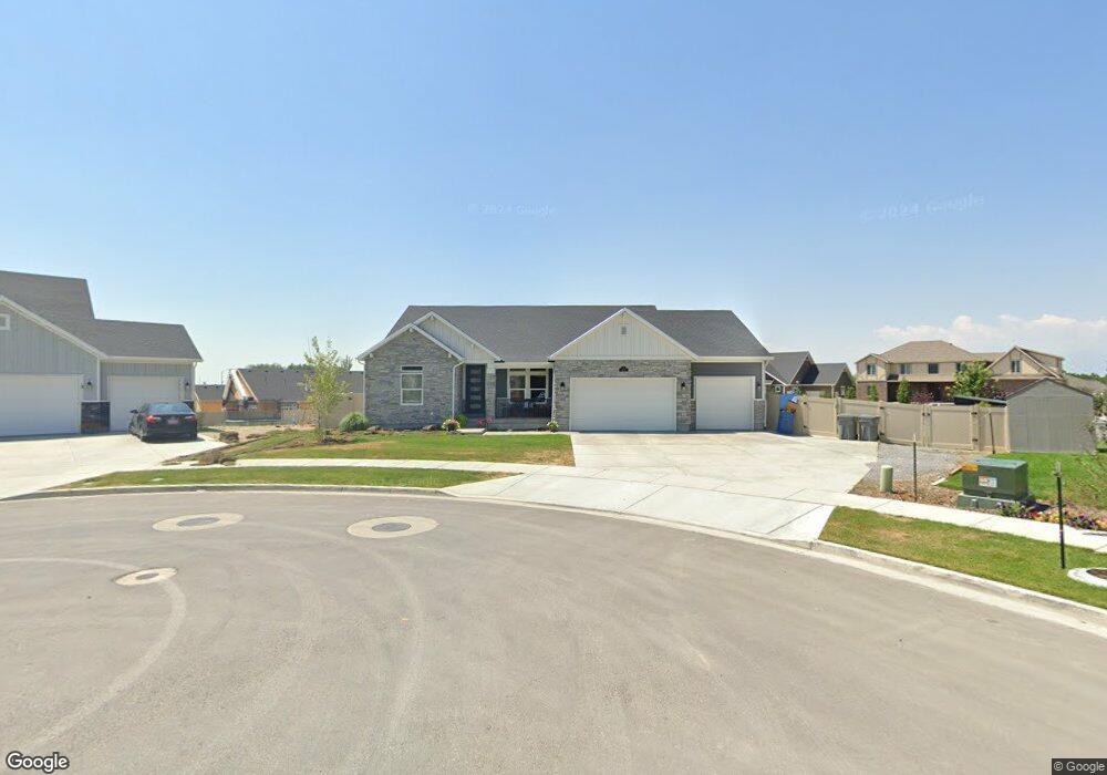
451 N 1120 E American Fork, UT 84003
Estimated Value: $962,000 - $1,225,717
3
Beds
4
Baths
2,219
Sq Ft
$493/Sq Ft
Est. Value
About This Home
This home is located at 451 N 1120 E, American Fork, UT 84003 and is currently estimated at $1,093,859, approximately $492 per square foot. 451 N 1120 E is a home with nearby schools including Barratt Elementary School, American Fork Junior High School, and American Fork High School.
Ownership History
Date
Name
Owned For
Owner Type
Purchase Details
Closed on
Dec 19, 2023
Sold by
Durfey Mark Evan and Durfey Jacquelyne Eastham
Bought by
Mark And Jacque Durfey Family Trust and Durfey
Current Estimated Value
Purchase Details
Closed on
Dec 11, 2019
Sold by
Clayton Properties Group Ii Inc
Bought by
Durfey Mark Evan and Durfey Jacquelyne Eastham
Home Financials for this Owner
Home Financials are based on the most recent Mortgage that was taken out on this home.
Original Mortgage
$536,800
Interest Rate
3.7%
Mortgage Type
New Conventional
Create a Home Valuation Report for This Property
The Home Valuation Report is an in-depth analysis detailing your home's value as well as a comparison with similar homes in the area
Home Values in the Area
Average Home Value in this Area
Purchase History
| Date | Buyer | Sale Price | Title Company |
|---|---|---|---|
| Mark And Jacque Durfey Family Trust | -- | None Listed On Document | |
| Durfey Mark Evan | -- | Cottonwood Title Ins Agcy In |
Source: Public Records
Mortgage History
| Date | Status | Borrower | Loan Amount |
|---|---|---|---|
| Previous Owner | Durfey Mark Evan | $536,800 |
Source: Public Records
Tax History
| Year | Tax Paid | Tax Assessment Tax Assessment Total Assessment is a certain percentage of the fair market value that is determined by local assessors to be the total taxable value of land and additions on the property. | Land | Improvement |
|---|---|---|---|---|
| 2025 | $4,511 | $582,505 | -- | -- |
| 2024 | $4,511 | $501,270 | $0 | $0 |
| 2023 | $4,154 | $489,390 | $0 | $0 |
| 2022 | $4,671 | $543,015 | $0 | $0 |
| 2021 | $4,091 | $742,800 | $203,500 | $539,300 |
| 2020 | $4,202 | $740,000 | $188,400 | $551,600 |
| 2019 | $1,801 | $180,400 | $180,400 | $0 |
Source: Public Records
Map
Nearby Homes
- 459 N 1120 E Unit 311
- 1122 E 450 N
- 1103 E 400 N Unit 101
- 1134 E 450 N Unit 308
- 1115 E 400 N
- 1125 E 450 N Unit 312
- 455 N 1100 E
- 1127 E 400 N
- 437 N 1100 E Unit .41
- 437 N 1100 E
- 473 N 1100 E
- 1146 E 450 N
- 1137 E 450 N
- 1126 E 490 N
- 467 N 1100 E
- 410 N 1100 E Unit 410
- 419 N 1100 E
- 1139 E 400 N
- 475 N 1100 E
- 394 N 1100 E
Your Personal Tour Guide
Ask me questions while you tour the home.