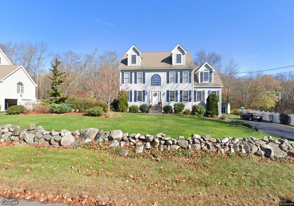
451 Walnut St Shrewsbury, MA 01545
Estimated Value: $937,000 - $1,021,000
About This Home
This home is located at 451 Walnut St, Shrewsbury, MA 01545 and is currently estimated at $996,701, approximately $416 per square foot. 451 Walnut St is a home located in Worcester County with nearby schools including Floral Street School, Sherwood Middle School, and Oak Middle School.
Ownership History
We collect this data history from publicly available records. To have your information removed, we recommend requesting removal directly through your county’s website.
Purchase Details
Home Financials for this Owner
Home Financials are based on the most recent Mortgage that was taken out on this home.Purchase Details
Home Values in the Area
Average Home Value in this Area
Purchase History
We collect this data history from publicly available records. To have your information removed, we recommend requesting removal directly through your county’s website.
| Date | Buyer | Sale Price | Title Company |
|---|---|---|---|
| $549,900 | -- | ||
| -- | -- |
Mortgage History
We collect this data history from publicly available records. To have your information removed, we recommend requesting removal directly through your county’s website.
| Date | Status | Borrower | Loan Amount |
|---|---|---|---|
| Open | $250,000 |
Tax History
We collect this data history from publicly available records. To have your information removed, we recommend requesting removal directly through your county’s website.
| Year | Tax Paid | Tax Assessment Tax Assessment Total Assessment is a certain percentage of the fair market value that is determined by local assessors to be the total taxable value of land and additions on the property. | Land | Improvement |
|---|---|---|---|---|
| 2025 | $112 | $929,500 | $324,200 | $605,300 |
| 2024 | $11,136 | $899,500 | $308,900 | $590,600 |
| 2023 | $10,501 | $800,400 | $308,900 | $491,500 |
| 2022 | $9,598 | $680,200 | $274,800 | $405,400 |
| 2021 | $8,592 | $651,400 | $274,800 | $376,600 |
| 2020 | $8,114 | $650,700 | $274,800 | $375,900 |
| 2019 | $7,891 | $627,800 | $276,300 | $351,500 |
| 2018 | $7,801 | $616,200 | $250,200 | $366,000 |
| 2017 | $7,517 | $585,900 | $231,900 | $354,000 |
| 2016 | $7,311 | $562,400 | $211,000 | $351,400 |
| 2015 | $7,190 | $544,700 | $193,100 | $351,600 |
Map
- 6 Afra Dr
- 10 Falcon Dr
- 0 Falcon Dr
- 14 Gleason St Unit B
- 2106 Simeon Howard Way Unit 2106
- 26 Corning Fairbanks Way Unit 26
- 57 Townsend Blvd
- 64 Arch St
- Lot 1 Beeton Path
- 23 Emerald Run Unit 14
- 15 Emerald Run Unit 10
- 7 Green St Unit 1301
- 7 Green St Unit 204
- 7 Green St Unit 308
- 41 Lebeaux Dr
- 27 Lebeaux Dr Unit 27
- 14 Hillside Rd
- 28 Ladyslipper Dr
- 30 Hillando Dr
- 6 Hillside Rd
- 455 Walnut St
- 449 Walnut St
- 454 Walnut St
- 456 Walnut St
- 450 Walnut St
- 460 Walnut St
- 461 Walnut St
- 441 Walnut St
- 444 Walnut St
- 439 Walnut St
- 440 Walnut St
- 11 Boston Hill Cir
- 458 Walnut St
- 464 Walnut St
- 465 Walnut St
- 462 Walnut St
- 9 Boston Hill Cir
- 430 Walnut St
- 15 Boston Hill Cir
- 15 Boston Hill Cir Unit 15
Ask me questions while you tour the home.