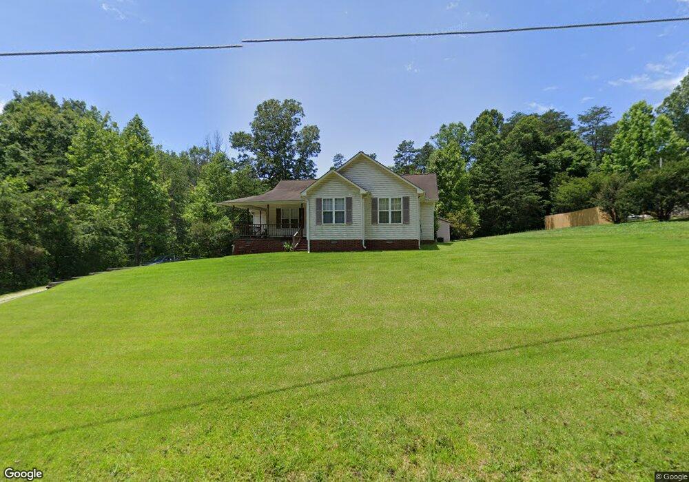
452 Carlton Rd Stokesdale, NC 27357
Estimated Value: $144,000 - $290,000
3
Beds
2
Baths
1,301
Sq Ft
$188/Sq Ft
Est. Value
About This Home
This home is located at 452 Carlton Rd, Stokesdale, NC 27357 and is currently estimated at $244,171, approximately $187 per square foot. 452 Carlton Rd is a home located in Rockingham County with nearby schools including Huntsville Elementary School, John W. Dillard Academy, and Western Rockingham Middle School.
Ownership History
Date
Name
Owned For
Owner Type
Purchase Details
Closed on
Dec 9, 2009
Sold by
Grosso Vincent M
Bought by
Wingo James A and Wingo Susan W
Current Estimated Value
Home Financials for this Owner
Home Financials are based on the most recent Mortgage that was taken out on this home.
Original Mortgage
$117,727
Outstanding Balance
$77,221
Interest Rate
5.01%
Mortgage Type
FHA
Estimated Equity
$166,950
Create a Home Valuation Report for This Property
The Home Valuation Report is an in-depth analysis detailing your home's value as well as a comparison with similar homes in the area
Purchase History
| Date | Buyer | Sale Price | Title Company |
|---|---|---|---|
| Wingo James A | $120,000 | None Available |
Source: Public Records
Mortgage History
| Date | Status | Borrower | Loan Amount |
|---|---|---|---|
| Open | Wingo James A | $117,727 |
Source: Public Records
Tax History
| Year | Tax Paid | Tax Assessment Tax Assessment Total Assessment is a certain percentage of the fair market value that is determined by local assessors to be the total taxable value of land and additions on the property. | Land | Improvement |
|---|---|---|---|---|
| 2025 | $1,386 | $199,423 | $24,200 | $175,223 |
| 2024 | $1,320 | $199,423 | $24,200 | $175,223 |
| 2023 | $1,320 | $126,162 | $22,000 | $104,162 |
| 2022 | $984 | $126,162 | $22,000 | $104,162 |
| 2021 | $984 | $126,162 | $22,000 | $104,162 |
| 2020 | $984 | $126,162 | $22,000 | $104,162 |
| 2019 | $984 | $126,162 | $22,000 | $104,162 |
| 2018 | $978 | $125,195 | $32,000 | $93,195 |
| 2017 | $978 | $125,195 | $32,000 | $93,195 |
| 2015 | $988 | $125,195 | $32,000 | $93,195 |
| 2014 | $978 | $125,195 | $32,000 | $93,195 |
Source: Public Records
Map
Nearby Homes
- 110 Levington Way
- 173 Carlton Rd
- 136 W Farm Loop
- 142 W Farm Loop
- 146 W Farm Loop
- 152 W Farm Loop
- 00 Griffin Rd
- 192.74 AC Us Highway 220
- 220 Farmview Rd
- 424 Gold Hill Rd
- 448 Gold Hill Rd
- 460 Gold Hill Rd
- 183 Providence Trail
- 184 Providence Trail
- 198 Twin Creeks Dr
- 668 Gold Hill Rd
- 696 Gold Hill Rd
- 154 Sitting Rock Dr
- 1325 Simpson Rd
- 219 Sitting Rock Dr
- Lot 3B Carlton Rd
- 720 Carlton Rd
- 0 Carlton Rd
- 460 Carlton Rd
- 337 Carlton Rd
- 329 Carlton Rd
- 586 Carlton Rd
- 322 Carlton Rd
- 601 Carlton Rd
- 606 Carlton Rd
- 630 Carlton Rd
- 674 Carlton Rd
- 000 Carlton Rd
- 00 Carlton
- 687 Carlton Rd
- 719 Carlton Rd
- 105 Levington Way Unit 37902987
- 105 Levington Way Unit 37902981
- 105 Levington Way Unit 37902929
- 105 Levington Way Unit 37902913
Your Personal Tour Guide
Ask me questions while you tour the home.