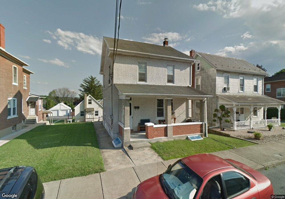
452 E 10th St Northampton, PA 18067
Estimated Value: $296,000 - $364,000
3
Beds
2
Baths
1,174
Sq Ft
$283/Sq Ft
Est. Value
About This Home
This home is located at 452 E 10th St, Northampton, PA 18067 and is currently estimated at $332,809, approximately $283 per square foot. 452 E 10th St is a home located in Northampton County with nearby schools including Colonel John Siegfried Elementary School, Northampton Area Middle School, and Northampton Area High School.
Ownership History
Date
Name
Owned For
Owner Type
Purchase Details
Closed on
Apr 14, 2023
Sold by
Unknown
Bought by
Hooven Dane M
Current Estimated Value
Home Financials for this Owner
Home Financials are based on the most recent Mortgage that was taken out on this home.
Original Mortgage
$217,000
Outstanding Balance
$209,893
Interest Rate
6.65%
Mortgage Type
New Conventional
Estimated Equity
$122,916
Purchase Details
Closed on
Jun 1, 1983
Sold by
Franko Roberto A
Bought by
Franco Roberto A
Purchase Details
Closed on
Feb 1, 1983
Bought by
Franko Roberto A
Create a Home Valuation Report for This Property
The Home Valuation Report is an in-depth analysis detailing your home's value as well as a comparison with similar homes in the area
Home Values in the Area
Average Home Value in this Area
Purchase History
| Date | Buyer | Sale Price | Title Company |
|---|---|---|---|
| Hooven Dane M | $310,000 | None Listed On Document | |
| Franco Roberto A | $32,000 | -- | |
| Franko Roberto A | -- | -- |
Source: Public Records
Mortgage History
| Date | Status | Borrower | Loan Amount |
|---|---|---|---|
| Open | Hooven Dane M | $217,000 |
Source: Public Records
Tax History
| Year | Tax Paid | Tax Assessment Tax Assessment Total Assessment is a certain percentage of the fair market value that is determined by local assessors to be the total taxable value of land and additions on the property. | Land | Improvement |
|---|---|---|---|---|
| 2026 | $594 | $55,000 | $15,600 | $39,400 |
| 2025 | $594 | $55,000 | $15,600 | $39,400 |
| 2024 | $4,401 | $55,000 | $15,600 | $39,400 |
| 2023 | $4,346 | $55,000 | $15,600 | $39,400 |
| 2022 | $4,291 | $55,000 | $15,600 | $39,400 |
| 2021 | $4,300 | $55,000 | $15,600 | $39,400 |
| 2020 | $4,245 | $55,000 | $15,600 | $39,400 |
| 2019 | $4,160 | $55,000 | $15,600 | $39,400 |
| 2018 | $4,101 | $55,000 | $15,600 | $39,400 |
| 2017 | $4,017 | $55,000 | $15,600 | $39,400 |
| 2016 | -- | $55,000 | $15,600 | $39,400 |
| 2015 | -- | $54,200 | $15,600 | $38,600 |
| 2014 | -- | $54,200 | $15,600 | $38,600 |
Source: Public Records
Map
Nearby Homes
- 455 E 11th St
- 426 E 12th St
- 1117 Wynnewood Dr
- 654 Buckingham Dr
- 320 Bendelow Ln
- 316 Bendelow Ln
- 1352 Main St
- 314 Kingsbarns Ln
- 1372 Main St
- 1352 Vienna St
- 115 Chestnut St
- 4120 Pine Hurst Dr
- 1555 Washington Ave
- 103 Main St
- 1427 Canal St
- 25 N 4th St
- 1330 Lincoln St
- 5162 Stone Terrace Dr
- 649 E 20th St
- 1690 Newport Ave
- 460 E 10th St
- 448 E 10th St
- 466 E 10th St
- 468 E 10th St
- 474 E 10th St
- 0 Adaire St Unit Lot23 432093
- 0 Adaire St Unit Lot27 432068
- 0 Adaire St Unit 26
- 453 E 9th St
- 436 E 10th St
- 476 E 10th St
- 439 E 9th St
- 463 E 9th St
- 449 E 10th St
- 482 E 10th St
- 447 E 10th St
- 451 E 10th St
- 453 E 10th St
- 437 E 9th St
- 445 E 10th St
Your Personal Tour Guide
Ask me questions while you tour the home.