
Seller's Agent in 2012
Colleen Brinkoetter
Brinkoetter REALTORS®
(217) 433-9068
15 in this area
104 Total Sales

Estimated Value: $219,170 - $291,000
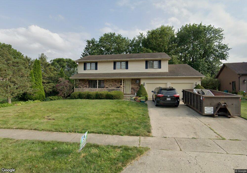
Great North Location... Very well maintained... 4 bedroom, 2.5 baths... Kitchen updated with granite countertops and stainless appliances... Family room is off kitchen with fireplace and sliders leading to a great yard and deck for entertaining... Big rooms, walk in closet, full finished basement with additional storage. A/c - Furnace 06, roof 07 and other updates as well... This one is a winner.....
Last Agent to Sell the Property
Brinkoetter REALTORS® License #471001648 Listed on: 04/27/2012
Last Buyer's Agent
Glenda Williamson
Glenda Williamson Realty License #471004505
| Date | Buyer | Sale Price | Title Company |
|---|---|---|---|
| Goozen Benjamin M | $174,000 | None Available |
| Date | Status | Borrower | Loan Amount |
|---|---|---|---|
| Open | Goozen Benjamin M | $139,200 |
| Date | Event | Price | List to Sale | Price per Sq Ft |
|---|---|---|---|---|
| 09/07/2012 09/07/12 | Sold | $174,000 | -5.9% | $70 / Sq Ft |
| 07/31/2012 07/31/12 | Pending | -- | -- | -- |
| 04/27/2012 04/27/12 | For Sale | $184,900 | -- | $74 / Sq Ft |
| Year | Tax Paid | Tax Assessment Tax Assessment Total Assessment is a certain percentage of the fair market value that is determined by local assessors to be the total taxable value of land and additions on the property. | Land | Improvement |
|---|---|---|---|---|
| 2024 | $6,126 | $68,045 | $8,857 | $59,188 |
| 2023 | $5,696 | $62,553 | $8,142 | $54,411 |
| 2022 | $5,374 | $58,016 | $7,552 | $50,464 |
| 2021 | $5,054 | $54,725 | $7,061 | $47,664 |
| 2020 | $5,077 | $53,594 | $6,915 | $46,679 |
| 2019 | $5,077 | $53,594 | $6,915 | $46,679 |
| 2018 | $5,053 | $53,977 | $6,964 | $47,013 |
| 2017 | $5,074 | $54,278 | $7,003 | $47,275 |
| 2016 | $5,125 | $54,409 | $7,020 | $47,389 |
| 2015 | $4,885 | $53,764 | $6,937 | $46,827 |
| 2014 | $4,578 | $53,764 | $6,937 | $46,827 |
| 2013 | $4,561 | $53,764 | $6,937 | $46,827 |
Seller's Agent in 2012
Colleen Brinkoetter
Brinkoetter REALTORS®
(217) 433-9068
15 in this area
104 Total Sales
G
Buyer's Agent in 2012
Glenda Williamson
Glenda Williamson Realty
Source: Central Illinois Board of REALTORS®
MLS Number: 5188942
APN: 07-07-27-102-027
Ask me questions while you tour the home.