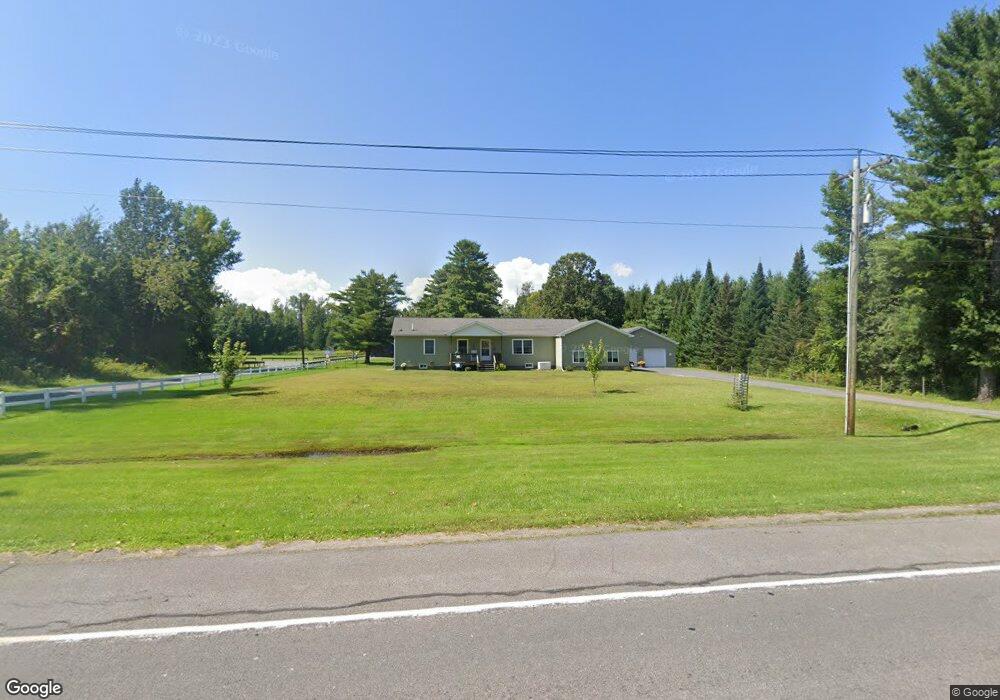
4525 State Route 9 Plattsburgh, NY 12901
Estimated Value: $262,000 - $308,000
3
Beds
2
Baths
1,456
Sq Ft
$199/Sq Ft
Est. Value
About This Home
This home is located at 4525 State Route 9, Plattsburgh, NY 12901 and is currently estimated at $289,472, approximately $198 per square foot. 4525 State Route 9 is a home with nearby schools including Peru Elementary School, Peru Jr./Sr. High School, and Lakeshore Christian School.
Ownership History
Date
Name
Owned For
Owner Type
Purchase Details
Closed on
Apr 30, 2015
Sold by
Garrand Gerald J
Bought by
Garrand Deborah L
Current Estimated Value
Purchase Details
Closed on
May 21, 2008
Sold by
Garrand Gerald
Bought by
Garrand Gerald
Purchase Details
Closed on
Mar 8, 2005
Sold by
Lynch Michael
Bought by
Garrand Gary
Purchase Details
Closed on
Jul 9, 2003
Sold by
Lynch James
Bought by
Lynch Trustee Michael
Create a Home Valuation Report for This Property
The Home Valuation Report is an in-depth analysis detailing your home's value as well as a comparison with similar homes in the area
Home Values in the Area
Average Home Value in this Area
Purchase History
| Date | Buyer | Sale Price | Title Company |
|---|---|---|---|
| Garrand Deborah L | -- | Brian Snell | |
| Garrand Gerald | -- | -- | |
| Garrand Gary | $40,000 | Carl J Madonna | |
| Lynch Trustee Michael | -- | Edward J Trombley |
Source: Public Records
Tax History
| Year | Tax Paid | Tax Assessment Tax Assessment Total Assessment is a certain percentage of the fair market value that is determined by local assessors to be the total taxable value of land and additions on the property. | Land | Improvement |
|---|---|---|---|---|
| 2024 | $6,094 | $265,000 | $27,500 | $237,500 |
| 2023 | $6,471 | $225,000 | $27,500 | $197,500 |
| 2022 | $6,351 | $225,000 | $27,500 | $197,500 |
| 2021 | $6,692 | $225,000 | $27,500 | $197,500 |
| 2020 | $6,536 | $200,000 | $27,500 | $172,500 |
| 2019 | $6,320 | $200,000 | $38,500 | $161,500 |
| 2018 | $6,320 | $200,000 | $38,500 | $161,500 |
| 2017 | $6,360 | $200,000 | $38,500 | $161,500 |
| 2016 | $5,767 | $185,000 | $55,100 | $129,900 |
| 2015 | -- | $55,100 | $55,100 | $0 |
| 2014 | -- | $55,100 | $55,100 | $0 |
Source: Public Records
Map
Nearby Homes
- 19 Marie Dr
- 3 Laurel Ct
- 02 Woodcliff Dr
- 01 Woodcliff Dr
- 03 Woodcliff Dr
- 24 Golf Course Rd
- 00 Wood Cliff Dr
- 20 Louisiana Ave
- 0 Kansas Ave Unit 178633
- 00 Kansas Ave
- 0 Bluff Point Dr Unit 178752
- 0 Bluff Point Dr Unit 178750
- 41 Bluff Point Dr
- 45 Bluff Point Dr
- 74 Bluff Point Dr
- 73 Bluff Point Dr
- 46 Bluff Point Dr
- 72 Bluff Point Dr
- 71 Bluff Point Dr
- 01 Bluff Point Dr
- 26 Lakeshore Dr
- 28 Lakeshore Dr
- 30 Lakeshore Dr
- 4539 State Route 9
- 32 Lakeshore Dr
- 11 Plattsburgh Ave
- 34 Lakeshore Dr
- 10 Plattsburgh Ave
- 24 Washington Place
- 22 Washington Place
- 22 Lakeshore Dr
- 20 Washington Place
- 9 Plattsburgh Ave
- 36 Lakeshore Dr
- 72 Washington Place
- 18 Washington Place
- 66 Washington Place
- 16 Washington Place
- 20 Lakeshore Dr
- 38 Lakeshore Dr
Your Personal Tour Guide
Ask me questions while you tour the home.