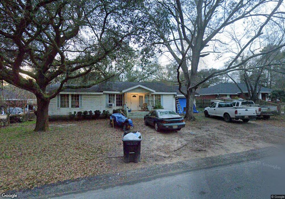
4538 Schimpfs Ln Mobile, AL 36619
Devonshire NeighborhoodEstimated Value: $78,000 - $200,000
Studio
1
Bath
1,530
Sq Ft
$78/Sq Ft
Est. Value
About This Home
This home is located at 4538 Schimpfs Ln, Mobile, AL 36619 and is currently estimated at $119,233, approximately $77 per square foot. 4538 Schimpfs Ln is a home located in Mobile County with nearby schools including WC Griggs Elementary School, Burns Middle School, and Theodore High School.
Ownership History
Date
Name
Owned For
Owner Type
Purchase Details
Closed on
Feb 28, 2019
Sold by
Knapp Herbert H
Bought by
Slater Mandy M
Current Estimated Value
Home Financials for this Owner
Home Financials are based on the most recent Mortgage that was taken out on this home.
Original Mortgage
$38,500
Outstanding Balance
$33,641
Interest Rate
4.4%
Mortgage Type
Unknown
Estimated Equity
$85,592
Purchase Details
Closed on
Nov 2, 2018
Sold by
Mccrory Betty Joyce
Bought by
Knapp Herbert H
Create a Home Valuation Report for This Property
The Home Valuation Report is an in-depth analysis detailing your home's value as well as a comparison with similar homes in the area
Home Values in the Area
Average Home Value in this Area
Purchase History
We collect this data history from publicly available records. To have your information removed, we recommend requesting removal directly through your county’s website.
| Date | Buyer | Sale Price | Title Company |
|---|---|---|---|
| Slater Mandy M | $45,000 | None Available | |
| Knapp Herbert H | $30,000 | Guaranty Title Company |
Source: Public Records
Mortgage History
We collect this data history from publicly available records. To have your information removed, we recommend requesting removal directly through your county’s website.
| Date | Status | Borrower | Loan Amount |
|---|---|---|---|
| Open | Slater Mandy M | $38,500 |
Source: Public Records
Tax History
| Year | Tax Paid | Tax Assessment Tax Assessment Total Assessment is a certain percentage of the fair market value that is determined by local assessors to be the total taxable value of land and additions on the property. | Land | Improvement |
|---|---|---|---|---|
| 2025 | $315 | $5,560 | $900 | $4,660 |
| 2024 | $315 | $5,040 | $750 | $4,290 |
| 2023 | $298 | $4,980 | $750 | $4,230 |
| 2022 | $151 | $4,490 | $750 | $3,740 |
| 2021 | $151 | $4,490 | $750 | $3,740 |
| 2020 | $151 | $4,490 | $750 | $3,740 |
| 2019 | $124 | $3,940 | $0 | $0 |
| 2018 | $0 | $3,920 | $0 | $0 |
| 2017 | $0 | $3,920 | $0 | $0 |
| 2016 | -- | $4,040 | $0 | $0 |
| 2013 | -- | $4,300 | $0 | $0 |
Source: Public Records
Map
Nearby Homes
- 4475 Wilmer Dr
- 4401 Wilmer Dr
- 4700 Diamond Ave
- 7051 Cambridge Dr
- 6945 Three Notch Rd
- 6935 Three Notch Rd
- 5015 Santos Dr W
- 5084 Fairland Dr
- 0 Stone Mill Ct Unit 7715820
- 0 Stone Mill Ct Unit 1
- 0 Stone Mill Dr Unit 7570233
- 0 Stone Mill Dr Unit 9 381415
- 5070 Santos Dr W
- 4314 Lumsden Battery Cir W
- 5139 Guinevere Dr
- 5023 Freeway Ln
- 4916 Meadow Gay Dr
- 0 Mill House Dr N Unit 7709816
- 5171 Fairland Dr
- 6170 Southbend Dr N
- 4522 Schimpfs Ln
- 4550 Schimpfs Ln
- 6606 Davis Rd
- 6603 Tillman Dr
- 6612 Davis Rd
- 6628 Davis Rd
- 6601 Davis Rd
- 6613 Davis Rd
- 6600 Tillman Dr
- 6608 Tillman Dr
- 4567 Schimpfs Ln
- 6650 Davis Rd
- 4590 Schimpfs Ln
- 4460 Schimpfs Ln
- 0 Davis Rd
- 6638 Tillman Dr
- 4401 Cecil Bolton Dr
- 4387 Jack Treadwell Ln
- 8067 Valor Ridge Way N
- 7968 Valor Ridge Way N
Your Personal Tour Guide
Ask me questions while you tour the home.