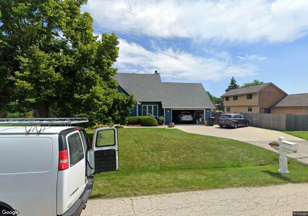
455 Cavin Ave Winthrop Harbor, IL 60096
Estimated Value: $355,392 - $397,000
4
Beds
3
Baths
1,859
Sq Ft
$204/Sq Ft
Est. Value
About This Home
This home is located at 455 Cavin Ave, Winthrop Harbor, IL 60096 and is currently estimated at $378,348, approximately $203 per square foot. 455 Cavin Ave is a home located in Lake County with nearby schools including Westfield School, North Prairie Junior High School, and Zion-Benton Township High School.
Ownership History
Date
Name
Owned For
Owner Type
Purchase Details
Closed on
Aug 24, 2018
Sold by
Rdzok John E and Rdzok Beverly J
Bought by
Rdzok John E and Rdzok Beverly J
Current Estimated Value
Purchase Details
Closed on
Aug 14, 1997
Sold by
Osterbrink Paul T and Osterbrink Deborah L
Bought by
Rdzok John E and Rdzok Beverly J
Home Financials for this Owner
Home Financials are based on the most recent Mortgage that was taken out on this home.
Original Mortgage
$166,250
Interest Rate
7.18%
Create a Home Valuation Report for This Property
The Home Valuation Report is an in-depth analysis detailing your home's value as well as a comparison with similar homes in the area
Home Values in the Area
Average Home Value in this Area
Purchase History
| Date | Buyer | Sale Price | Title Company |
|---|---|---|---|
| Rdzok John E | -- | None Available | |
| Rdzok John E | $175,000 | Chicago Title Insurance Co |
Source: Public Records
Mortgage History
| Date | Status | Borrower | Loan Amount |
|---|---|---|---|
| Previous Owner | Rdzok John E | $166,250 |
Source: Public Records
Tax History
| Year | Tax Paid | Tax Assessment Tax Assessment Total Assessment is a certain percentage of the fair market value that is determined by local assessors to be the total taxable value of land and additions on the property. | Land | Improvement |
|---|---|---|---|---|
| 2024 | $7,980 | $103,618 | $8,743 | $94,875 |
| 2023 | $7,557 | $90,448 | $8,440 | $82,008 |
| 2022 | $7,557 | $80,049 | $8,253 | $71,796 |
| 2021 | $8,297 | $78,013 | $8,043 | $69,970 |
| 2020 | $8,047 | $74,447 | $7,675 | $66,772 |
| 2019 | $7,851 | $70,633 | $7,282 | $63,351 |
| 2018 | $7,208 | $65,066 | $8,825 | $56,241 |
| 2017 | $7,152 | $61,210 | $8,302 | $52,908 |
| 2016 | $6,963 | $58,273 | $7,904 | $50,369 |
| 2015 | $6,835 | $53,442 | $7,249 | $46,193 |
| 2014 | $7,109 | $57,328 | $10,725 | $46,603 |
| 2012 | $6,997 | $59,574 | $11,145 | $48,429 |
Source: Public Records
Map
Nearby Homes
- 0 Garnett Ave
- 535 Thompson Ave
- 514 Judith Ct
- 338 College Ave
- 630 Whitney Ave
- 150 Old Darby Ln
- 802 Kirkwood Ave
- 714 Landon Ave
- 907 E Broadway Ave Unit E
- 12212 Sheridan Rd
- 0 13th St Unit MRD12569828
- 3106 13th St
- 1134 Franklin Ave
- 1808 13th St
- 1206 Landon Ave
- 0 14th St Unit MRD12502206
- 11912 28th Ave
- 1400 Sheridan Rd
- 1715 14th St
- 210 Oak Ln
Your Personal Tour Guide
Ask me questions while you tour the home.