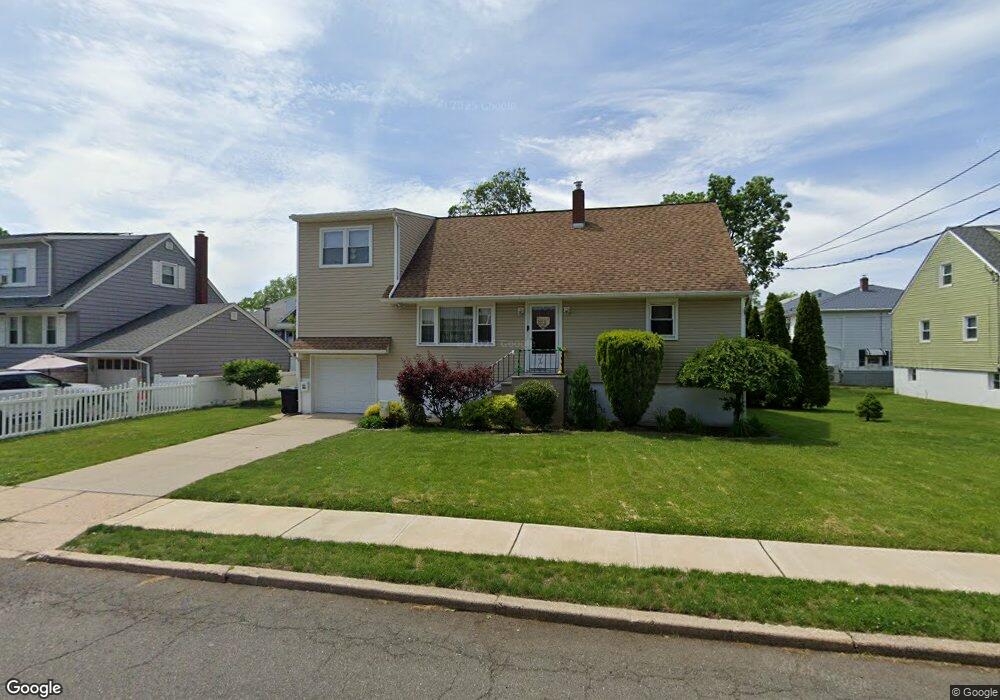
455 Taylor Ave South Hackensack, NJ 07606
Estimated Value: $679,191 - $847,000
Studio
--
Bath
1,887
Sq Ft
$399/Sq Ft
Est. Value
About This Home
This home is located at 455 Taylor Ave, South Hackensack, NJ 07606 and is currently estimated at $752,048, approximately $398 per square foot. 455 Taylor Ave is a home located in Bergen County with nearby schools including Memorial Elementary School and George Washington School.
Ownership History
Date
Name
Owned For
Owner Type
Purchase Details
Closed on
Nov 30, 2001
Current Estimated Value
Purchase Details
Closed on
Nov 20, 1997
Sold by
Roselli Philip J and Roselli Patrick G
Bought by
Stasiuk Dolce Ringe
Purchase Details
Closed on
Jan 18, 1994
Sold by
Christensen Albert
Bought by
Roselli Patrick
Home Financials for this Owner
Home Financials are based on the most recent Mortgage that was taken out on this home.
Original Mortgage
$191,000
Interest Rate
7.11%
Create a Home Valuation Report for This Property
The Home Valuation Report is an in-depth analysis detailing your home's value as well as a comparison with similar homes in the area
Home Values in the Area
Average Home Value in this Area
Purchase History
We collect this data history from publicly available records. To have your information removed, we recommend requesting removal directly through your county’s website.
| Date | Buyer | Sale Price | Title Company |
|---|---|---|---|
| -- | -- | -- | |
| Stasiuk Dolce Ringe | $92,000 | -- | |
| Roselli Patrick | $213,000 | -- |
Source: Public Records
Mortgage History
We collect this data history from publicly available records. To have your information removed, we recommend requesting removal directly through your county’s website.
| Date | Status | Borrower | Loan Amount |
|---|---|---|---|
| Previous Owner | Roselli Patrick | $191,000 |
Source: Public Records
Tax History
| Year | Tax Paid | Tax Assessment Tax Assessment Total Assessment is a certain percentage of the fair market value that is determined by local assessors to be the total taxable value of land and additions on the property. | Land | Improvement |
|---|---|---|---|---|
| 2025 | $10,387 | $573,700 | $267,900 | $305,800 |
| 2024 | $10,288 | $530,200 | $244,800 | $285,400 |
| 2023 | $9,795 | $482,800 | $227,300 | $255,500 |
| 2022 | $9,795 | $444,200 | $202,900 | $241,300 |
| 2021 | $9,171 | $388,100 | $182,900 | $205,200 |
| 2020 | $9,139 | $340,500 | $165,300 | $175,200 |
| 2019 | $9,221 | $337,400 | $163,300 | $174,100 |
| 2018 | $9,174 | $332,500 | $161,300 | $171,200 |
| 2017 | $9,090 | $327,200 | $157,300 | $169,900 |
| 2016 | $8,806 | $318,600 | $152,300 | $166,300 |
| 2015 | $8,622 | $314,000 | $148,300 | $165,700 |
| 2014 | $7,804 | $288,200 | $145,400 | $142,800 |
Source: Public Records
Map
Nearby Homes
- 47 Worth St
- 38 Moonachie Rd Unit 101
- 38 Moonachie Rd Unit 402
- 401 Chestnut Ave
- 467 Hudson St
- 1 Veprek Ln
- 33 Pulaski Place Unit 35
- 355 Chestnut Ave
- 33-35 Pulaski Place
- 347 Chestnut Ave
- 453 Liberty St Unit 12
- 468 Liberty St Unit 201
- 462C Liberty St Unit 312
- 470 Liberty St Unit 308
- 468a Liberty St Unit 101
- 85 Grove St
- 464 Liberty St Unit 205
- 138 Old Hoboken Rd
- 43 4th St
- 190 Washington Ave
Your Personal Tour Guide
Ask me questions while you tour the home.