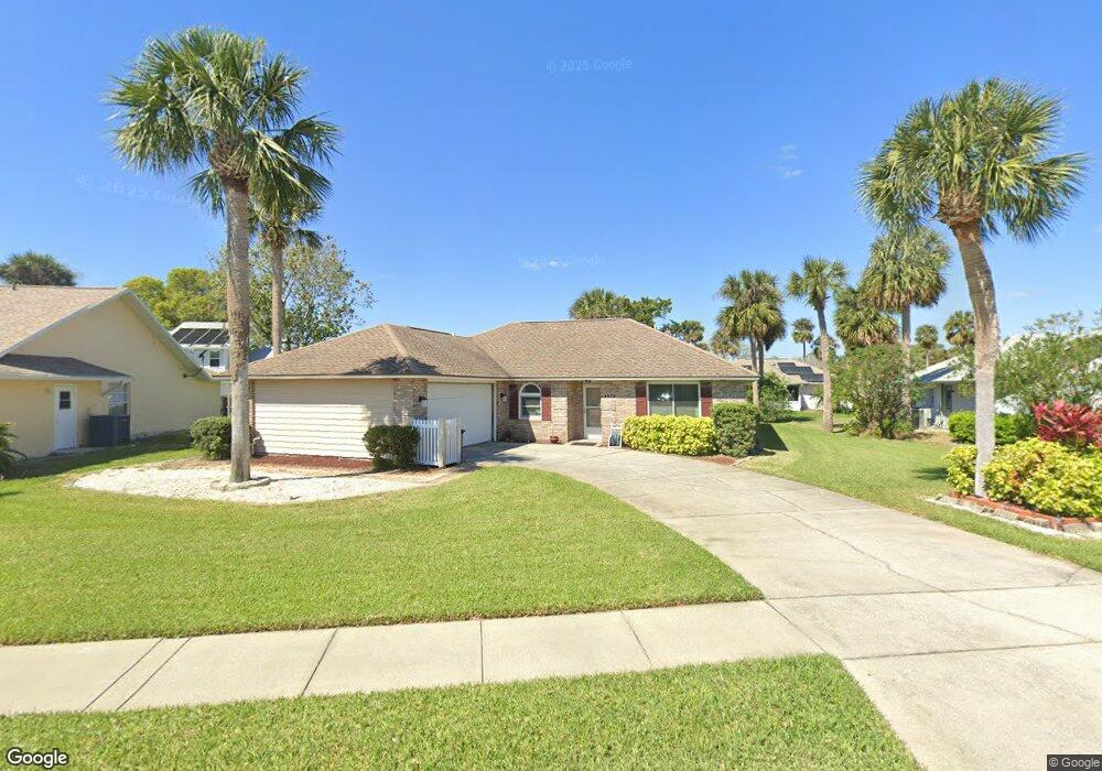
4572 Barnacle Dr Port Orange, FL 32127
South Port Orange NeighborhoodEstimated Value: $301,188 - $323,000
3
Beds
2
Baths
1,683
Sq Ft
$187/Sq Ft
Est. Value
About This Home
This home is located at 4572 Barnacle Dr, Port Orange, FL 32127 and is currently estimated at $314,297, approximately $186 per square foot. 4572 Barnacle Dr is a home located in Volusia County with nearby schools including Sugar Mill Elementary School, Silver Sands Middle School, and Spruce Creek High School.
Ownership History
Date
Name
Owned For
Owner Type
Purchase Details
Closed on
Aug 1, 2006
Sold by
Kelligan Marjorie Ola
Bought by
Anema Clifford W
Current Estimated Value
Purchase Details
Closed on
Feb 18, 2004
Sold by
Mccarty Thomas R
Bought by
Kelligan Marjorie Ola
Purchase Details
Closed on
Mar 15, 1991
Bought by
Anema Clifford W
Purchase Details
Closed on
Jul 15, 1989
Bought by
Anema Clifford W
Create a Home Valuation Report for This Property
The Home Valuation Report is an in-depth analysis detailing your home's value as well as a comparison with similar homes in the area
Home Values in the Area
Average Home Value in this Area
Purchase History
| Date | Buyer | Sale Price | Title Company |
|---|---|---|---|
| Anema Clifford W | $220,000 | Adams Cameron Title Svcs Inc | |
| Kelligan Marjorie Ola | $156,900 | -- | |
| Anema Clifford W | $80,400 | -- | |
| Anema Clifford W | $100 | -- |
Source: Public Records
Tax History
| Year | Tax Paid | Tax Assessment Tax Assessment Total Assessment is a certain percentage of the fair market value that is determined by local assessors to be the total taxable value of land and additions on the property. | Land | Improvement |
|---|---|---|---|---|
| 2026 | $5,176 | $296,605 | $72,450 | $224,155 |
| 2025 | $5,176 | $293,022 | $72,450 | $220,572 |
| 2024 | $4,858 | $299,706 | $72,900 | $226,806 |
| 2023 | $4,858 | $312,528 | $72,900 | $239,628 |
| 2022 | $4,271 | $253,366 | $45,900 | $207,466 |
| 2021 | $3,994 | $207,412 | $37,868 | $169,544 |
| 2020 | $3,772 | $197,808 | $31,631 | $166,177 |
| 2019 | $3,463 | $182,656 | $20,049 | $162,607 |
| 2018 | $3,292 | $169,251 | $23,760 | $145,491 |
| 2017 | $1,519 | $114,186 | $0 | $0 |
| 2016 | $1,511 | $111,837 | $0 | $0 |
| 2015 | $1,553 | $111,060 | $0 | $0 |
| 2014 | $1,556 | $110,179 | $0 | $0 |
Source: Public Records
Map
Nearby Homes
- 4589 Alder Dr
- 825 Wooddusk Dr
- 71 Tropical Ct
- 4552 Rockledge Ln
- 722 Raven Rock Ct
- 4538 Rockledge Ln
- 719 Brom Bones Ct
- 4531 Nettle Creek Ct
- 104 Flamingo Dr
- 8 Royal Palm Cir
- 4527 Nettle Creek Ct
- 830 Lakeland Dr
- 5410 Marshfield Dr
- 112 Flamingo Dr
- 60 Windward Ct
- 712 Kristina Ct
- 13 Royal Palm Cir
- 5415 Marshfield Dr
- 75 Royal Palm Cir
- 5409 Wilson Dr
- 4574 Barnacle Dr
- 4570 Barnacle Dr
- 4573 Miles Dr
- 4571 Miles Dr
- 4568 Barnacle Dr
- 4576 Barnacle Dr
- 4575 Barnacle Dr
- 4571 Barnacle Dr
- 4569 Miles Dr
- 4577 Barnacle Dr
- 4569 Barnacle Dr
- 4576 Alder Dr
- 4578 Barnacle Dr
- 4566 Barnacle Dr
- 4572 Miles Dr
- 4570 Miles Dr
- 4578 Alder Dr
- 4574 Alder Dr
- 4579 Miles Dr
- 4567 Riverwood Dr
Your Personal Tour Guide
Ask me questions while you tour the home.