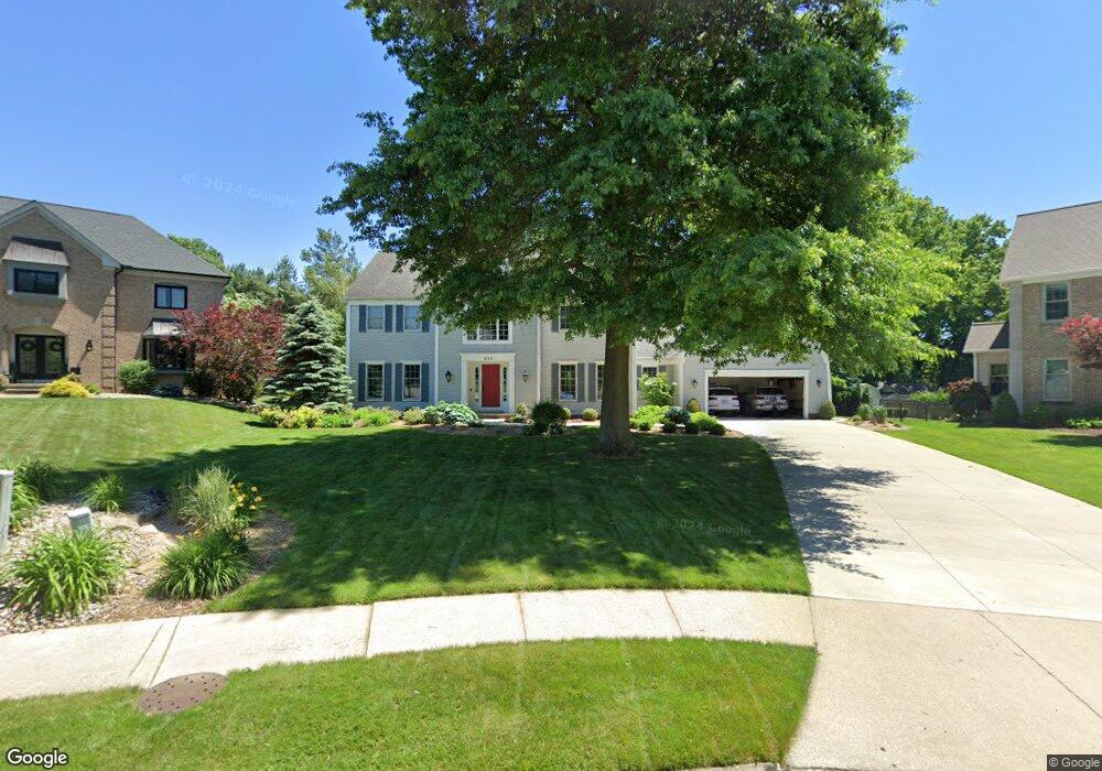
459 Pheasant Knoll Cir Wadsworth, OH 44281
Estimated Value: $519,000 - $612,000
About This Home
This home is located at 459 Pheasant Knoll Cir, Wadsworth, OH 44281 and is currently estimated at $546,606, approximately $171 per square foot. 459 Pheasant Knoll Cir is a home located in Medina County with nearby schools including Lincoln Elementary School, Central Intermediate School, and Wadsworth Middle School.
Ownership History
We collect this data history from publicly available records. To have your information removed, we recommend requesting removal directly through your county’s website.
Purchase Details
Home Financials for this Owner
Home Financials are based on the most recent Mortgage that was taken out on this home.Purchase Details
Home Values in the Area
Average Home Value in this Area
Purchase History
We collect this data history from publicly available records. To have your information removed, we recommend requesting removal directly through your county’s website.
| Date | Buyer | Sale Price | Title Company |
|---|---|---|---|
| $520,000 | None Listed On Document | ||
| -- | -- |
Mortgage History
We collect this data history from publicly available records. To have your information removed, we recommend requesting removal directly through your county’s website.
| Date | Status | Borrower | Loan Amount |
|---|---|---|---|
| Open | $338,000 |
Tax History
We collect this data history from publicly available records. To have your information removed, we recommend requesting removal directly through your county’s website.
| Year | Tax Paid | Tax Assessment Tax Assessment Total Assessment is a certain percentage of the fair market value that is determined by local assessors to be the total taxable value of land and additions on the property. | Land | Improvement |
|---|---|---|---|---|
| 2025 | $6,621 | $174,510 | $35,000 | $139,510 |
| 2024 | $6,621 | $141,440 | $35,000 | $106,440 |
| 2023 | $6,235 | $141,440 | $35,000 | $106,440 |
| 2022 | $6,242 | $141,440 | $35,000 | $106,440 |
| 2021 | $5,911 | $113,150 | $28,000 | $85,150 |
| 2020 | $5,209 | $113,150 | $28,000 | $85,150 |
| 2019 | $5,216 | $113,150 | $28,000 | $85,150 |
| 2018 | $4,720 | $96,000 | $21,490 | $74,510 |
| 2017 | $4,722 | $96,000 | $21,490 | $74,510 |
| 2016 | $4,800 | $96,000 | $21,490 | $74,510 |
| 2015 | $4,618 | $88,070 | $19,710 | $68,360 |
| 2014 | $4,694 | $88,070 | $19,710 | $68,360 |
| 2013 | $4,700 | $88,070 | $19,710 | $68,360 |
Map
- 410 Breezewood Cir
- 614 Red Rock Dr
- 587 Red Rock Dr
- 502 Farr Ave
- 300 Tanglewood Trail
- 498 Oak St
- 119 Barkwood Dr
- 554 Highland Ave
- 347 N Lyman St
- 247 Highland Ave
- 145 Hall Dr
- 133 E North St
- 118 Gordon Ave
- 310 Broad St
- 314 Kaylee Dr
- 281 High St
- 123 Durling Dr
- V/L Hartman Rd
- 773 Kristy Ct
- 159 N Lyman St
- 436 Whitestone Cir
- 450 Whitestone Cir
- 433 Whitestone Cir
- 473 Pheasant Knoll Cir
- 465 Pheasant Knoll Cir
- 481 Pheasant Knoll Cir
- 653 Red Rock Dr
- 661 Red Rock Dr
- 441 Whitestone Cir
- 643 Red Rock Dr
- 460 Whitestone Cir
- 671 Red Rock Dr
- 447 Whitestone Cir
- 633 Red Rock Dr
- 450 Winding Way
- 444 Winding Way
- 472 Whitestone Cir
- 476 Pheasant Knoll Cir
- 455 Whitestone Cir
- 434 Winding Way
Ask me questions while you tour the home.