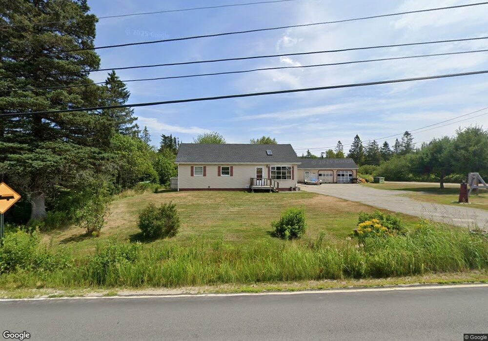
46 E Side Rd Addison, ME 04606
Estimated Value: $132,349 - $261,000
About This Home
This home is located at 46 E Side Rd, Addison, ME 04606 and is currently estimated at $208,837, approximately $191 per square foot. 46 E Side Rd is a home.
Ownership History
We collect this data history from publicly available records. To have your information removed, we recommend requesting removal directly through your county’s website.
Purchase Details
Home Financials for this Owner
Home Financials are based on the most recent Mortgage that was taken out on this home.Purchase History
We collect this data history from publicly available records. To have your information removed, we recommend requesting removal directly through your county’s website.
| Date | Buyer | Sale Price | Title Company |
|---|---|---|---|
| -- | -- |
Mortgage History
We collect this data history from publicly available records. To have your information removed, we recommend requesting removal directly through your county’s website.
| Date | Status | Borrower | Loan Amount |
|---|---|---|---|
| Closed | $5,000 | ||
| Closed | $86,464 |
Tax History
We collect this data history from publicly available records. To have your information removed, we recommend requesting removal directly through your county’s website.
| Year | Tax Paid | Tax Assessment Tax Assessment Total Assessment is a certain percentage of the fair market value that is determined by local assessors to be the total taxable value of land and additions on the property. | Land | Improvement |
|---|---|---|---|---|
| 2025 | $1,779 | $92,200 | $23,200 | $69,000 |
| 2024 | $1,726 | $92,200 | $23,200 | $69,000 |
| 2023 | $1,588 | $92,200 | $23,200 | $69,000 |
| 2022 | $1,512 | $91,100 | $22,100 | $69,000 |
| 2021 | $1,512 | $91,100 | $22,100 | $69,000 |
| 2020 | $1,853 | $91,100 | $22,100 | $69,000 |
| 2019 | $927 | $91,100 | $22,100 | $69,000 |
| 2018 | $1,996 | $91,100 | $22,100 | $69,000 |
| 2017 | $1,561 | $91,100 | $22,100 | $69,000 |
| 2016 | $924 | $91,300 | $22,100 | $69,200 |
| 2015 | $1,310 | $91,300 | $22,100 | $69,200 |
| 2014 | $1,223 | $91,300 | $22,100 | $69,200 |
| 2013 | -- | $92,200 | $22,100 | $70,100 |
Map
- 60 Wescogus Rd
- 191 Water St
- 423 Ridge Rd
- 426 Point St
- Lot 1 Point St
- 330 Point St
- Lot #7 Highland Rd
- 362 Indian River Rd
- 337 W Side Rd
- 16 & 18 Nelson Way
- 166 Ridge Rd
- 288 Marshville Rd
- 75 Point St
- M20L2 E Side Rd
- 61 Point St
- Lot 13 Reef Point Rd
- Lot 12 Reef Point Rd
- M3 L53 Cates Rd
- 29 Reef Point Rd
- 83 Station Rd
Ask me questions while you tour the home.