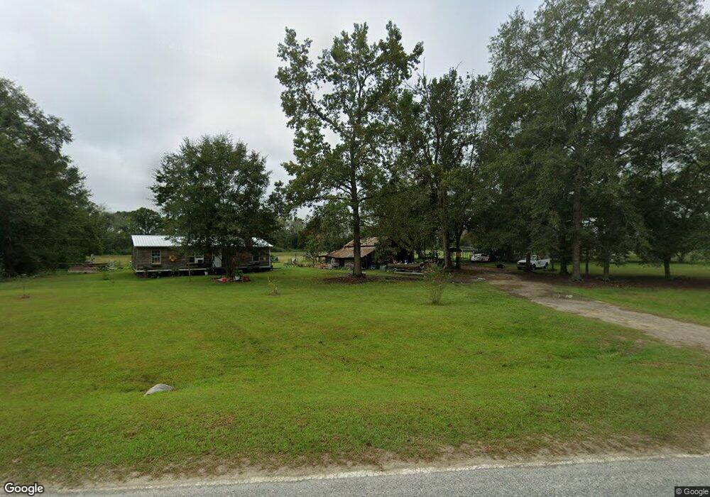
46 Sumner Rd Surrency, GA 31563
Estimated Value: $95,000 - $211,000
3
Beds
1
Bath
1,200
Sq Ft
$125/Sq Ft
Est. Value
About This Home
This home is located at 46 Sumner Rd, Surrency, GA 31563 and is currently estimated at $150,351, approximately $125 per square foot. 46 Sumner Rd is a home located in Appling County.
Ownership History
Date
Name
Owned For
Owner Type
Purchase Details
Closed on
Jan 11, 2018
Sold by
Adams Kristy Willis
Bought by
Morris Lesa H
Current Estimated Value
Purchase Details
Closed on
Oct 19, 2015
Sold by
Adams Tony Jerome
Bought by
Adams Kristy Willis
Purchase Details
Closed on
Oct 21, 2009
Sold by
Adams Tony Jerome
Bought by
Adams Tony Jerome and Adams Kristy Willis
Home Financials for this Owner
Home Financials are based on the most recent Mortgage that was taken out on this home.
Original Mortgage
$54,500
Interest Rate
5.01%
Mortgage Type
New Conventional
Purchase Details
Closed on
May 22, 2001
Sold by
Adams Tony J and Adams Kristy
Bought by
Adams Tony Jerome
Purchase Details
Closed on
Jul 28, 1997
Bought by
Adams Tony J and Adams Kristy
Purchase Details
Closed on
Feb 10, 1992
Bought by
Bell Edgar and Linda Dale
Purchase Details
Closed on
Jan 23, 1991
Bought by
Bell Edgar and Linda Dale
Create a Home Valuation Report for This Property
The Home Valuation Report is an in-depth analysis detailing your home's value as well as a comparison with similar homes in the area
Purchase History
| Date | Buyer | Sale Price | Title Company |
|---|---|---|---|
| Morris Lesa H | $72,000 | -- | |
| Adams Kristy Willis | -- | -- | |
| Adams Tony Jerome | -- | -- | |
| Adams Tony Jerome | -- | -- | |
| Adams Tony J | $39,500 | -- | |
| Bell Edgar | -- | -- | |
| Bell Edgar | $17,000 | -- |
Source: Public Records
Mortgage History
| Date | Status | Borrower | Loan Amount |
|---|---|---|---|
| Previous Owner | Adams Tony Jerome | $54,500 |
Source: Public Records
Tax History
| Year | Tax Paid | Tax Assessment Tax Assessment Total Assessment is a certain percentage of the fair market value that is determined by local assessors to be the total taxable value of land and additions on the property. | Land | Improvement |
|---|---|---|---|---|
| 2025 | $702 | $37,752 | $3,760 | $33,992 |
| 2024 | $762 | $36,960 | $2,560 | $34,400 |
| 2023 | $799 | $36,966 | $2,566 | $34,400 |
| 2022 | $475 | $24,430 | $2,566 | $21,864 |
| 2021 | $474 | $24,430 | $2,566 | $21,864 |
| 2020 | $496 | $24,430 | $2,566 | $21,864 |
| 2019 | $668 | $24,430 | $2,566 | $21,864 |
| 2018 | $283 | $15,967 | $2,291 | $13,676 |
| 2017 | $282 | $15,967 | $2,291 | $13,676 |
| 2016 | $282 | $15,967 | $2,291 | $13,676 |
| 2015 | $283 | $15,967 | $2,291 | $13,676 |
| 2014 | $284 | $15,967 | $2,291 | $13,676 |
| 2013 | -- | $15,285 | $1,609 | $13,676 |
Source: Public Records
Map
Nearby Homes
- 286 Carter Bight Landing Rd
- 0 Lee Woods Rd Unit 18062646
- 2286 Carter Bight Landing Rd
- 315 Getaway Ln
- 163 High Bluff Rd
- 0 Lee Woods Rd Unit 11355226
- 0 Eagles Point (Lot 12) Unit 23776
- 0 Eagles Point (Lot 11) Unit 23775
- 0 Eagles Point (Lot 8) Unit 23774
- Tract 4 Brentwood Rd
- 1564 Eagles Point
- 0 Eagles Point Unit LOT 8
- 0 Eagles Point Unit LOT 12
- 0 Eagles Point Unit LOT 11
- 965 Oquinn Loop
- 0 O'Quinn Loop
- 0 Oquinn Loop
- TRACT 5 Morris Break Rd
- 0 Georgia 121
- Rivers Edge Rd Hwy 178
- 134 Sumner Rd
- 0 Georgia 144
- 10689 Ga Highway 144 NE
- 9883 Ga Highway 144 NE
- 225 Murray Rd
- 370 Sumner Rd
- 434 Orville Knight Rd
- 10097 Ga Highway 144 NE
- 517 Sumner Rd
- 250 Orville Knight Rd
- 9968 Georgia 144
- 595 Ernest Obrien Rd
- 9774 Highway Hwy
- 880 Ernest Obrien Rd
- 1043 Ernest Obrien Rd
- 903 Ernest Obrien Rd
- 891 Sumner Rd
Your Personal Tour Guide
Ask me questions while you tour the home.