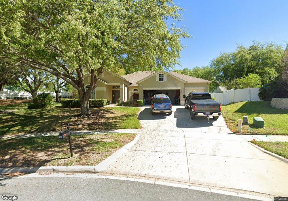
460 Rob Roy Dr Clermont, FL 34711
Estimated Value: $449,223 - $524,000
3
Beds
2
Baths
2,830
Sq Ft
$173/Sq Ft
Est. Value
About This Home
This home is located at 460 Rob Roy Dr, Clermont, FL 34711 and is currently estimated at $490,556, approximately $173 per square foot. 460 Rob Roy Dr is a home located in Lake County with nearby schools including Aurelia Cole Academy, South Lake High School, and Better Life K4c Christian Academy.
Ownership History
Date
Name
Owned For
Owner Type
Purchase Details
Closed on
Nov 24, 2003
Sold by
Parrish Pamela S and Parrish John R
Bought by
Parrish John R and Parrish Pamela S
Current Estimated Value
Purchase Details
Closed on
Jun 13, 2002
Sold by
Cambridge Homes Ltd
Bought by
Lorenz Pamela S
Home Financials for this Owner
Home Financials are based on the most recent Mortgage that was taken out on this home.
Original Mortgage
$143,250
Outstanding Balance
$59,299
Interest Rate
6.79%
Mortgage Type
Purchase Money Mortgage
Estimated Equity
$431,257
Create a Home Valuation Report for This Property
The Home Valuation Report is an in-depth analysis detailing your home's value as well as a comparison with similar homes in the area
Purchase History
| Date | Buyer | Sale Price | Title Company |
|---|---|---|---|
| Parrish John R | $66,400 | -- | |
| Lorenz Pamela S | $203,300 | -- |
Source: Public Records
Mortgage History
| Date | Status | Borrower | Loan Amount |
|---|---|---|---|
| Open | Lorenz Pamela S | $143,250 |
Source: Public Records
Tax History
| Year | Tax Paid | Tax Assessment Tax Assessment Total Assessment is a certain percentage of the fair market value that is determined by local assessors to be the total taxable value of land and additions on the property. | Land | Improvement |
|---|---|---|---|---|
| 2026 | -- | $175,520 | -- | -- |
| 2025 | -- | $170,750 | -- | -- |
| 2024 | -- | $170,750 | -- | -- |
| 2023 | $0 | $160,960 | $0 | $0 |
| 2022 | $2,006 | $156,280 | $0 | $0 |
| 2021 | $1,889 | $151,732 | $0 | $0 |
| 2020 | $1,869 | $149,638 | $0 | $0 |
| 2019 | $1,897 | $146,274 | $0 | $0 |
| 2018 | $1,811 | $143,547 | $0 | $0 |
| 2017 | $1,774 | $140,595 | $0 | $0 |
| 2016 | $1,759 | $137,704 | $0 | $0 |
| 2015 | $1,798 | $136,747 | $0 | $0 |
| 2014 | $1,750 | $135,662 | $0 | $0 |
Source: Public Records
Map
Nearby Homes
- 629 Harbor Villa Ct
- 0 Roys Rd Unit MFRO6235691
- 682 Lexington Dr
- 333 Nautica Mile Dr
- 152 Riggings Way
- 162 Riggings Way
- 292 Nautica Mile Dr
- 697 Winding Lake Dr
- 241 Nautica Mile Dr
- 902 S Galena Ave
- 103 Patricia St
- 747/749 Pitt St
- 550 Disston Ave
- 627 Anderson St
- 0 E Minneola Ave
- 747 Roane Rd
- 660 Shady Nook Dr
- 2411 Palm St
- 508 S Bloxam Ave
- 211 Willow Bend Dr
Your Personal Tour Guide
Ask me questions while you tour the home.