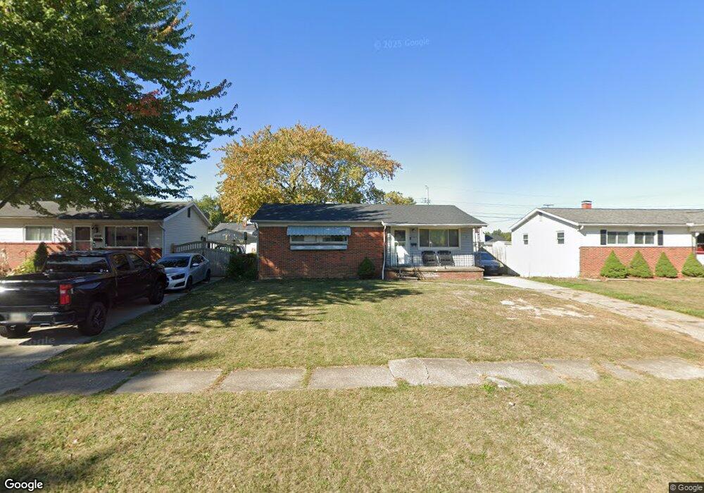
4604 Palm Ave Lorain, OH 44055
Estimated Value: $115,000 - $151,000
3
Beds
1
Bath
936
Sq Ft
$146/Sq Ft
Est. Value
About This Home
This home is located at 4604 Palm Ave, Lorain, OH 44055 and is currently estimated at $136,931, approximately $146 per square foot. 4604 Palm Ave is a home located in Lorain County with nearby schools including Helen Steiner Rice Elementary School, Southview Middle School, and Lorain High School.
Ownership History
Date
Name
Owned For
Owner Type
Purchase Details
Closed on
Jan 21, 2010
Sold by
Grange Mutual Casualty Company
Bought by
Crossroad Properties Llc
Current Estimated Value
Purchase Details
Closed on
Aug 20, 2009
Sold by
Tater Derek
Bought by
Grange Mutual Casualty Company
Purchase Details
Closed on
Dec 13, 2005
Sold by
Bevaque Joseph H and Bevaque William S
Bought by
Tater Derek
Home Financials for this Owner
Home Financials are based on the most recent Mortgage that was taken out on this home.
Original Mortgage
$72,815
Interest Rate
6.4%
Mortgage Type
Purchase Money Mortgage
Create a Home Valuation Report for This Property
The Home Valuation Report is an in-depth analysis detailing your home's value as well as a comparison with similar homes in the area
Home Values in the Area
Average Home Value in this Area
Purchase History
| Date | Buyer | Sale Price | Title Company |
|---|---|---|---|
| Crossroad Properties Llc | $29,900 | Evergreen Title Agency Ltd | |
| Grange Mutual Casualty Company | $40,000 | Attorney | |
| Tater Derek | $56,100 | None Available |
Source: Public Records
Mortgage History
| Date | Status | Borrower | Loan Amount |
|---|---|---|---|
| Previous Owner | Tater Derek | $72,815 |
Source: Public Records
Tax History
| Year | Tax Paid | Tax Assessment Tax Assessment Total Assessment is a certain percentage of the fair market value that is determined by local assessors to be the total taxable value of land and additions on the property. | Land | Improvement |
|---|---|---|---|---|
| 2024 | $1,541 | $36,463 | $9,877 | $26,586 |
| 2023 | $1,312 | $24,826 | $5,915 | $18,911 |
| 2022 | $1,301 | $24,826 | $5,915 | $18,911 |
| 2021 | $1,301 | $24,826 | $5,915 | $18,911 |
| 2020 | $1,205 | $19,990 | $4,760 | $15,230 |
| 2019 | $1,199 | $19,990 | $4,760 | $15,230 |
| 2018 | $1,229 | $19,990 | $4,760 | $15,230 |
| 2017 | $1,259 | $19,780 | $6,370 | $13,410 |
| 2016 | $1,249 | $19,780 | $6,370 | $13,410 |
| 2015 | $1,180 | $19,780 | $6,370 | $13,410 |
| 2014 | $1,127 | $18,930 | $6,100 | $12,830 |
| 2013 | $1,118 | $18,930 | $6,100 | $12,830 |
Source: Public Records
Map
Nearby Homes
- V/L Grove Ave
- 0 Vincent Ave
- 4510 Riverside Dr
- 5278 Farr Ave
- 5193 Liberty Ave
- 4314 Talbot Ln
- 4061 Gregus Ave
- V/L Rear Land Unit 1
- V/L Rear Land Unit 2
- 2456 E 37th St
- 5254 Clinton Ave
- V/L Clinton Ave
- 2402 E 35th St
- 41589 Northwood St
- 1951 E 39th St
- 4210 Seneca Ave
- 42953 N Ridge Rd
- 41651 Northwood St
- 2217 E 32nd St
- 122 Haydens Arbor
Your Personal Tour Guide
Ask me questions while you tour the home.