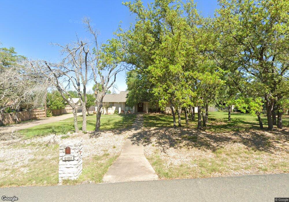
4606 Hightower Dr Round Rock, TX 78681
Brushy Creek NeighborhoodEstimated Value: $485,000 - $600,000
Studio
2
Baths
1,888
Sq Ft
$291/Sq Ft
Est. Value
About This Home
This home is located at 4606 Hightower Dr, Round Rock, TX 78681 and is currently estimated at $549,260, approximately $290 per square foot. 4606 Hightower Dr is a home located in Williamson County with nearby schools including Monta Jane Akin Elementary School, Florence W Stiles Middle, and Vista Ridge High School.
Ownership History
Date
Name
Owned For
Owner Type
Purchase Details
Closed on
Jun 24, 2021
Sold by
Barrette Alan Fredrick and Barrette Alan Fredrick
Bought by
Barrett Jamie
Current Estimated Value
Purchase Details
Closed on
Dec 9, 2020
Sold by
Barrette Janie Kathryn
Bought by
Barrette Alan F and Barrette Alan Fredrick
Home Financials for this Owner
Home Financials are based on the most recent Mortgage that was taken out on this home.
Original Mortgage
$184,900
Interest Rate
2.8%
Mortgage Type
New Conventional
Create a Home Valuation Report for This Property
The Home Valuation Report is an in-depth analysis detailing your home's value as well as a comparison with similar homes in the area
Home Values in the Area
Average Home Value in this Area
Purchase History
| Date | Buyer | Sale Price | Title Company |
|---|---|---|---|
| Barrett Jamie | -- | None Listed On Document | |
| Barrette Alan F | -- | None Available |
Source: Public Records
Mortgage History
| Date | Status | Borrower | Loan Amount |
|---|---|---|---|
| Previous Owner | Barrette Alan F | $184,900 |
Source: Public Records
Tax History
| Year | Tax Paid | Tax Assessment Tax Assessment Total Assessment is a certain percentage of the fair market value that is determined by local assessors to be the total taxable value of land and additions on the property. | Land | Improvement |
|---|---|---|---|---|
| 2025 | $5,591 | $518,193 | $311,293 | $206,900 |
| 2024 | $5,591 | $541,822 | $275,239 | $266,583 |
| 2023 | $5,660 | $539,745 | $0 | $0 |
| 2022 | $9,137 | $490,677 | $0 | $0 |
| 2021 | $9,380 | $446,070 | $202,597 | $245,169 |
| 2020 | $8,602 | $405,518 | $157,212 | $248,306 |
| 2019 | $8,192 | $373,428 | $125,407 | $248,021 |
| 2018 | $5,333 | $379,298 | $125,407 | $253,891 |
| 2017 | $8,076 | $365,415 | $125,407 | $240,008 |
| 2016 | $7,709 | $348,810 | $112,711 | $236,099 |
| 2015 | $4,699 | $292,868 | $112,711 | $195,712 |
| 2014 | $4,699 | $266,244 | $0 | $0 |
Source: Public Records
Map
Nearby Homes
- 1910 Walsh Dr
- 1905 Brushy Bend Dr
- 400 Walsh Glen Dr
- 1607 Mayfield Dr
- 4518 Zacharys Run
- 4516 Zacharys Run
- 502 Williams Way
- 4301 Logan Ridge Dr
- 4213 Arrow Wood Rd
- 2410 Great Oaks Dr Unit 802
- 2410 Great Oaks Dr Unit 401
- 2410 Great Oaks Dr Unit 501
- 4211 Oldenburg Ln
- 4204 Zacharys Run
- 1008 Walsh Hill Trail
- 208 Shorthorn St
- 2702 Double Tree St
- 4026 Anderson Bluff Dr
- 3526 Aquamarine Dr
- 9405 Graceland Trail
- 4604 Hightower Dr
- 2001 Mayfield Dr
- 4602 Hightower Dr
- 4609 Hightower Dr
- 2003 Mayfield Dr
- 2000 Mayfield Dr
- 2004 Walsh Dr
- 1906 Walsh Dr
- LOT 4 MAYFIELD DRIVE Mayfield Dr
- LOT 5 MAYFIELD DRIVE Mayfield Dr
- LOT 3 MAYFIELD DRIVE Mayfield Dr
- LOT 2 MAYFIELD DRIVE Mayfield Dr
- LOT 6 MAYFIELD DRIVE Mayfield Dr
- LOT 1 MAYFIELD DRIVE Mayfield Dr
- 2409 Mayfield Dr
- 2005 Mayfield Dr
- 1904 Mayfield Dr
- 1901 Mayfield Dr
- 1901 Mayfield Dr
- 2007 Mayfield Dr
Your Personal Tour Guide
Ask me questions while you tour the home.