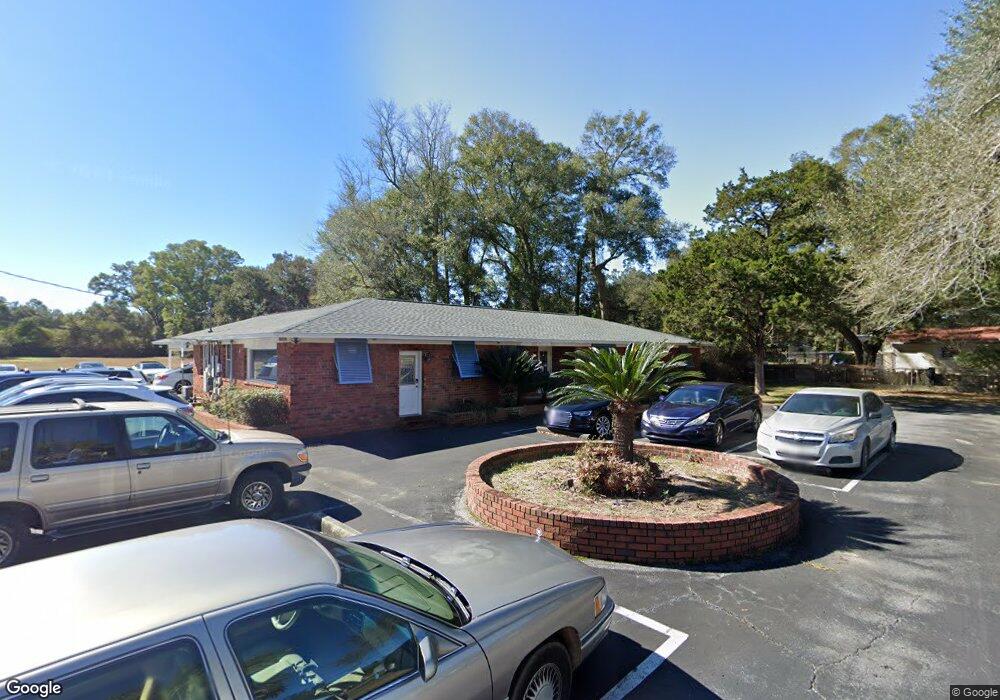
461 E 10 Mile Rd Pensacola, FL 32534
Estimated Value: $734,682
Studio
2
Baths
3,050
Sq Ft
$241/Sq Ft
Est. Value
About This Home
This home is located at 461 E 10 Mile Rd, Pensacola, FL 32534 and is currently estimated at $734,682, approximately $240 per square foot. 461 E 10 Mile Rd is a home located in Escambia County with nearby schools including L.D. McArthur Elementary School, Ferry Pass Middle School, and J.M. Tate Senior High School.
Ownership History
Date
Name
Owned For
Owner Type
Purchase Details
Closed on
Oct 24, 2016
Sold by
Bay Dental Inc
Bought by
Hinman Roy H
Current Estimated Value
Purchase Details
Closed on
Jun 4, 2009
Sold by
Professional Association Of Health Care
Bought by
Bay Dental Inc
Home Financials for this Owner
Home Financials are based on the most recent Mortgage that was taken out on this home.
Original Mortgage
$199,746
Interest Rate
4.77%
Mortgage Type
Commercial
Create a Home Valuation Report for This Property
The Home Valuation Report is an in-depth analysis detailing your home's value as well as a comparison with similar homes in the area
Home Values in the Area
Average Home Value in this Area
Purchase History
| Date | Buyer | Sale Price | Title Company |
|---|---|---|---|
| Hinman Roy H | $358,000 | Southern Guaranty Title Co | |
| Bay Dental Inc | $240,000 | Surety Land Title Of Fl Llc |
Source: Public Records
Mortgage History
| Date | Status | Borrower | Loan Amount |
|---|---|---|---|
| Previous Owner | Bay Dental Inc | $199,746 |
Source: Public Records
Tax History
| Year | Tax Paid | Tax Assessment Tax Assessment Total Assessment is a certain percentage of the fair market value that is determined by local assessors to be the total taxable value of land and additions on the property. | Land | Improvement |
|---|---|---|---|---|
| 2025 | $4,199 | $315,376 | $47,450 | $267,926 |
| 2024 | $3,926 | $340,608 | $47,450 | $293,158 |
| 2023 | $3,926 | $272,328 | $0 | $0 |
| 2022 | $3,608 | $279,128 | $27,740 | $251,388 |
| 2021 | $3,256 | $227,602 | $0 | $0 |
| 2020 | $2,912 | $204,605 | $0 | $0 |
| 2019 | $2,815 | $195,822 | $0 | $0 |
| 2018 | $2,764 | $188,246 | $0 | $0 |
| 2017 | $2,700 | $179,693 | $0 | $0 |
| 2016 | $2,229 | $144,341 | $0 | $0 |
| 2015 | $3,002 | $195,909 | $0 | $0 |
| 2014 | $2,865 | $185,060 | $0 | $0 |
Source: Public Records
Map
Nearby Homes
- 571 Bridle Way
- 543 Bridle Way
- 534 Bridle Way
- 530 Bridle Way
- 554 Bridle Way
- 550 Bridle Way
- 542 Bridle Way
- 527 Bridle Way
- 10608 Chemstrand Rd
- 10610 Chemstrand Rd
- 538 Bridle Way
- 539 Bridle Way
- 531 Bridle Way
- 526 Bridle Way
- 10408 Millbrook Dr
- 726 Anzie Ave
- 638 Saleta St
- 627 Saleta St
- 381 Robinson Ln
- 1007 Patriot Place
- 461 E Ten Mile Rd
- 441 E Ten Mile Rd
- 402 Twin Bay Dr
- 15 Northcreek Dr
- 431 E Ten Mile Rd
- 420 E Ten Mile Rd
- 481 E Ten Mile Rd
- 471 E Ten Mile Rd
- 421 E Ten Mile Rd
- 440 E Ten Mile Rd
- 406 Twin Bay Dr
- 460 E Ten Mile Rd
- 403 Twin Bay Dr
- 430 E Ten Mile Rd
- 411 E Ten Mile Rd
- 424 Twin Bay Dr
- 470 E Ten Mile Rd
- 10388 Holsberry Rd
- 491 E Ten Mile Rd
- 426 Twin Bay Dr
Your Personal Tour Guide
Ask me questions while you tour the home.