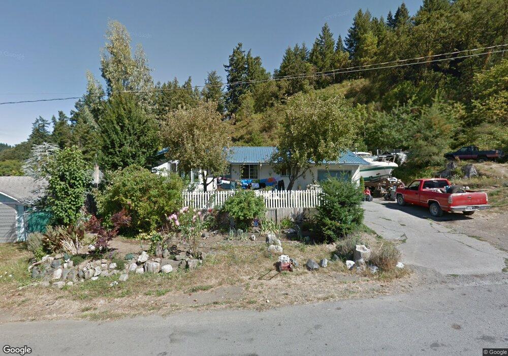
461 Fir St Powers, OR 97466
Estimated Value: $218,000 - $243,636
3
Beds
1
Bath
1,074
Sq Ft
$215/Sq Ft
Est. Value
About This Home
This home is located at 461 Fir St, Powers, OR 97466 and is currently estimated at $230,818, approximately $214 per square foot. 461 Fir St is a home located in Coos County with nearby schools including Powers High School.
Create a Home Valuation Report for This Property
The Home Valuation Report is an in-depth analysis detailing your home's value as well as a comparison with similar homes in the area
Tax History
We collect this data history from publicly available records. To have your information removed, we recommend requesting removal directly through your county’s website.
| Year | Tax Paid | Tax Assessment Tax Assessment Total Assessment is a certain percentage of the fair market value that is determined by local assessors to be the total taxable value of land and additions on the property. | Land | Improvement |
|---|---|---|---|---|
| 2025 | $1,754 | $108,850 | -- | -- |
| 2024 | $1,666 | $105,680 | -- | -- |
| 2023 | $1,617 | $102,610 | $0 | $0 |
| 2022 | $1,592 | $99,630 | $0 | $0 |
| 2021 | $1,546 | $96,730 | $0 | $0 |
| 2020 | $1,473 | $96,730 | $0 | $0 |
| 2019 | $1,411 | $91,190 | $0 | $0 |
| 2018 | $1,371 | $88,540 | $0 | $0 |
| 2017 | $1,334 | $85,970 | $0 | $0 |
| 2016 | $1,294 | $83,470 | $0 | $0 |
| 2015 | $1,204 | $81,040 | $0 | $0 |
| 2014 | $1,204 | $78,680 | $0 | $0 |
Source: Public Records
Map
Nearby Homes
- 410 3rd Ave
- 480 Poplar St
- 510 Fir St
- 631 2nd Ave
- 173 E Date St
- 151 E Date St
- 130 E Date St
- 815 E Ave
- 930 C Ave
- 321 W Date St
- 0 Alder St
- 0 Whobrey St Unit 154929787
- 889 H Ave
- 220 W Birch St
- 711 H Ave
- 800 King Unit 22
- 0 King St
- 45651 Johnson Mountain Rd
- 0 Johnson Mt Rd Unit 600 168667991
- 41308 S Powers Rd
Your Personal Tour Guide
Ask me questions while you tour the home.