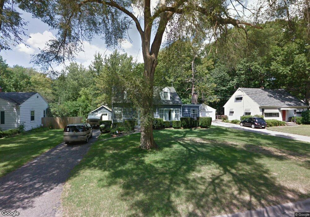
4618 Addison Rd Lansing, MI 48917
Estimated Value: $189,000 - $249,000
4
Beds
2
Baths
1,659
Sq Ft
$132/Sq Ft
Est. Value
About This Home
This home is located at 4618 Addison Rd, Lansing, MI 48917 and is currently estimated at $219,199, approximately $132 per square foot. 4618 Addison Rd is a home located in Eaton County with nearby schools including Waverly Senior High School, Windemere Park Charter Academy, and St. Gerard Elementary School.
Ownership History
Date
Name
Owned For
Owner Type
Purchase Details
Closed on
Jul 10, 2025
Sold by
Ray Beth Ann and Ray William B
Bought by
William B Ray And Beth Ann Ray Revocable Trus and Ray
Current Estimated Value
Purchase Details
Closed on
Feb 22, 2005
Sold by
Washington Mutual Bank Fa
Bought by
Ray William and Ray Beth Ann
Home Financials for this Owner
Home Financials are based on the most recent Mortgage that was taken out on this home.
Original Mortgage
$97,500
Interest Rate
10.62%
Mortgage Type
New Conventional
Purchase Details
Closed on
Mar 4, 2004
Sold by
Ray William B and Phillips Beth Ann
Bought by
Washington Mutual Bank Fa
Create a Home Valuation Report for This Property
The Home Valuation Report is an in-depth analysis detailing your home's value as well as a comparison with similar homes in the area
Home Values in the Area
Average Home Value in this Area
Purchase History
We collect this data history from publicly available records. To have your information removed, we recommend requesting removal directly through your county’s website.
| Date | Buyer | Sale Price | Title Company |
|---|---|---|---|
| William B Ray And Beth Ann Ray Revocable Trus | -- | None Listed On Document | |
| William B Ray And Beth Ann Ray Revocable Trus | -- | None Listed On Document | |
| Ray William | $89,414 | Westminster Title Agency | |
| Washington Mutual Bank Fa | $77,460 | -- |
Source: Public Records
Mortgage History
We collect this data history from publicly available records. To have your information removed, we recommend requesting removal directly through your county’s website.
| Date | Status | Borrower | Loan Amount |
|---|---|---|---|
| Previous Owner | Ray William | $97,500 |
Source: Public Records
Tax History
| Year | Tax Paid | Tax Assessment Tax Assessment Total Assessment is a certain percentage of the fair market value that is determined by local assessors to be the total taxable value of land and additions on the property. | Land | Improvement |
|---|---|---|---|---|
| 2025 | $2,821 | $86,300 | $0 | $0 |
| 2024 | $1,647 | $81,200 | $0 | $0 |
| 2023 | $1,583 | $73,300 | $0 | $0 |
| 2022 | $2,457 | $69,200 | $0 | $0 |
| 2021 | $2,376 | $63,000 | $0 | $0 |
| 2020 | $2,440 | $58,300 | $0 | $0 |
| 2019 | $2,427 | $56,052 | $0 | $0 |
| 2018 | $2,385 | $53,800 | $0 | $0 |
| 2017 | $2,329 | $53,800 | $0 | $0 |
| 2016 | -- | $52,800 | $0 | $0 |
| 2015 | -- | $52,600 | $0 | $0 |
| 2014 | -- | $50,000 | $0 | $0 |
| 2013 | -- | $50,500 | $0 | $0 |
Source: Public Records
Map
Nearby Homes
- 1021 Bretton Rd
- 4522 Arden Rd
- 5035 Applewood Dr
- 1031 Mall Dr E
- 821 Clark Rd
- 0 San Gabriel
- 401 Richard Ave
- 410 Julian Ave
- 1910 Elmwood Rd
- 4103 Wagon Wheel Ln
- 3716 Macon Ave
- 321 Renker Rd
- 2133 Wayland Dr
- 215 Winifred Ave Unit A & B
- 1325 Shaffer Ct
- 217 Richard Ave
- 0000 N Dibble Ave
- 5137 Dorene Dr
- 1222 Ravenswood Dr
- 761 Fitting Ave
- 4616 Addison Rd
- 1111 Bretton Rd
- 1115 Bretton Rd
- 4625 Arden Rd
- 4613 Addison Rd
- 4617 Arden Rd
- 4611 Addison Rd
- 4635 Arden Rd
- 4615 Addison Rd
- 1100 Maycroft Rd
- 4530 Addison Rd
- 1127 Bretton Rd
- 1046 Maycroft Rd
- 4526 Addison Rd
- 1040 Bretton Rd
- 1118 Bretton Rd
- 1023 Bretton Rd
- V/L Maycroft Rd
- 1200 Bretton Rd
- 1040 Maycroft Rd
Your Personal Tour Guide
Ask me questions while you tour the home.