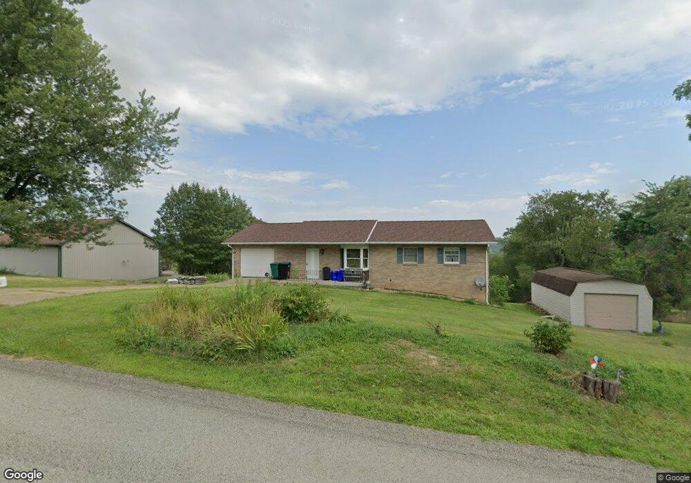
463 Malone Ridge Rd Washington, PA 15301
Estimated Value: $270,647 - $293,000
1
Bed
2
Baths
1,144
Sq Ft
$249/Sq Ft
Est. Value
About This Home
This home is located at 463 Malone Ridge Rd, Washington, PA 15301 and is currently estimated at $284,912, approximately $249 per square foot. 463 Malone Ridge Rd is a home located in Washington County with nearby schools including Trinity Senior High School and First Love Christian Academy.
Ownership History
Date
Name
Owned For
Owner Type
Purchase Details
Closed on
May 27, 2014
Sold by
Howe Lang Eileen M
Bought by
Howe Lang Tr Eileen M and Eileen M Howe Lang Rev Liv Tr
Current Estimated Value
Purchase Details
Closed on
Feb 3, 2003
Sold by
Brocious Brook
Bought by
Lang George
Home Financials for this Owner
Home Financials are based on the most recent Mortgage that was taken out on this home.
Original Mortgage
$108,000
Interest Rate
6.09%
Mortgage Type
New Conventional
Purchase Details
Closed on
Aug 23, 2001
Sold by
I M C Mtg Co
Bought by
Brocious Brook
Create a Home Valuation Report for This Property
The Home Valuation Report is an in-depth analysis detailing your home's value as well as a comparison with similar homes in the area
Home Values in the Area
Average Home Value in this Area
Purchase History
| Date | Buyer | Sale Price | Title Company |
|---|---|---|---|
| Howe Lang Tr Eileen M | -- | -- | |
| Lang George | $120,000 | -- | |
| Brocious Brook | $111,000 | -- |
Source: Public Records
Mortgage History
| Date | Status | Borrower | Loan Amount |
|---|---|---|---|
| Previous Owner | Lang George | $108,000 |
Source: Public Records
Tax History
| Year | Tax Paid | Tax Assessment Tax Assessment Total Assessment is a certain percentage of the fair market value that is determined by local assessors to be the total taxable value of land and additions on the property. | Land | Improvement |
|---|---|---|---|---|
| 2025 | $3,984 | $200,500 | $40,400 | $160,100 |
| 2024 | $3,511 | $200,500 | $40,400 | $160,100 |
| 2023 | $3,511 | $200,500 | $40,400 | $160,100 |
| 2022 | $3,394 | $200,500 | $40,400 | $160,100 |
| 2021 | $3,344 | $200,500 | $40,400 | $160,100 |
| 2020 | $3,344 | $200,500 | $40,400 | $160,100 |
| 2019 | $3,276 | $200,500 | $40,400 | $160,100 |
| 2018 | $3,320 | $200,500 | $40,400 | $160,100 |
| 2017 | $87 | $200,500 | $40,400 | $160,100 |
| 2016 | $87 | $15,790 | $1,851 | $13,939 |
| 2015 | $87 | $15,790 | $1,851 | $13,939 |
| 2014 | $393 | $15,790 | $1,851 | $13,939 |
| 2013 | $393 | $15,790 | $1,851 | $13,939 |
Source: Public Records
Map
Nearby Homes
- 1050 Lynn Portal Rd
- 2667 Jefferson Ave
- 4 Dogwood Dr
- 395 Crescent Dr
- 215 Wolf Ave
- 69 Hewitt Ave
- 1120 Henderson Ave
- 338 Festival Rd
- 328 Festival Rd
- 502 Bower Ave
- 204 Castle Rd
- 199 Mcclay Rd
- 180 Hilltop Ln
- 421 Fawn Dr
- 1824 Jefferson Ave
- 172 Malone Ridge Rd
- 229 Miller Rd
- 7 Short Ave
- 952 Murphy Dr
- 108 Oakwood Ave
- 459 Malone Ridge Rd
- 472 Malone Ridge Rd
- 472 Malone Ridge Rd
- 460 Malone Ridge Rd
- 457 Malone Ridge Rd
- 441 Malone Ridge Rd
- 447 Malone Ridge Rd
- 419 Malone Ridge Rd
- 435 Malone Ridge Rd
- 23 Rawson Dr
- 0 Rawson Dr
- 517 Malone Ridge Rd
- 39 Rawson Dr
- 39 Rawson Dr
- 39 Rawson Dr
- 423 Malone Ridge Rd
- 424 Malone Ridge Rd
- 527 Malone Ridge Rd
- 61 Rawson Dr
- 530 Malone Ridge Rd
Your Personal Tour Guide
Ask me questions while you tour the home.