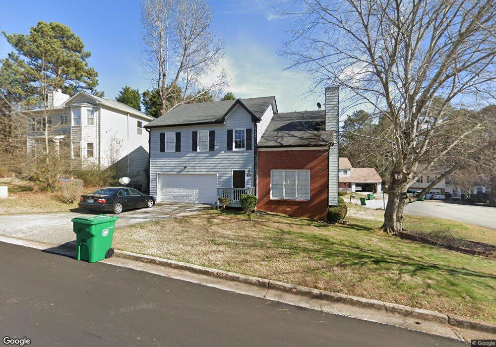
464 Allgood Cir Stone Mountain, GA 30083
Estimated Value: $234,000 - $295,000
4
Beds
3
Baths
2,154
Sq Ft
$124/Sq Ft
Est. Value
About This Home
This home is located at 464 Allgood Cir, Stone Mountain, GA 30083 and is currently estimated at $267,883, approximately $124 per square foot. 464 Allgood Cir is a home located in DeKalb County with nearby schools including Allgood Elementary School, Freedom Middle School, and Clarkston High School.
Ownership History
Date
Name
Owned For
Owner Type
Purchase Details
Closed on
May 10, 2019
Sold by
Resicap Fund 1 Llc
Bought by
Lindo Howein
Current Estimated Value
Home Financials for this Owner
Home Financials are based on the most recent Mortgage that was taken out on this home.
Original Mortgage
$131,920
Outstanding Balance
$115,507
Interest Rate
4.1%
Mortgage Type
New Conventional
Estimated Equity
$152,376
Purchase Details
Closed on
Feb 5, 2019
Sold by
Williams Jody
Bought by
Resicap Fund 1 Llc
Purchase Details
Closed on
Aug 19, 2013
Sold by
Williams Debra Renee
Bought by
Williams Jody Robriquez
Purchase Details
Closed on
Jun 16, 1998
Sold by
Reticker Timothy E and Reticker Aleyda D
Bought by
Williams Jody and Williams Debora
Home Financials for this Owner
Home Financials are based on the most recent Mortgage that was taken out on this home.
Original Mortgage
$110,276
Interest Rate
7.14%
Mortgage Type
FHA
Create a Home Valuation Report for This Property
The Home Valuation Report is an in-depth analysis detailing your home's value as well as a comparison with similar homes in the area
Home Values in the Area
Average Home Value in this Area
Purchase History
| Date | Buyer | Sale Price | Title Company |
|---|---|---|---|
| Lindo Howein | $136,000 | -- | |
| Resicap Fund 1 Llc | $109,000 | -- | |
| Williams Jody Robriquez | -- | -- | |
| Williams Jody | $112,000 | -- |
Source: Public Records
Mortgage History
| Date | Status | Borrower | Loan Amount |
|---|---|---|---|
| Open | Lindo Howein | $131,920 | |
| Previous Owner | Williams Jody | $110,276 |
Source: Public Records
Tax History
| Year | Tax Paid | Tax Assessment Tax Assessment Total Assessment is a certain percentage of the fair market value that is determined by local assessors to be the total taxable value of land and additions on the property. | Land | Improvement |
|---|---|---|---|---|
| 2025 | $5,286 | $110,440 | $15,000 | $95,440 |
| 2024 | $4,822 | $99,840 | $15,000 | $84,840 |
| 2023 | $4,822 | $91,120 | $15,000 | $76,120 |
Source: Public Records
Map
Nearby Homes
- 407 Sheppard Xing Ct
- 488 Barclay Ct
- 4223 Sheppard Xing Way Unit 1
- 481 Pine Dr
- 434 Dixie Lee Ln
- 592 Allgood Rd
- 550 S Rays Rd
- 539 Prince of Wales
- 645 Oak Hill Cir
- 4561 Garden Hills Dr
- 497 Prince of Wales
- 486 Prince of Wales
- 525 Magnolia Dr
- 4234 Rockbridge Heights Dr
- 457 Prince of Wales
- 4584 Garden Hills Dr
- 4250 Village Square Ln
- 4578 Craghill Cir
- 404 Prince of Wales
- 448 Prince of Wales
- 458 Allgood Cir
- 4385 Allgood Place
- 4394 Allgood Place
- 463 Allgood Cir
- 450 Allgood Cir
- 459 Allgood Cir
- 469 Allgood Cir
- 4393 Allgood Place
- 480 Allgood Cir
- 4391 Allgood Place
- 455 Allgood Cir Unit 1
- 473 Allgood Cir
- 449 Allgood Cir
- 4388 Allgood Terrace
- 4384 Allgood Terrace
- 445 Allgood Cir
- 432 Sheppard Crook
- 4390 Allgood Terrace
- 467 Allgood Rd
- 428 Sheppard Crook
Your Personal Tour Guide
Ask me questions while you tour the home.