Estimated Value: $732,000 - $898,000
5
Beds
2
Baths
2,017
Sq Ft
$413/Sq Ft
Est. Value
About This Home
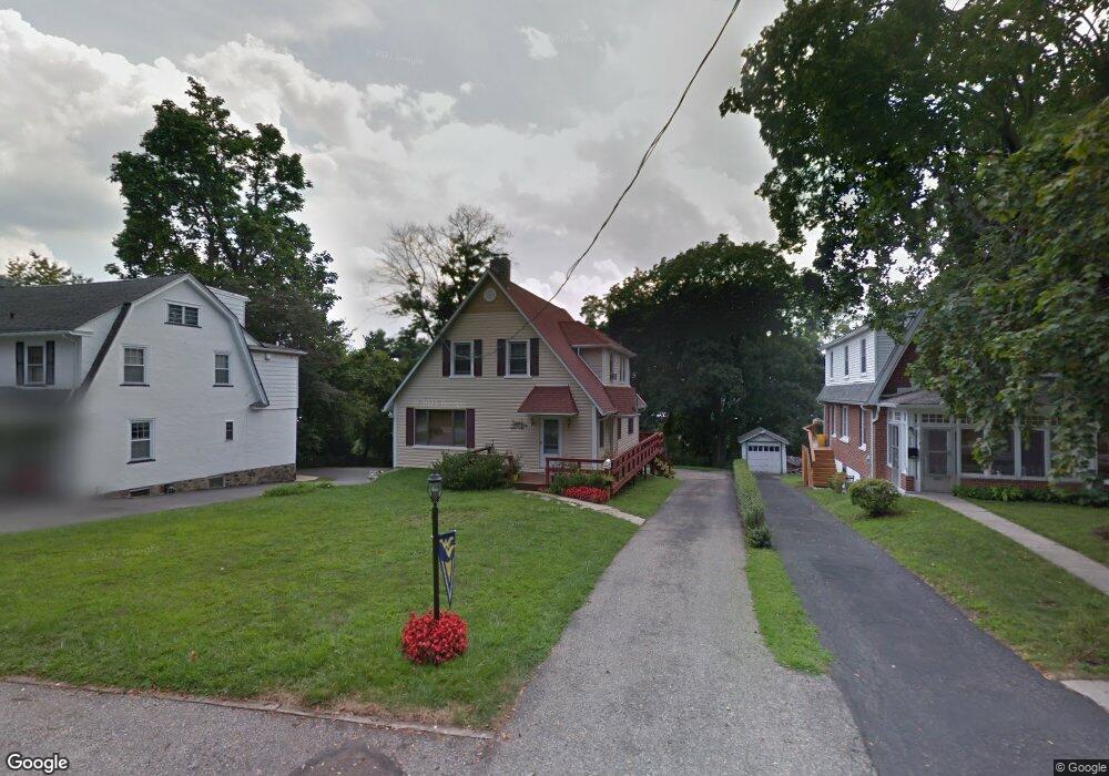
This home is located at 464 Saint Davids Ave, Wayne, PA 19087 and is currently estimated at $833,445, approximately $413 per square foot. 464 Saint Davids Ave is a home located in Delaware County with nearby schools including Wayne Elementary School, Radnor Middle School, and Radnor Senior High School.
Ownership History
Date
Name
Owned For
Owner Type
Purchase Details
Closed on
Nov 14, 2008
Sold by
Keogh Judith L
Bought by
Shao Stephen and Shao Ting Nam
Current Estimated Value
Home Financials for this Owner
Home Financials are based on the most recent Mortgage that was taken out on this home.
Original Mortgage
$286,975
Interest Rate
5.65%
Mortgage Type
Purchase Money Mortgage
Create a Home Valuation Report for This Property
The Home Valuation Report is an in-depth analysis detailing your home's value as well as a comparison with similar homes in the area
Home Values in the Area
Average Home Value in this Area
Purchase History
| Date | Buyer | Sale Price | Title Company |
|---|---|---|---|
| Shao Stephen | $445,000 | None Available |
Source: Public Records
Mortgage History
| Date | Status | Borrower | Loan Amount |
|---|---|---|---|
| Closed | Shao Stephen | $286,975 |
Source: Public Records
Tax History
| Year | Tax Paid | Tax Assessment Tax Assessment Total Assessment is a certain percentage of the fair market value that is determined by local assessors to be the total taxable value of land and additions on the property. | Land | Improvement |
|---|---|---|---|---|
| 2025 | $11,163 | $552,130 | $145,710 | $406,420 |
| 2024 | $11,163 | $552,130 | $145,710 | $406,420 |
| 2023 | $10,721 | $552,130 | $145,710 | $406,420 |
| 2022 | $10,604 | $552,130 | $145,710 | $406,420 |
| 2021 | $17,032 | $552,130 | $145,710 | $406,420 |
| 2020 | $7,156 | $205,710 | $71,570 | $134,140 |
| 2019 | $6,954 | $205,710 | $71,570 | $134,140 |
| 2018 | $6,818 | $205,710 | $0 | $0 |
| 2017 | $6,675 | $205,710 | $0 | $0 |
| 2016 | $1,129 | $205,710 | $0 | $0 |
| 2015 | $1,152 | $205,710 | $0 | $0 |
| 2014 | $1,152 | $205,710 | $0 | $0 |
Source: Public Records
Map
Nearby Homes
- 300 Iron Works Way Unit 326
- 421 Midland Ave
- 260 N Aberdeen Ave
- 500 E Lancaster Ave Unit 111A
- 458 Huston Rd
- 317 E Beechtree Ln
- 1052 Eagle Rd
- 50 Fariston Rd
- 118 W Beechtree Ln
- 220 Radnor Chester Rd
- 216 Bloomingdale Ave
- 105 Privet Ln
- 417 Eagle Rd Unit 9
- 415 Eagle Rd Unit 8
- 423 Maplewood Ave
- 24 Orchard Ln
- 658 Brooke Rd
- 848 Parkes Run Ln
- 306 Windsor Ave
- 228 S Radnor Chester Rd
- 462 Saint Davids Ave
- 458 Saint Davids Ave
- 468 Saint Davids Ave
- 470 Saint Davids Ave
- 456 Saint Davids Ave
- 450 Saint Davids Ave
- 472 Saint Davids Ave
- 454 Saint Davids Ave
- 474 Saint Davids Ave
- 452 Saint Davids Ave
- 455 Saint Davids Ave
- 453 Saint Davids Ave
- 473 Saint Davids Ave
- 476 Saint Davids Ave
- 448 Saint Davids Ave
- 214 Iron Works Way Unit F
- 221 Iron Works Way
- 215 Iron Works Way
- 235 Iron Works Way
- 212 Iron Works Way Unit 212
Your Personal Tour Guide
Ask me questions while you tour the home.