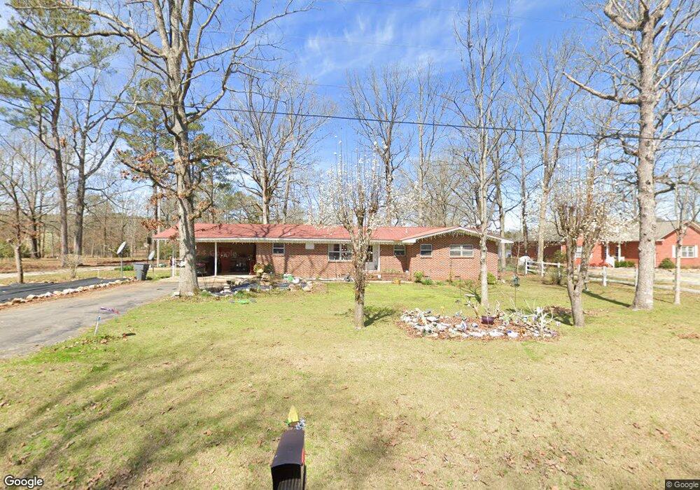
4640 Cornwall Dr Cedar Bluff, GA 35959
Estimated Value: $189,099 - $308,000
Studio
2
Baths
1,628
Sq Ft
$141/Sq Ft
Est. Value
About This Home
This home is located at 4640 Cornwall Dr, Cedar Bluff, GA 35959 and is currently estimated at $230,275, approximately $141 per square foot. 4640 Cornwall Dr is a home located in Cherokee County with nearby schools including Cherokee County High School.
Ownership History
Date
Name
Owned For
Owner Type
Purchase Details
Closed on
Jun 10, 2021
Sold by
Lynn Jones Jennifer
Bought by
Jones Reginald D
Current Estimated Value
Purchase Details
Closed on
Dec 13, 2019
Sold by
Lutenbacher Melissa A and Lutenbacher Melissa A
Bought by
Jones Reginald D and Jones Jennifer L
Home Financials for this Owner
Home Financials are based on the most recent Mortgage that was taken out on this home.
Original Mortgage
$135,057
Interest Rate
3.62%
Mortgage Type
FHA
Purchase Details
Closed on
Dec 3, 2010
Sold by
Roberts Doyle B and Roberts Cynthia A
Bought by
Adams Mary Grace
Create a Home Valuation Report for This Property
The Home Valuation Report is an in-depth analysis detailing your home's value as well as a comparison with similar homes in the area
Purchase History
| Date | Buyer | Sale Price | Title Company |
|---|---|---|---|
| Jones Reginald D | $82,000 | None Listed On Document | |
| Jones Reginald D | $137,550 | Source Of Title | |
| Adams Mary Grace | -- | -- |
Source: Public Records
Mortgage History
| Date | Status | Borrower | Loan Amount |
|---|---|---|---|
| Previous Owner | Jones Reginald D | $135,057 |
Source: Public Records
Tax History
| Year | Tax Paid | Tax Assessment Tax Assessment Total Assessment is a certain percentage of the fair market value that is determined by local assessors to be the total taxable value of land and additions on the property. | Land | Improvement |
|---|---|---|---|---|
| 2025 | $1,412 | $26,280 | $1,100 | $25,180 |
| 2024 | $1,412 | $26,280 | $1,100 | $25,180 |
| 2023 | $1,412 | $30,040 | $0 | $0 |
| 2022 | $1,412 | $4,860 | $1,100 | $3,760 |
| 2021 | $1,159 | $21,320 | $1,000 | $20,320 |
| 2020 | $1,155 | $4,260 | $1,000 | $3,260 |
| 2019 | $1,155 | $21,320 | $1,000 | $20,320 |
| 2018 | $1,155 | $24,580 | $0 | $0 |
| 2017 | $979 | $104,060 | $0 | $0 |
| 2016 | $979 | $104,060 | $0 | $0 |
| 2015 | $394 | $104,060 | $0 | $0 |
| 2014 | $383 | $101,100 | $0 | $0 |
| 2013 | $384 | $101,540 | $0 | $0 |
Source: Public Records
Map
Nearby Homes
- 15210 Highway 9
- 8735 Highway 9
- 4920 Deer Run Rd
- 0 Deer Run Rd
- 1 County Road 92
- 410 County Road 509
- 0 County Road 131 Unit 10720345
- 0 County Road 131 Unit 7743322
- 3899 Hidden Cove Rd
- 3293 Old Highway 9
- 5357 Hidden Cove Rd
- 0 Woodmont Rd Unit 21438707
- 5160 Hidden Cove Rd
- 440 County Road 131
- 345 Cr 1036
- 5150 Sewell Ferry Rd Unit A8
- 5255 Lakeside Ln
- 3780 E Chattooga Dr
- Lot 10 County Road 595
- 3700 Quail Run Dr
- 4640 Cornwall Dr
- 4636 Spruce St
- 4669 Cornwall Dr
- 4619 Poplar St
- 4665 Neely St
- 4635 Cornwall Dr
- 4609 Spruce St
- 4645 Spruce St
- 4709 Neely St
- 4610 Neely St
- 4745 Neely St
- 4720 Neely St
- 4775 Neely St
- 4750 Neely St
- 4715 Forrest St
- 4801 Neely St
- 4655 Al Highway 9
- 4655 Al Highway 9
- 4655 Al Highway 9
- 4790 Neely St
Your Personal Tour Guide
Ask me questions while you tour the home.