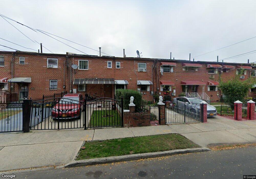
465 Christopher Ave Brooklyn, NY 11212
Brownsville NeighborhoodEstimated Value: $555,046 - $665,000
About This Home
This home is located at 465 Christopher Ave, Brooklyn, NY 11212 and is currently estimated at $604,512, approximately $541 per square foot. 465 Christopher Ave is a home located in Kings County with nearby schools including P.S. 165 Ida Posner, P.S. 150 - Christopher, and P.S. 156 Waverly.
Ownership History
We collect this data history from publicly available records. To have your information removed, we recommend requesting removal directly through your county’s website.
Purchase Details
Purchase Details
Home Financials for this Owner
Home Financials are based on the most recent Mortgage that was taken out on this home.Purchase Details
Home Values in the Area
Average Home Value in this Area
Purchase History
We collect this data history from publicly available records. To have your information removed, we recommend requesting removal directly through your county’s website.
| Date | Buyer | Sale Price | Title Company |
|---|---|---|---|
| -- | -- | ||
| -- | -- | ||
| $125,500 | United General Title Ins Co | ||
| $125,500 | United General Title Ins Co | ||
| -- | -- | ||
| -- | -- |
Mortgage History
We collect this data history from publicly available records. To have your information removed, we recommend requesting removal directly through your county’s website.
| Date | Status | Borrower | Loan Amount |
|---|---|---|---|
| Previous Owner | $124,474 | ||
| Closed | $0 |
Tax History
We collect this data history from publicly available records. To have your information removed, we recommend requesting removal directly through your county’s website.
| Year | Tax Paid | Tax Assessment Tax Assessment Total Assessment is a certain percentage of the fair market value that is determined by local assessors to be the total taxable value of land and additions on the property. | Land | Improvement |
|---|---|---|---|---|
| 2026 | $4,296 | $37,080 | $13,200 | $23,880 |
| 2025 | $4,109 | $33,480 | $13,200 | $20,280 |
| 2024 | $4,109 | $38,400 | $13,200 | $25,200 |
| 2023 | $4,129 | $38,460 | $13,200 | $25,260 |
| 2022 | $3,806 | $36,180 | $13,200 | $22,980 |
| 2021 | $3,944 | $29,220 | $13,200 | $16,020 |
| 2020 | $1,328 | $28,260 | $13,200 | $15,060 |
| 2019 | $2,492 | $27,360 | $13,200 | $14,160 |
| 2018 | $3,394 | $18,109 | $11,160 | $6,949 |
| 2017 | $3,183 | $17,085 | $11,425 | $5,660 |
| 2016 | $3,047 | $16,790 | $12,272 | $4,518 |
| 2015 | $1,724 | $15,840 | $10,980 | $4,860 |
| 2014 | $1,724 | $15,180 | $10,980 | $4,200 |
Map
- 699 Sackman St
- 546 Powell St
- 797 Mother Gaston Blvd
- 555 Christopher Ave
- 570 Christopher Ave
- 578 Christopher Ave
- 428 Newport St
- 533 Snediker Ave
- 587 Osborn St
- 450 Newport St
- 584 Hinsdale St
- 504 Thatford Ave
- 639 Watkins St
- 515 Hinsdale St
- 893 Rockaway Ave
- 460 Hinsdale St
- 578 Williams Ave
- 524 Chester St
- 650 Williams Ave
- 569 Chester St
- 467 Christopher Ave
- 463 Christopher Ave
- 469 Christopher Ave
- 461 Christopher Ave
- 471 Christopher Ave
- 459 Christopher Ave
- 473 Christopher Ave
- 457 Christopher Ave
- 475 Christopher Ave
- 455 Christopher Ave
- 678 Sackman St
- 676 Sackman St
- 682 Sackman St
- 477 Christopher Ave
- 674 Sackman St
- 684 Sackman St
- 672 Sackman St
- 686 Sackman St
- 670 Sackman St
- 688 Sackman St
Ask me questions while you tour the home.