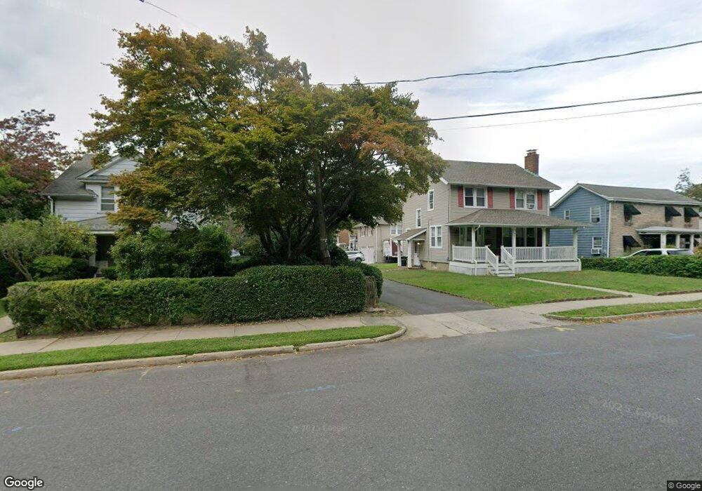
465 High St Long Branch, NJ 07740
Estimated Value: $445,000 - $526,000
3
Beds
1
Bath
1,149
Sq Ft
$416/Sq Ft
Est. Value
About This Home
This home is located at 465 High St, Long Branch, NJ 07740 and is currently estimated at $478,102, approximately $416 per square foot. 465 High St is a home located in Monmouth County with nearby schools including Long Branch High School, Holy Trinity School, and Bet Yaakov of the Jersey Shore.
Ownership History
Date
Name
Owned For
Owner Type
Purchase Details
Closed on
Feb 12, 1998
Sold by
Tirado Reuben
Bought by
Brown Kerry
Current Estimated Value
Home Financials for this Owner
Home Financials are based on the most recent Mortgage that was taken out on this home.
Original Mortgage
$73,000
Outstanding Balance
$12,808
Interest Rate
6.9%
Mortgage Type
FHA
Estimated Equity
$465,294
Create a Home Valuation Report for This Property
The Home Valuation Report is an in-depth analysis detailing your home's value as well as a comparison with similar homes in the area
Home Values in the Area
Average Home Value in this Area
Purchase History
| Date | Buyer | Sale Price | Title Company |
|---|---|---|---|
| Brown Kerry | $73,000 | -- |
Source: Public Records
Mortgage History
| Date | Status | Borrower | Loan Amount |
|---|---|---|---|
| Open | Brown Kerry | $73,000 |
Source: Public Records
Tax History
| Year | Tax Paid | Tax Assessment Tax Assessment Total Assessment is a certain percentage of the fair market value that is determined by local assessors to be the total taxable value of land and additions on the property. | Land | Improvement |
|---|---|---|---|---|
| 2025 | $4,674 | $360,300 | $206,100 | $154,200 |
| 2024 | $4,479 | $304,100 | $156,600 | $147,500 |
| 2023 | $4,479 | $288,400 | $147,600 | $140,800 |
| 2022 | $4,354 | $232,800 | $108,800 | $124,000 |
| 2021 | $4,354 | $217,600 | $101,600 | $116,000 |
| 2020 | $4,307 | $206,100 | $90,800 | $115,300 |
| 2019 | $4,181 | $198,900 | $89,000 | $109,900 |
| 2018 | $4,082 | $193,100 | $87,200 | $105,900 |
| 2017 | $3,883 | $188,400 | $84,500 | $103,900 |
| 2016 | $3,789 | $187,500 | $86,300 | $101,200 |
| 2015 | $4,318 | $193,900 | $91,100 | $102,800 |
| 2014 | $4,084 | $193,300 | $102,100 | $91,200 |
Source: Public Records
Map
Nearby Homes
- 539 Summer St
- 274 Bath Ave
- 274 Bath Ave Unit 23
- 554 Winter St
- 274 N Bath Ave Unit 8
- 325 Bath Ave Unit 27
- 364 Westwood Ave Unit 78
- 364 Westwood Ave Unit 16
- 364 Westwood Ave Unit 52
- 364 Westwood Ave Unit 21
- 377 Westwood Ave
- 578 High St
- 158 Norwood Ave
- 303 Westwood Ave
- 28 Morrell St
- 88 Norwood Ave
- 288 Morris Ave
- 638 Overton Place
- 495 Westwood Ave
- 15 Woolley Ave
- 467 High St
- 377 Waverly Place
- 379 Waverly Place
- 461 High St
- 381 Waverly Place
- 463 High St
- 455 High St
- 488 Waverly Place
- 341 Waverly Place
- 477 High St
- 453 High St
- 492 Waverly Place
- 483 High St
- 389 Waverly Place
- 382 Waverly Place
- 487 High St
- 496 Waverly Place
- 386 Waverly Place
- 491 High St
- 501 Springdale Ave
Your Personal Tour Guide
Ask me questions while you tour the home.