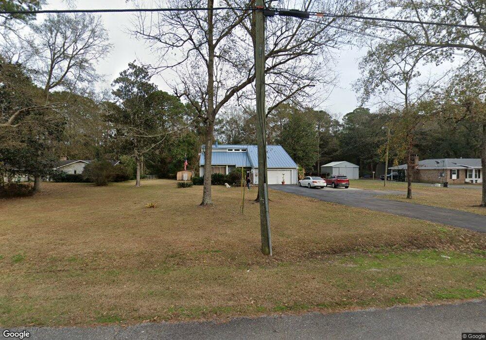
4653 Benson Rd Mobile, AL 36619
Cypress Shores NeighborhoodEstimated Value: $224,000 - $261,000
About This Home
This home is located at 4653 Benson Rd, Mobile, AL 36619 and is currently estimated at $237,756, approximately $123 per square foot. 4653 Benson Rd is a home located in Mobile County with nearby schools including Mary W Burroughs Elementary School, Katherine H Hankins Middle School, and Theodore High School.
Ownership History
We collect this data history from publicly available records. To have your information removed, we recommend requesting removal directly through your county’s website.
Purchase Details
Home Financials for this Owner
Home Financials are based on the most recent Mortgage that was taken out on this home.Home Values in the Area
Average Home Value in this Area
Purchase History
We collect this data history from publicly available records. To have your information removed, we recommend requesting removal directly through your county’s website.
| Date | Buyer | Sale Price | Title Company |
|---|---|---|---|
| $118,000 | -- |
Mortgage History
We collect this data history from publicly available records. To have your information removed, we recommend requesting removal directly through your county’s website.
| Date | Status | Borrower | Loan Amount |
|---|---|---|---|
| Open | $118,000 |
Tax History
We collect this data history from publicly available records. To have your information removed, we recommend requesting removal directly through your county’s website.
| Year | Tax Paid | Tax Assessment Tax Assessment Total Assessment is a certain percentage of the fair market value that is determined by local assessors to be the total taxable value of land and additions on the property. | Land | Improvement |
|---|---|---|---|---|
| 2025 | $1,000 | $16,630 | $2,500 | $14,130 |
| 2024 | $1,000 | $15,910 | $2,400 | $13,510 |
| 2023 | $954 | $13,860 | $2,900 | $10,960 |
| 2022 | $818 | $13,910 | $2,950 | $10,960 |
| 2021 | $789 | $13,460 | $2,500 | $10,960 |
| 2020 | $789 | $13,460 | $2,500 | $10,960 |
| 2019 | $785 | $13,400 | $1,600 | $11,800 |
| 2018 | $785 | $13,420 | $0 | $0 |
| 2017 | $794 | $13,560 | $0 | $0 |
| 2016 | $805 | $13,740 | $0 | $0 |
| 2013 | $684 | $11,680 | $0 | $0 |
Map
- 3875 Patricia Dr
- 3801 Point Rd
- 0 Audubon Dr Unit 7716268
- 0 Patricia Dr Unit 7279576
- 4441 Nicholl Dr
- 4502 Cypress Park Dr
- 5030 Cole Dr E
- 0 Downey Dr Unit 7684534
- 4323 Downey Dr
- 3847 Riviere Du Chien Rd
- 4082 Dawson Dr
- 4532 Cypress Park Dr
- 4532 Cypress Park Dr Unit 15
- 0 Riviere Du Chien Unit 7789301
- 0 Riviere Du Chien Unit 27303453
- 0 Worth Dr Unit 7748082
- 0 Worth Dr Unit 7747878
- 4586 Cypress Park Dr
- 2308 Henning Dr N
- 3921 St Andrews Dr E
- 4675 Benson Rd
- 4699 Benson Rd
- 4715 Benson Rd
- 4639 Benson Rd
- 3963 Canal Dr
- 4721 Benson Rd
- 3960 Higgins Rd
- 3973 Canal Dr
- 4617 Benson Rd
- 3924 Higgins Rd
- 3970 Higgins Rd
- 3983 Canal Dr
- 3916 Higgins Rd
- 4626 Benson Rd
- 3984 Canal Dr
- 4618 Benson Rd
- 3959 Higgins Rd
- 3993 Canal Dr
- 3941 Higgins Rd
- 3975 Higgins Rd
Ask me questions while you tour the home.