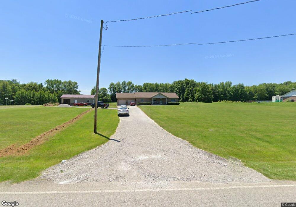
4654 Bardwell Buford Rd Mount Orab, OH 45154
Estimated Value: $276,000 - $306,000
3
Beds
2
Baths
1,653
Sq Ft
$175/Sq Ft
Est. Value
About This Home
This home is located at 4654 Bardwell Buford Rd, Mount Orab, OH 45154 and is currently estimated at $289,491, approximately $175 per square foot. 4654 Bardwell Buford Rd is a home located in Brown County with nearby schools including Western Brown High School.
Ownership History
Date
Name
Owned For
Owner Type
Purchase Details
Closed on
Mar 6, 2019
Sold by
Jones Dawson L and Jones Goldie M
Bought by
Brown Timothy A and Brown Paula D
Current Estimated Value
Purchase Details
Closed on
Feb 15, 2018
Sold by
Bingham Diane S
Bought by
Bingham James S
Purchase Details
Closed on
Feb 23, 1999
Sold by
Jones Dawson L
Bought by
Bingham James S and Bingham Diane S
Home Financials for this Owner
Home Financials are based on the most recent Mortgage that was taken out on this home.
Original Mortgage
$20,000
Interest Rate
8%
Mortgage Type
New Conventional
Create a Home Valuation Report for This Property
The Home Valuation Report is an in-depth analysis detailing your home's value as well as a comparison with similar homes in the area
Purchase History
| Date | Buyer | Sale Price | Title Company |
|---|---|---|---|
| Brown Timothy A | $165,000 | Prodigy Title Agency | |
| Bingham James S | -- | None Available | |
| Bingham James S | $22,500 | -- |
Source: Public Records
Mortgage History
| Date | Status | Borrower | Loan Amount |
|---|---|---|---|
| Previous Owner | Bingham James S | $20,000 |
Source: Public Records
Tax History
| Year | Tax Paid | Tax Assessment Tax Assessment Total Assessment is a certain percentage of the fair market value that is determined by local assessors to be the total taxable value of land and additions on the property. | Land | Improvement |
|---|---|---|---|---|
| 2025 | $2,166 | $75,430 | $14,720 | $60,710 |
| 2024 | $2,166 | $75,430 | $14,720 | $60,710 |
| 2023 | $2,166 | $57,650 | $10,120 | $47,530 |
| 2022 | $1,770 | $57,650 | $10,120 | $47,530 |
| 2021 | $1,744 | $57,650 | $10,120 | $47,530 |
| 2020 | $1,566 | $50,130 | $8,800 | $41,330 |
| 2019 | $1,681 | $50,130 | $8,800 | $41,330 |
| 2018 | $1,668 | $50,130 | $8,800 | $41,330 |
| 2017 | $1,486 | $44,430 | $8,520 | $35,910 |
| 2016 | $1,486 | $44,430 | $8,520 | $35,910 |
| 2015 | $1,499 | $44,430 | $8,520 | $35,910 |
| 2014 | $1,499 | $43,660 | $7,750 | $35,910 |
| 2013 | $1,495 | $43,660 | $7,750 | $35,910 |
Source: Public Records
Map
Nearby Homes
- 3517 Bardwell Buford Rd
- 206 Bingaman Ln
- 203 Bingaman Ln
- 102 Lonny St
- 210 Robin Ave
- 506 E Main St
- 216 Gregory St
- 224 Gregory St
- 226 Gregory St
- 210 Woodward St
- 414 Castle Ave
- 108 Keethler St
- 104 N High St
- 0 Crescent Dr Unit 1876227
- 311 Smith Ave
- 0 State Route 32 Unit 1795308
- 5176 County Highway 8-C
- 5685 Tri County Hwy
- 419 Liming Farm Rd
- 13166 New Hope-White Oak Station Rd
- 4674 Bardwell Buford Rd
- 4700 Bardwell Buford Rd
- 4641 Bardwell Buford Rd
- 4634 Bardwell Buford Rd
- 4746 Bardwell Buford Rd
- 4612 Bardwell Buford Rd
- 4609 Bardwell Buford Rd
- 4747 Bardwell Buford Rd
- 4602 Bardwell Buford Rd
- 4762 Bardwell Buford Rd
- 4556 Bardwell Buford Rd
- 4557 Bardwell Buford Rd
- 14517 Klein Rd
- 4810 Bardwell Buford Rd
- 4514 Bardwell Buford Rd
- 14493 Klein Rd
- 4498 Bardwell Buford Rd
- 14459 Klein Rd
- acres Bardwell Buford Rd
- 14435 Klein Rd
Your Personal Tour Guide
Ask me questions while you tour the home.