4663 Nugent Dr Columbus, OH 43220
Estimated Value: $692,718 - $820,000
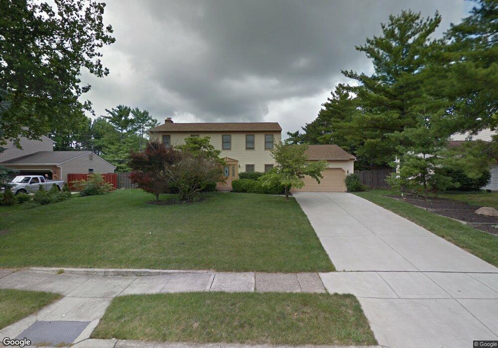
About This Home
This home is located at 4663 Nugent Dr, Columbus, OH 43220 and is currently estimated at $741,930, approximately $261 per square foot. 4663 Nugent Dr is a home located in Franklin County with nearby schools including Greensview Elementary School, Hastings Middle School, and Upper Arlington High School.
Ownership History
We collect this data history from publicly available records. To have your information removed, we recommend requesting removal directly through your county’s website.
Purchase Details
Purchase Details
Home Financials for this Owner
Home Financials are based on the most recent Mortgage that was taken out on this home.Purchase Details
Home Values in the Area
Average Home Value in this Area
Purchase History
We collect this data history from publicly available records. To have your information removed, we recommend requesting removal directly through your county’s website.
| Date | Buyer | Sale Price | Title Company |
|---|---|---|---|
| -- | None Available | ||
| $215,000 | -- | ||
| -- | -- |
Mortgage History
We collect this data history from publicly available records. To have your information removed, we recommend requesting removal directly through your county’s website.
| Date | Status | Borrower | Loan Amount |
|---|---|---|---|
| Open | $172,000 |
Tax History
We collect this data history from publicly available records. To have your information removed, we recommend requesting removal directly through your county’s website.
| Year | Tax Paid | Tax Assessment Tax Assessment Total Assessment is a certain percentage of the fair market value that is determined by local assessors to be the total taxable value of land and additions on the property. | Land | Improvement |
|---|---|---|---|---|
| 2025 | $10,162 | $185,330 | $74,100 | $111,230 |
| 2024 | $10,162 | $185,330 | $74,100 | $111,230 |
| 2023 | $10,072 | $185,325 | $74,095 | $111,230 |
| 2022 | $9,598 | $146,100 | $50,090 | $96,010 |
| 2021 | $8,496 | $146,100 | $50,090 | $96,010 |
| 2020 | $8,957 | $146,100 | $50,090 | $96,010 |
| 2019 | $8,374 | $120,760 | $50,090 | $70,670 |
| 2018 | $7,740 | $120,760 | $50,090 | $70,670 |
| 2017 | $7,790 | $120,760 | $50,090 | $70,670 |
| 2016 | $7,146 | $108,080 | $32,060 | $76,020 |
| 2015 | $7,096 | $107,420 | $32,060 | $75,360 |
| 2014 | $7,104 | $107,420 | $32,060 | $75,360 |
| 2013 | $3,393 | $97,650 | $29,155 | $68,495 |
Map
- 2060 Mackenzie Dr Unit 2
- 4671 Coach Rd
- 2160 Coach Rd N Unit 9
- 2248 Sandover Rd
- 4792 Merrifield Place Unit 41
- 2213 Partlow Dr
- 4573 Arlingate Dr W Unit 4573
- 2315 Haverford Rd
- 1945 Willoway Cir N Unit 1945
- 1915 Brandywine Dr
- 4350 Crown Point Dr
- 2462 Lane Rd
- 1580 Lafayette Dr Unit 1580
- 4342 Randmore Rd
- 4544 Sandringham Dr Unit 4544
- 1512 Lafayette Dr Unit B
- 1474 Lafayette Dr Unit B
- 1484 Lafayette Dr Unit A
- 4532 Carriage Hill Ln
- 4714-4716 Arthur Ct
- 4675 Nugent Dr
- 2065 Sandover Ct
- 4639 Nugent Dr
- 2060 Sandover Ct Unit 62
- 4689 Nugent Dr
- 2027 Braemar Dr
- 2073 Sandover Ct
- 4676 Nugent Dr
- 2074 Sandover Ct
- 2024 Keswick Dr
- 4627 Nugent Dr
- 4701 Nugent Dr Unit 705
- 2015 Braemar Dr
- 2081 Sandover Ct
- 2014 Braemar Dr
- 4690 Nugent Dr Unit 692
- 4692 Nugent Dr
- 2065 Mackenzie Dr Unit 2065
- 2061 Mackenzie Dr
- 2082 Sandover Ct
Ask me questions while you tour the home.