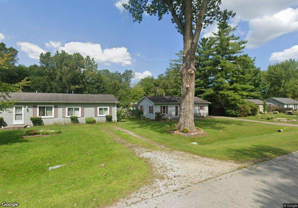
4668 Davidson Rd Smiths Creek, MI 48074
Estimated Value: $140,000 - $220,000
2
Beds
1
Bath
1,190
Sq Ft
$144/Sq Ft
Est. Value
About This Home
This home is located at 4668 Davidson Rd, Smiths Creek, MI 48074 and is currently estimated at $171,532, approximately $144 per square foot. 4668 Davidson Rd is a home located in St. Clair County with nearby schools including Kimball Elementary School, Central Middle School, and Port Huron High School.
Ownership History
Date
Name
Owned For
Owner Type
Purchase Details
Closed on
Mar 10, 2021
Sold by
Schultz Jana M
Bought by
Schultz Gerald
Current Estimated Value
Purchase Details
Closed on
Mar 14, 2008
Sold by
Howe Lawrence A and Howe Tina L
Bought by
Havens Jana M
Home Financials for this Owner
Home Financials are based on the most recent Mortgage that was taken out on this home.
Original Mortgage
$111,150
Outstanding Balance
$69,282
Interest Rate
5.75%
Mortgage Type
Purchase Money Mortgage
Estimated Equity
$102,250
Create a Home Valuation Report for This Property
The Home Valuation Report is an in-depth analysis detailing your home's value as well as a comparison with similar homes in the area
Home Values in the Area
Average Home Value in this Area
Purchase History
| Date | Buyer | Sale Price | Title Company |
|---|---|---|---|
| Schultz Gerald | -- | Liberty Title | |
| Havens Jana M | $117,000 | None Available |
Source: Public Records
Mortgage History
| Date | Status | Borrower | Loan Amount |
|---|---|---|---|
| Open | Havens Jana M | $111,150 |
Source: Public Records
Tax History
| Year | Tax Paid | Tax Assessment Tax Assessment Total Assessment is a certain percentage of the fair market value that is determined by local assessors to be the total taxable value of land and additions on the property. | Land | Improvement |
|---|---|---|---|---|
| 2025 | $877 | $67,700 | $0 | $0 |
| 2024 | $851 | $64,100 | $0 | $0 |
| 2023 | $780 | $61,400 | $0 | $0 |
| 2022 | $1,437 | $51,200 | $0 | $0 |
| 2020 | $1,117 | $46,200 | $46,200 | $0 |
| 2019 | $1,101 | $39,600 | $0 | $0 |
| 2018 | $1,059 | $38,400 | $0 | $0 |
| 2017 | $1,055 | $41,100 | $0 | $0 |
| 2016 | $546 | $41,100 | $0 | $0 |
| 2015 | -- | $40,300 | $40,300 | $0 |
| 2014 | -- | $39,800 | $39,800 | $0 |
| 2013 | -- | $46,100 | $0 | $0 |
Source: Public Records
Map
Nearby Homes
- 1814 Leland Rd
- 1786 Omar Rd
- 1405 Range Rd
- 0000 Range Rd
- 00 Range Rd
- V/L Allen
- 1604 Allen Rd
- 00 Howard Rd
- 0 Wall Rd Unit 50185999
- 0 Allen Rd Unit 20250008597
- 0 Allen Rd Unit 20250008612
- 1255 Quain Ln
- 269 Westbrook Ct
- 284 Rosebud Ct
- 0 Lapeer Rd Unit 50137357
- 4380 Lapeer Rd
- 174 Meadow Ln
- 209 Oldbrook Ln
- 104 Oldbrook Ln
- 153 Meadow Ln
- 4674 Davidson Rd
- 4660 Davidson Rd
- 4654 Davidson Rd
- 4677 Davidson Rd
- 4682 Davidson Rd
- 4685 Davidson Rd
- 4671 Davidson Rd
- 4688 Davidson Rd
- 4655 Davidson Rd
- 4639 Davidson Rd
- 1835 Harvey Rd
- 4696 Davidson Rd
- 4695 Davidson Rd
- 4623 Davidson Rd
- 1841 Harvey Rd
- 1865 Harvey Rd
- 4697 Davidson Rd
- 4697 Davidson Rd
- 4617 Davidson Rd
- 4707 Davidson Rd
Your Personal Tour Guide
Ask me questions while you tour the home.