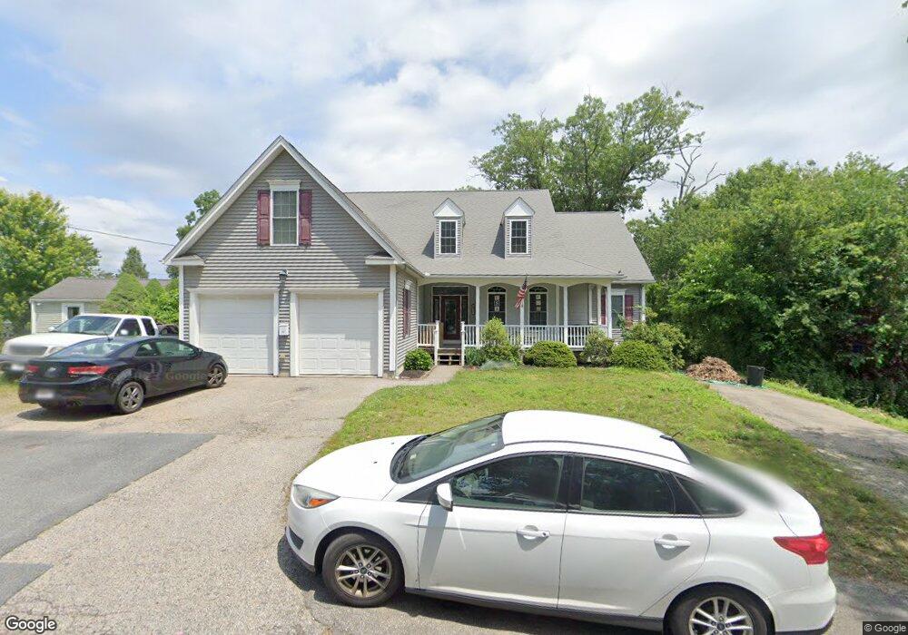
47 Epping St Millbury, MA 01527
Estimated Value: $594,000 - $712,000
4
Beds
3
Baths
2,292
Sq Ft
$290/Sq Ft
Est. Value
About This Home
This home is located at 47 Epping St, Millbury, MA 01527 and is currently estimated at $664,674, approximately $289 per square foot. 47 Epping St is a home located in Worcester County with nearby schools including Elmwood Street Elementary School, Raymond E. Shaw Elementary School, and Millbury Junior/Senior High School.
Create a Home Valuation Report for This Property
The Home Valuation Report is an in-depth analysis detailing your home's value as well as a comparison with similar homes in the area
Home Values in the Area
Average Home Value in this Area
Tax History
| Year | Tax Paid | Tax Assessment Tax Assessment Total Assessment is a certain percentage of the fair market value that is determined by local assessors to be the total taxable value of land and additions on the property. | Land | Improvement |
|---|---|---|---|---|
| 2025 | $9,145 | $683,000 | $109,800 | $573,200 |
| 2024 | $8,408 | $635,500 | $101,700 | $533,800 |
| 2023 | $7,186 | $497,300 | $71,300 | $426,000 |
| 2022 | $6,905 | $460,300 | $71,300 | $389,000 |
| 2021 | $6,721 | $435,600 | $71,300 | $364,300 |
| 2020 | $6,488 | $423,200 | $71,300 | $351,900 |
| 2019 | $6,196 | $390,900 | $64,800 | $326,100 |
| 2018 | $6,129 | $375,100 | $64,800 | $310,300 |
| 2017 | $7,075 | $396,000 | $64,800 | $331,200 |
| 2016 | $6,564 | $398,800 | $64,800 | $334,000 |
| 2015 | $6,370 | $387,000 | $68,900 | $318,100 |
| 2014 | $5,953 | $348,100 | $68,900 | $279,200 |
Source: Public Records
Map
Nearby Homes
- 25 Upton St
- 2 Diane St
- 12 Irene Ct
- 2 Wilson Rd Unit B
- 2 Wilson Rd Unit A
- 1459 Grafton Rd
- 11 Maplewood Rd
- 2 Riverlin Pkwy
- 10 Logan's Run Unit 10
- 38 Garnet St
- 1260 Grafton St
- 1257 Grafton St
- 7 Clarissa St
- 4 John Dr
- 457 Granite St
- 1195 Grafton St Unit 19
- 1195 Grafton St Unit 39
- 1205 Grafton St Unit 31
- 5 Ann Dr Unit 5
- 3 Julien Ave
Your Personal Tour Guide
Ask me questions while you tour the home.