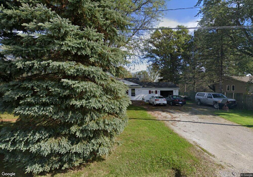
470 Burns Rd Kimball, MI 48074
Estimated Value: $122,634 - $227,000
3
Beds
1
Bath
1,000
Sq Ft
$173/Sq Ft
Est. Value
About This Home
This home is located at 470 Burns Rd, Kimball, MI 48074 and is currently estimated at $173,159, approximately $173 per square foot. 470 Burns Rd is a home located in St. Clair County with nearby schools including Marysville High School.
Ownership History
Date
Name
Owned For
Owner Type
Purchase Details
Closed on
Nov 18, 2011
Sold by
Beindit Tracy J and Hornbacher Tracy J
Bought by
Wormsbacher Bylnn
Current Estimated Value
Purchase Details
Closed on
Dec 28, 2005
Sold by
Tapert Todd T and Tapert Jessica L
Bought by
Hornbacher Tracy J
Home Financials for this Owner
Home Financials are based on the most recent Mortgage that was taken out on this home.
Original Mortgage
$128,000
Interest Rate
6.4%
Mortgage Type
New Conventional
Create a Home Valuation Report for This Property
The Home Valuation Report is an in-depth analysis detailing your home's value as well as a comparison with similar homes in the area
Home Values in the Area
Average Home Value in this Area
Purchase History
| Date | Buyer | Sale Price | Title Company |
|---|---|---|---|
| Wormsbacher Bylnn | $60,500 | None Available | |
| Hornbacher Tracy J | $128,000 | None Available |
Source: Public Records
Mortgage History
| Date | Status | Borrower | Loan Amount |
|---|---|---|---|
| Previous Owner | Hornbacher Tracy J | $128,000 |
Source: Public Records
Tax History
| Year | Tax Paid | Tax Assessment Tax Assessment Total Assessment is a certain percentage of the fair market value that is determined by local assessors to be the total taxable value of land and additions on the property. | Land | Improvement |
|---|---|---|---|---|
| 2025 | $385 | $42,300 | $0 | $0 |
| 2024 | $373 | $48,300 | $0 | $0 |
| 2023 | $355 | $46,200 | $0 | $0 |
| 2022 | $923 | $41,300 | $0 | $0 |
| 2020 | $823 | $35,600 | $0 | $35,600 |
| 2019 | $808 | $30,300 | $0 | $0 |
| 2018 | $789 | $43,200 | $0 | $0 |
| 2016 | $305 | $40,200 | $0 | $0 |
| 2015 | -- | $36,100 | $9,400 | $26,700 |
| 2014 | -- | $26,200 | $9,400 | $16,800 |
| 2013 | -- | $36,900 | $0 | $0 |
Source: Public Records
Map
Nearby Homes
- 0 Mayer Rd Unit Lot- 5
- 0 Mayer Rd Unit Lot- 6
- 1040 Mayer Rd
- 0 Richman Rd Unit 50197304
- 6776 Ravenswood Rd
- 385 Mayer Rd
- 00 Smiths Creek Rd Smiths Creek Rd
- 6417 Dove Rd
- 00 Drexler Rd
- 8237 Lambs Rd
- 1900 Burns Rd
- 6154 Birch Creek Ct
- 00 Meskill Rd
- 0 Sparling & Mayer Rd Unit Lot- 4
- 5771 Gratiot Ave
- 0 Sparling Rd Unit 2210034403
- 0 Sparling Unit Lot-1
- 0 Sparling Unit Lot- 2
- 0 Sparling Unit Lot- 3
- 00 Griswold Rd
- 478 Burns Rd
- 464 Burns Rd
- 475 Burns Rd
- 467 Burns Rd
- 460 Burns Rd
- 434 Burns Rd
- 417 Burns Rd
- 7260 Smiths Creek Rd
- 7259 Smiths Creek Rd
- 7264 Smiths Creek Rd
- 7201 Smiths Creek Rd
- 416 Burns Rd
- 7261 Smiths Creek Rd
- 401 Henry St
- 7263 Smiths Creek Rd
- 400 Burns Rd
- 363 Burns Rd
- 7320 Smiths Creek Rd
- 7249 Smiths Creek Rd
- 358 Burns Rd
Your Personal Tour Guide
Ask me questions while you tour the home.