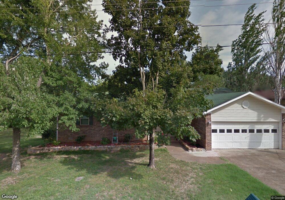
470 E Charles St Batesville, AR 72501
Estimated Value: $166,215 - $190,000
About This Home
This home is located at 470 E Charles St, Batesville, AR 72501 and is currently estimated at $174,554, approximately $94 per square foot. 470 E Charles St is a home located in Independence County with nearby schools including Batesville Junior High School, Batesville High School, and Hope Lutheran School.
Ownership History
We collect this data history from publicly available records. To have your information removed, we recommend requesting removal directly through your county’s website.
Purchase Details
Purchase Details
Purchase Details
Purchase Details
Purchase Details
Purchase Details
Purchase Details
Purchase History
We collect this data history from publicly available records. To have your information removed, we recommend requesting removal directly through your county’s website.
| Date | Buyer | Sale Price | Title Company |
|---|---|---|---|
| -- | None Available | ||
| -- | -- | ||
| $114,000 | -- | ||
| $114,000 | -- | ||
| $83,000 | -- | ||
| $83,000 | -- | ||
| $105,000 | -- | ||
| $105,000 | -- | ||
| $79,000 | -- | ||
| $59,000 | -- |
Tax History
We collect this data history from publicly available records. To have your information removed, we recommend requesting removal directly through your county’s website.
| Year | Tax Paid | Tax Assessment Tax Assessment Total Assessment is a certain percentage of the fair market value that is determined by local assessors to be the total taxable value of land and additions on the property. | Land | Improvement |
|---|---|---|---|---|
| 2025 | $709 | $22,660 | $2,180 | $20,480 |
| 2024 | $709 | $22,660 | $2,180 | $20,480 |
| 2023 | $784 | $22,660 | $2,180 | $20,480 |
| 2022 | $1,209 | $22,660 | $2,180 | $20,480 |
| 2021 | $1,209 | $22,660 | $2,180 | $20,480 |
| 2020 | $1,209 | $22,660 | $2,180 | $20,480 |
| 2019 | $1,159 | $21,730 | $1,940 | $19,790 |
| 2018 | $1,159 | $21,730 | $1,940 | $19,790 |
| 2017 | $1,146 | $21,730 | $1,940 | $19,790 |
| 2016 | $1,146 | $21,730 | $1,940 | $19,790 |
| 2015 | $1,138 | $21,730 | $1,940 | $19,790 |
| 2014 | $1,125 | $21,320 | $1,630 | $19,690 |
Map
- 283 E Chestnut St
- 748 Brooks St
- 784 Brooks St
- 253 N 8th St
- 814 Bayou St
- 795 N Central Ave
- 476 E Boswell St
- 292 E Boswell St
- 909 E Boswell St
- 1014 E Main St
- 365 S 8th St
- 447 S Broad St
- 1443 N Heights Ave
- 190 W Mark St
- 1775 Sun Valley Dr
- 5 Estes Way
- 548 S Broad St
- 718 Bates St
- 719 S Broad St
- 1461 Addie St
- 470 E Charles St
- E Charles St
- 420 E Charles St
- 500 E Charles St
- 475 E Charles St
- 490 E Charles St
- 405 E Charles St
- 405 E Charles St
- 390 E Charles St
- 505 E Charles St
- 505 N Hill St
- 510 E Charles St
- 370 E Charles St
- 350 E Charles St
- 420 E Chestnut St
- 430 E Chestnut St
- 520 E Charles St
- 595 N Hill St
- 470 E Chestnut St
- 415 E Chestnut 1o9erh434dl4
Ask me questions while you tour the home.