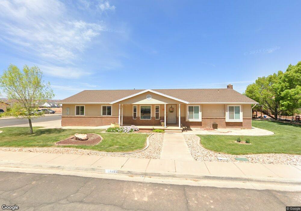
471 E Stanley Cir Washington, UT 84780
Estimated Value: $544,651 - $711,000
4
Beds
3
Baths
1,926
Sq Ft
$333/Sq Ft
Est. Value
About This Home
This home is located at 471 E Stanley Cir, Washington, UT 84780 and is currently estimated at $642,163, approximately $333 per square foot. 471 E Stanley Cir is a home located in Washington County with nearby schools including Riverside School, Fossil Ridge Intermediate School, and Pine View Middle School.
Ownership History
Date
Name
Owned For
Owner Type
Purchase Details
Closed on
Sep 28, 2022
Sold by
Neilson Russell M
Bought by
Russell M Neilson And Tonya Neilson Revocable
Current Estimated Value
Purchase Details
Closed on
Oct 12, 2006
Sold by
Neilson Russell M
Bought by
Neilson Russell M and Neilson Tonya
Home Financials for this Owner
Home Financials are based on the most recent Mortgage that was taken out on this home.
Original Mortgage
$182,000
Interest Rate
6.39%
Mortgage Type
New Conventional
Create a Home Valuation Report for This Property
The Home Valuation Report is an in-depth analysis detailing your home's value as well as a comparison with similar homes in the area
Purchase History
| Date | Buyer | Sale Price | Title Company |
|---|---|---|---|
| Russell M Neilson And Tonya Neilson Revocable | -- | -- | |
| Neilson Russell M | -- | Atlas Title Co | |
| Neilson Russell M | -- | None Available |
Source: Public Records
Mortgage History
| Date | Status | Borrower | Loan Amount |
|---|---|---|---|
| Previous Owner | Neilson Russell M | $182,000 |
Source: Public Records
Tax History
| Year | Tax Paid | Tax Assessment Tax Assessment Total Assessment is a certain percentage of the fair market value that is determined by local assessors to be the total taxable value of land and additions on the property. | Land | Improvement |
|---|---|---|---|---|
| 2025 | $1,861 | $280,335 | $60,115 | $220,220 |
| 2023 | $1,832 | $274,890 | $60,115 | $214,775 |
| 2022 | $2,140 | $302,225 | $52,250 | $249,975 |
| 2021 | $1,770 | $371,600 | $71,300 | $300,300 |
| 2020 | $1,614 | $320,500 | $61,800 | $258,700 |
| 2019 | $1,575 | $305,500 | $57,000 | $248,500 |
| 2018 | $1,515 | $147,730 | $0 | $0 |
| 2017 | $1,327 | $129,415 | $0 | $0 |
| 2016 | $1,387 | $125,235 | $0 | $0 |
| 2015 | $1,346 | $116,985 | $0 | $0 |
| 2014 | $1,225 | $107,195 | $0 | $0 |
Source: Public Records
Map
Nearby Homes
- Lot 54 Haystack Ln
- 454 E Old Stone
- Lot 30 Old Stone Cove
- 1883 S Old Stone
- 1967 Heritage Fields Dr
- 1877 Heritage Fields Dr
- 1924 S Cyclone Dr Unit 264
- 1912 S Cyclone Dr Unit 263
- 1863 S Heritage Fields Dr
- 1923 S Cyclone Dr Unit 255
- 1904 S Cyclone Dr Unit 262
- 1903 S Cyclone Dr Unit 253
- 1792 S Roy Ct
- 2038 Great Basin Dr
- 1759 S Vilate Dr
- 1906 S Bridle Cir
- 1848 S Bridle Cir
- 1935 S Great Basin Dr
- 1845 S Pommel Cir
- 720 E Meadow Ln
- 2000 Franklin Dr
- 456 E 2000 S
- 489 E Stanley Cir
- 470 E Stanley Cir
- 492 E Stanley Cir
- 2020 Franklin Dr
- 491 E Stanley Cir
- 471 E Kays Cir
- 510 E Stanley Cir
- 485 E Kays Cir
- 2032 Franklin Dr
- 0 Franklin Dr
- 493 E Kays Cir
- 493 Kay's Cir
- 2061 S Nichols Dr
- 2044 Franklin Dr
- 2060 S Nichols Dr
- 2100 S 500 E (Nichols Peak Rd)
- 468 E Kays Cir
- 503 E Kays Cir
Your Personal Tour Guide
Ask me questions while you tour the home.