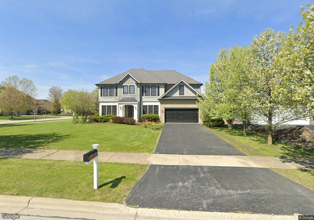
472 Mount Ct North Aurora, IL 60542
Estimated Value: $649,633 - $730,000
5
Beds
4
Baths
3,899
Sq Ft
$176/Sq Ft
Est. Value
About This Home
This home is located at 472 Mount Ct, North Aurora, IL 60542 and is currently estimated at $687,658, approximately $176 per square foot. 472 Mount Ct is a home located in Kane County with nearby schools including Goodwin Elementary School, Jewel Middle School, and West Aurora High School.
Ownership History
Date
Name
Owned For
Owner Type
Purchase Details
Closed on
Mar 18, 2005
Sold by
Gladstone Acquisitions Llc
Bought by
Nazir Sadia
Current Estimated Value
Home Financials for this Owner
Home Financials are based on the most recent Mortgage that was taken out on this home.
Original Mortgage
$420,718
Outstanding Balance
$204,194
Interest Rate
5.37%
Mortgage Type
Purchase Money Mortgage
Estimated Equity
$483,464
Create a Home Valuation Report for This Property
The Home Valuation Report is an in-depth analysis detailing your home's value as well as a comparison with similar homes in the area
Home Values in the Area
Average Home Value in this Area
Purchase History
| Date | Buyer | Sale Price | Title Company |
|---|---|---|---|
| Nazir Sadia | $526,000 | Chicago Title Insurance Comp |
Source: Public Records
Mortgage History
| Date | Status | Borrower | Loan Amount |
|---|---|---|---|
| Open | Nazir Sadia | $420,718 | |
| Closed | Nazir Sadia | $52,590 |
Source: Public Records
Tax History
| Year | Tax Paid | Tax Assessment Tax Assessment Total Assessment is a certain percentage of the fair market value that is determined by local assessors to be the total taxable value of land and additions on the property. | Land | Improvement |
|---|---|---|---|---|
| 2024 | $11,727 | $164,015 | $24,562 | $139,453 |
| 2023 | $11,462 | $148,861 | $22,293 | $126,568 |
| 2022 | $11,001 | $139,123 | $20,835 | $118,288 |
| 2021 | $10,707 | $131,945 | $19,760 | $112,185 |
| 2020 | $10,675 | $129,408 | $19,380 | $110,028 |
| 2019 | $10,802 | $124,827 | $18,694 | $106,133 |
| 2018 | $10,722 | $120,072 | $17,982 | $102,090 |
| 2017 | $10,733 | $116,113 | $17,389 | $98,724 |
| 2016 | $10,719 | $112,732 | $16,883 | $95,849 |
| 2015 | -- | $110,166 | $16,499 | $93,667 |
| 2014 | -- | $106,699 | $15,980 | $90,719 |
| 2013 | -- | $104,617 | $15,668 | $88,949 |
Source: Public Records
Map
Nearby Homes
- 413 N Sycamore Ln
- 448 Prairie Ridge Ln
- 444 Prairie Ridge Ln
- 423 Prairie Ridge Ln
- 357 Pheasant Hill Dr
- 415 Mallard Point Dr
- 459 Prairie Ridge Ln
- 415 Juniper Dr
- 451 Pheasant Hill Dr
- 406 Juniper Dr
- 422 Princeton Dr
- 208 W State St
- 28 S Willow Way
- 2S904 Heritage Glen Ct
- 116 Briar Ln Unit 2
- 111 Hidden Creek Ln Unit 286
- 317 Hidden Creek Ln Unit 317
- 10 S Grant St
- 81 Parkside Ct Unit 2
- 233 Spring Ct
- 476 Mount Ct
- 480 Mount Ct
- 429 N Sycamore Ln
- 433 N Sycamore Ln
- 462 Fox Crossing Ave
- 466 Fox Crossing Ave
- 458 Fox Crossing Ave
- 437 N Sycamore Ln
- 417 N Sycamore Ln
- 471 Mount Ct
- 484 Mount Ct
- 454 Fox Crossing Ave
- 475 Mount Ct
- 441 N Sycamore Ln
- 479 Mount Ct
- 450 Fox Crossing Ave
- 445 N Sycamore Ln
- 409 N Sycamore Ln
- 332 Pheasant Hill Dr
- 449 N Sycamore Ln
Your Personal Tour Guide
Ask me questions while you tour the home.