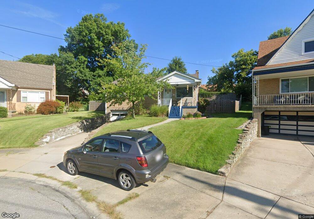
4730 Embrett Ct Cincinnati, OH 45238
West Price Hill NeighborhoodEstimated Value: $168,361 - $187,000
4
Beds
2
Baths
1,036
Sq Ft
$171/Sq Ft
Est. Value
About This Home
This home is located at 4730 Embrett Ct, Cincinnati, OH 45238 and is currently estimated at $177,340, approximately $171 per square foot. 4730 Embrett Ct is a home located in Hamilton County with nearby schools including Carson School, Gilbert A. Dater High School, and Western Hills High School.
Ownership History
Date
Name
Owned For
Owner Type
Purchase Details
Closed on
Jan 10, 2020
Sold by
Evans Tara Y and Riley John W
Bought by
Krueger Robyn and Jones Eric D
Current Estimated Value
Purchase Details
Closed on
Apr 2, 2002
Sold by
Dimuzio Paul V
Bought by
Kenner Benjamin
Home Financials for this Owner
Home Financials are based on the most recent Mortgage that was taken out on this home.
Original Mortgage
$75,520
Interest Rate
8.25%
Purchase Details
Closed on
Mar 16, 1995
Sold by
Centrulla Tina and Dimuzio Tina
Bought by
Dimuzio Paul V
Purchase Details
Closed on
Mar 30, 1994
Sold by
Rehage Marcella
Bought by
Dimuzio Paul V and Dimuzio Tina
Home Financials for this Owner
Home Financials are based on the most recent Mortgage that was taken out on this home.
Original Mortgage
$72,400
Interest Rate
7.35%
Mortgage Type
VA
Create a Home Valuation Report for This Property
The Home Valuation Report is an in-depth analysis detailing your home's value as well as a comparison with similar homes in the area
Home Values in the Area
Average Home Value in this Area
Purchase History
| Date | Buyer | Sale Price | Title Company |
|---|---|---|---|
| Krueger Robyn | $98,300 | Lawyers Title Of Cincinnati | |
| Kenner Benjamin | $94,400 | Accurate Title Solutions | |
| Dimuzio Paul V | -- | -- | |
| Dimuzio Paul V | -- | -- |
Source: Public Records
Mortgage History
| Date | Status | Borrower | Loan Amount |
|---|---|---|---|
| Previous Owner | Kenner Benjamin | $75,520 | |
| Previous Owner | Dimuzio Paul V | $72,400 | |
| Closed | Kenner Benjamin | $18,880 |
Source: Public Records
Tax History
| Year | Tax Paid | Tax Assessment Tax Assessment Total Assessment is a certain percentage of the fair market value that is determined by local assessors to be the total taxable value of land and additions on the property. | Land | Improvement |
|---|---|---|---|---|
| 2025 | $2,372 | $38,437 | $5,390 | $33,047 |
| 2023 | $2,352 | $38,437 | $5,390 | $33,047 |
| 2022 | $2,347 | $34,405 | $5,390 | $29,015 |
| 2021 | $2,258 | $34,405 | $5,390 | $29,015 |
| 2020 | $2,324 | $34,405 | $5,390 | $29,015 |
| 2019 | $1,745 | $23,622 | $4,900 | $18,722 |
| 2018 | $1,748 | $23,622 | $4,900 | $18,722 |
| 2017 | $1,660 | $23,622 | $4,900 | $18,722 |
| 2016 | $1,765 | $24,756 | $5,390 | $19,366 |
| 2015 | $1,591 | $24,756 | $5,390 | $19,366 |
| 2014 | $1,603 | $24,756 | $5,390 | $19,366 |
| 2013 | $1,852 | $28,133 | $6,125 | $22,008 |
Source: Public Records
Map
Nearby Homes
- 4716 Embrett Ct
- 4760 Clevesdale Dr
- 1782 Ashbrook Dr
- 1778 Ashbrook Dr
- 4730 Prosperity Place
- 4734 Prosperity Place
- 1735 Ashbrook Dr
- 1702 Ashbrook Dr
- 4778 Prosperity Place
- 4709 Guerley Rd
- 4808 Guerley Rd
- 4817 Prosperity Place
- 4827 Prosperity Place
- 4849 Prosperity Place
- 4965 Glenway Ave
- 1153 Omena Place
- 1144 Carmania Ave
- 4925 Shirley Place
- 1059 Lockman Ave
- 1127 Rulison Ave
- 4724 Embrett Ct
- 4734 Embrett Ct
- 1750 Tuxworth Ave
- 1754 Tuxworth Ave
- 4720 Embrett Ct
- 1746 Tuxworth Ave
- 1742 Tuxworth Ave
- 4735 Embrett Ct
- 1764 Tuxworth Ave
- 1740 Admiral Ct
- 4725 Embrett Ct
- 4731 Embrett Ct
- 1768 Tuxworth Ave
- 1738 Tuxworth Ave
- 1736 Admiral Ct
- 4721 Embrett Ct
- 4712 Embrett Ct
- 1772 Tuxworth Ave
- 4717 Embrett Ct
- 1734 Tuxworth Ave
Your Personal Tour Guide
Ask me questions while you tour the home.