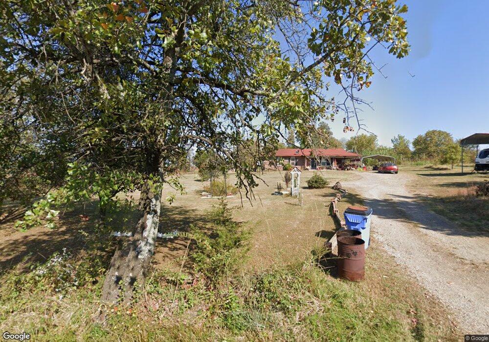
473771 E 1050 Rd Muldrow, OK 74948
Estimated Value: $106,000 - $206,000
3
Beds
1
Bath
1,000
Sq Ft
$149/Sq Ft
Est. Value
About This Home
This home is located at 473771 E 1050 Rd, Muldrow, OK 74948 and is currently estimated at $149,331, approximately $149 per square foot. 473771 E 1050 Rd is a home located in Sequoyah County with nearby schools including Muldrow Elementary School, Muldrow Middle School, and Muldrow High School.
Ownership History
Date
Name
Owned For
Owner Type
Purchase Details
Closed on
Dec 2, 2021
Sold by
Gordon and John
Bought by
Colman Daley
Current Estimated Value
Purchase Details
Closed on
Jan 7, 2021
Sold by
Coleman Daley Delane
Bought by
Coleman Daley Delane and Coleman Roy Lee
Purchase Details
Closed on
Feb 21, 2019
Sold by
Coleman Roy Lee and Coleman Kathy Sue
Bought by
Coleman Dale Delane
Purchase Details
Closed on
Nov 6, 2002
Sold by
Kathy Coleman
Bought by
Roy Lee Coleman
Purchase Details
Closed on
Feb 9, 1999
Sold by
Housing Auth Of Cherokee
Bought by
Coleman Roy Lee and Coleman Kathy
Create a Home Valuation Report for This Property
The Home Valuation Report is an in-depth analysis detailing your home's value as well as a comparison with similar homes in the area
Purchase History
| Date | Buyer | Sale Price | Title Company |
|---|---|---|---|
| Colman Daley | $20,000 | None Listed On Document | |
| Coleman Daley Delane | -- | None Available | |
| Coleman Dale Delane | -- | None Available | |
| Roy Lee Coleman | -- | -- | |
| Coleman Roy Lee | -- | -- |
Source: Public Records
Tax History
| Year | Tax Paid | Tax Assessment Tax Assessment Total Assessment is a certain percentage of the fair market value that is determined by local assessors to be the total taxable value of land and additions on the property. | Land | Improvement |
|---|---|---|---|---|
| 2025 | $279 | $4,929 | $793 | $4,136 |
| 2024 | $279 | $4,786 | $770 | $4,016 |
| 2023 | $269 | $4,646 | $770 | $3,876 |
| 2022 | $249 | $4,511 | $770 | $3,741 |
| 2021 | $251 | $4,538 | $770 | $3,768 |
| 2020 | $322 | $4,538 | $770 | $3,768 |
| 2019 | $258 | $4,626 | $770 | $3,856 |
| 2018 | $263 | $4,703 | $770 | $3,933 |
| 2017 | $256 | $4,602 | $737 | $3,865 |
| 2016 | $247 | $4,470 | $705 | $3,765 |
| 2015 | $237 | $4,339 | $662 | $3,677 |
| 2014 | $228 | $4,213 | $633 | $3,580 |
Source: Public Records
Map
Nearby Homes
- 473365 E 1050 Rd
- 103891 Oklahoma 64b
- 475531 E 1050 Rd
- 106438 S 4757 Rd
- 106219 S 4757 Rd
- TBD Tract 4 E 1070 Rd
- 600 N Paw Rd
- TBD Tbd
- 600 Paw Rd
- lOT 27 Woodland Hills
- Lot 43 E 1028 Rd
- 106078 S 4715 Rd
- 102816 Oklahoma 64b
- TBD E 1045 Rd
- 471804 E 1070 Rd
- 474132 Oklahoma 101
- TBD Oklahoma 101
- 104178 S 4769 Rd
- TBD S 4769 Rd
- 107774 S 4720
- 104929 S 4737 Rd
- 104907 S 4737 Rd
- 105148 S 4736 Rd
- 105154 S 4736 Rd
- 105160 S 4736 Rd
- 473523 E 1049 Rd
- 473973 E 1050 Rd
- 105205 S 4738 Rd
- 105048 State Highway 64b
- 104557 State Highway 64b
- 105088 S 4736 Rd
- 105114 S 4736 Rd
- 105033 State Highway 64b
- 105122 S 4736 Rd
- 105124 S 4736 Rd
- 105051 State Highway 64b
- 105142 S 4736 Rd
- 105120 S 4736 Rd
- 104814 State Highway 64b
- 474066 E 1050 Rd
Your Personal Tour Guide
Ask me questions while you tour the home.