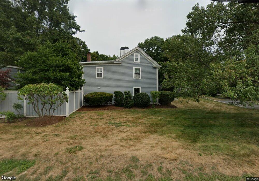
474 Old Bedford Rd Concord, MA 01742
Estimated Value: $846,000 - $1,442,000
3
Beds
3
Baths
2,289
Sq Ft
$492/Sq Ft
Est. Value
About This Home
This home is located at 474 Old Bedford Rd, Concord, MA 01742 and is currently estimated at $1,126,903, approximately $492 per square foot. 474 Old Bedford Rd is a home located in Middlesex County with nearby schools including Alcott Elementary School, Concord Middle School, and Concord Carlisle High School.
Ownership History
Date
Name
Owned For
Owner Type
Purchase Details
Closed on
May 17, 1994
Sold by
Hunter Dianne M
Bought by
Conley Deborah W and Conley Clinton J
Current Estimated Value
Home Financials for this Owner
Home Financials are based on the most recent Mortgage that was taken out on this home.
Original Mortgage
$115,000
Interest Rate
7.93%
Mortgage Type
Purchase Money Mortgage
Purchase Details
Closed on
Mar 16, 1987
Sold by
In Macdonald Blough
Bought by
Carpenter Alden
Create a Home Valuation Report for This Property
The Home Valuation Report is an in-depth analysis detailing your home's value as well as a comparison with similar homes in the area
Home Values in the Area
Average Home Value in this Area
Purchase History
| Date | Buyer | Sale Price | Title Company |
|---|---|---|---|
| Conley Deborah W | $273,000 | -- | |
| Carpenter Alden | $380,000 | -- |
Source: Public Records
Mortgage History
| Date | Status | Borrower | Loan Amount |
|---|---|---|---|
| Open | Carpenter Alden | $109,750 | |
| Closed | Carpenter Alden | $122,300 | |
| Closed | Carpenter Alden | $88,000 | |
| Closed | Carpenter Alden | $115,000 |
Source: Public Records
Tax History
| Year | Tax Paid | Tax Assessment Tax Assessment Total Assessment is a certain percentage of the fair market value that is determined by local assessors to be the total taxable value of land and additions on the property. | Land | Improvement |
|---|---|---|---|---|
| 2025 | $97 | $728,300 | $0 | $728,300 |
| 2024 | $9,301 | $708,400 | $0 | $708,400 |
| 2023 | $9,119 | $703,600 | $0 | $703,600 |
| 2022 | $9,073 | $614,700 | $0 | $614,700 |
| 2021 | $8,667 | $588,800 | $0 | $588,800 |
| 2020 | $8,379 | $588,800 | $0 | $588,800 |
| 2019 | $8,277 | $583,300 | $0 | $583,300 |
| 2018 | $8,197 | $573,600 | $0 | $573,600 |
| 2017 | $8,199 | $582,700 | $0 | $582,700 |
| 2016 | $7,493 | $538,300 | $0 | $538,300 |
| 2015 | $7,202 | $504,000 | $0 | $504,000 |
Source: Public Records
Map
Nearby Homes
- 22 Hatch Farm Ln
- 28 Hatch Farm Ln
- 10 Hatch Farm Ln
- 16 Hatch Farm Ln
- 7 Blue Heron Way
- 6 Parker Rd
- 612 Lexington Rd
- 96 Independence Rd
- 51 Revolutionary Rd
- 50 Wayside Rd
- 97 Hawthorne Ln
- 212 Hawthorne Ln
- 1 Glenridge Dr
- 646 Cambridge Turnpike
- 105 Lexington Rd
- 70 Lexington Rd
- 5 Hillcrest Rd
- 44 Sarah Way
- 1409 Monument St
- 181 Stow St
- 472 Old Bedford Rd
- 468 Old Bedford Rd
- 470 Old Bedford Rd
- 488 Old Bedford Rd
- 498 Old Bedford Rd
- 450 Old Bedford Rd
- 461 Old Bedford Rd
- 438 Old Bedford Rd
- 4 Granite Post Rd Unit 17
- 4 Granite Post Rd
- 4 Granite Post Rd
- 4 Granite Post Rd Unit 4
- 4 Granite Post Rd
- 505 Old Bedford Rd
- 449 Old Bedford Rd
- 506 Old Bedford Rd
- 5 Granite Post Rd Unit 25
- 7 Granite Post Rd Unit 37
- 3 Granite Post Rd Unit 11
- 430 Old Bedford Rd
Your Personal Tour Guide
Ask me questions while you tour the home.