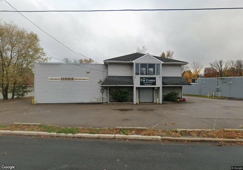
474 Route 38 E Maple Shade, NJ 08052
Estimated Value: $544,834
Studio
--
Bath
4,137
Sq Ft
$132/Sq Ft
Est. Value
About This Home
This home is located at 474 Route 38 E, Maple Shade, NJ 08052 and is currently estimated at $544,834, approximately $131 per square foot. 474 Route 38 E is a home located in Burlington County with nearby schools including Maude M. Wilkins Elementary School, Ralph J Steinhauer Elementary School, and Howard R Yocum School.
Ownership History
Date
Name
Owned For
Owner Type
Purchase Details
Closed on
Dec 8, 2014
Sold by
Diane Realty Inc
Bought by
Akj Maple Shade Realty Llc
Current Estimated Value
Home Financials for this Owner
Home Financials are based on the most recent Mortgage that was taken out on this home.
Original Mortgage
$206,250
Outstanding Balance
$158,393
Interest Rate
3.99%
Mortgage Type
Commercial
Estimated Equity
$386,441
Create a Home Valuation Report for This Property
The Home Valuation Report is an in-depth analysis detailing your home's value as well as a comparison with similar homes in the area
Home Values in the Area
Average Home Value in this Area
Purchase History
| Date | Buyer | Sale Price | Title Company |
|---|---|---|---|
| Akj Maple Shade Realty Llc | $275,000 | First American Title Ins Co |
Source: Public Records
Mortgage History
| Date | Status | Borrower | Loan Amount |
|---|---|---|---|
| Open | Akj Maple Shade Realty Llc | $206,250 |
Source: Public Records
Tax History
| Year | Tax Paid | Tax Assessment Tax Assessment Total Assessment is a certain percentage of the fair market value that is determined by local assessors to be the total taxable value of land and additions on the property. | Land | Improvement |
|---|---|---|---|---|
| 2025 | $13,286 | $350,000 | $260,000 | $90,000 |
| 2024 | $12,901 | $350,000 | $260,000 | $90,000 |
| 2023 | $12,901 | $350,000 | $260,000 | $90,000 |
| 2022 | $12,702 | $350,000 | $260,000 | $90,000 |
| 2021 | $12,579 | $350,000 | $260,000 | $90,000 |
| 2020 | $12,614 | $350,000 | $260,000 | $90,000 |
| 2019 | $12,152 | $350,000 | $260,000 | $90,000 |
| 2018 | $11,942 | $350,000 | $260,000 | $90,000 |
| 2017 | $13,404 | $397,500 | $294,600 | $102,900 |
| 2016 | $13,205 | $397,500 | $294,600 | $102,900 |
| 2015 | $12,919 | $397,500 | $294,600 | $102,900 |
| 2014 | $12,525 | $397,500 | $294,600 | $102,900 |
Source: Public Records
Map
Nearby Homes
- 180 Cherry Tree Ln
- 121 Weather Vane Dr
- 114 Weather Vane Dr
- 106 W Mill Rd
- 226 Ruth Ave
- 223 Ruth Ave
- 109 E Mill Rd
- 3001 Church Rd
- 204 E Mill Rd
- 102 Kings Croft
- 427 Cutler Ave
- 7 Kings Hwy N
- 734 Kings Croft
- 66 W Center Ave
- 28 W Center Ave
- 708 Kings Croft Unit C0708
- 318 Kings Croft
- 606 Kings Croft
- 8 Fountain Ct
- 5 S Syracuse Dr
- $15 sq.ft. 470 Route 38 E
- 470 Route 38 E
- 480 Route 38 E
- 486 Route 38 E
- 130 W Rudderow Ave
- 11 E Rudderow Ave
- 646 S Forklanding Rd
- 660 Buttonwood Ave
- 644 S Forklanding Rd
- 243 Route 38
- 642 S Forklanding Rd
- 216 W Rudderow Ave
- 623 Cutler Ave
- 461 Route 38 W
- 636 S Forklanding Rd
- 152 Cherry Tree Ln
- 150 Cherry Tree Ln
- 154 Cherry Tree Ln
- 148 Cherry Tree Ln
- 634 S Forklanding Rd
Your Personal Tour Guide
Ask me questions while you tour the home.