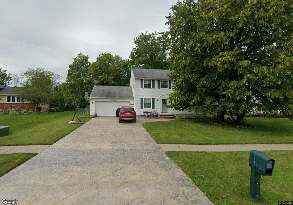
4744 Ruby Ln Brunswick, OH 44212
Estimated Value: $305,250 - $361,000
4
Beds
3
Baths
2,016
Sq Ft
$167/Sq Ft
Est. Value
About This Home
This home is located at 4744 Ruby Ln, Brunswick, OH 44212 and is currently estimated at $335,813, approximately $166 per square foot. 4744 Ruby Ln is a home located in Medina County with nearby schools including Brunswick Memorial Elementary School, Willets Middle School, and Brunswick High School.
Ownership History
Date
Name
Owned For
Owner Type
Purchase Details
Closed on
Feb 8, 2007
Sold by
Gould Stephanie
Bought by
Zarife Nicole S
Current Estimated Value
Home Financials for this Owner
Home Financials are based on the most recent Mortgage that was taken out on this home.
Original Mortgage
$169,100
Outstanding Balance
$101,621
Interest Rate
6.22%
Mortgage Type
Future Advance Clause Open End Mortgage
Estimated Equity
$234,192
Purchase Details
Closed on
Mar 31, 2006
Sold by
Gould James R
Bought by
Gould Stephanie
Create a Home Valuation Report for This Property
The Home Valuation Report is an in-depth analysis detailing your home's value as well as a comparison with similar homes in the area
Home Values in the Area
Average Home Value in this Area
Purchase History
| Date | Buyer | Sale Price | Title Company |
|---|---|---|---|
| Zarife Nicole S | $178,000 | -- | |
| Gould Stephanie | -- | -- |
Source: Public Records
Mortgage History
| Date | Status | Borrower | Loan Amount |
|---|---|---|---|
| Open | Zarife Nicole S | $169,100 |
Source: Public Records
Tax History
| Year | Tax Paid | Tax Assessment Tax Assessment Total Assessment is a certain percentage of the fair market value that is determined by local assessors to be the total taxable value of land and additions on the property. | Land | Improvement |
|---|---|---|---|---|
| 2024 | $4,912 | $78,750 | $22,400 | $56,350 |
| 2023 | $4,443 | $78,750 | $22,400 | $56,350 |
| 2022 | $4,220 | $78,750 | $22,400 | $56,350 |
| 2021 | $3,810 | $62,560 | $17,500 | $45,060 |
| 2020 | $3,461 | $62,560 | $17,500 | $45,060 |
| 2019 | $3,462 | $62,560 | $17,500 | $45,060 |
| 2018 | $3,156 | $54,890 | $15,370 | $39,520 |
| 2017 | $3,160 | $54,890 | $15,370 | $39,520 |
| 2016 | $3,158 | $54,890 | $15,370 | $39,520 |
| 2015 | $2,808 | $49,000 | $13,720 | $35,280 |
| 2014 | $2,802 | $49,000 | $13,720 | $35,280 |
| 2013 | $2,807 | $49,000 | $13,720 | $35,280 |
Source: Public Records
Map
Nearby Homes
- 4820 Emerald Ln
- 620 Topaz Ln
- 4571 Elm Ave
- 298 Substation Rd
- 86 Substation Rd
- 803 Substation Rd
- 647 Pearl Rd
- 455 Edge Park Ln
- 4242 Bennington Blvd
- 5221 Spruce Pointe Ln
- 4776 Aspen Oval
- 5415 Lake Forest Reserve Ln
- 5302 Spruce Pointe Ln
- 4344 Oak Ridge Trail
- 4340 Oak Ridge Trail
- 4332 Oak Ridge Trail
- 4431 Oak Ridge Trail
- 4336 Oak Ridge Trail
- 320 Marks Rd
- 5279 Creekside Blvd Unit T34
Your Personal Tour Guide
Ask me questions while you tour the home.