Estimated Value: $172,000 - $213,000
3
Beds
2
Baths
1,339
Sq Ft
$142/Sq Ft
Est. Value
About This Home
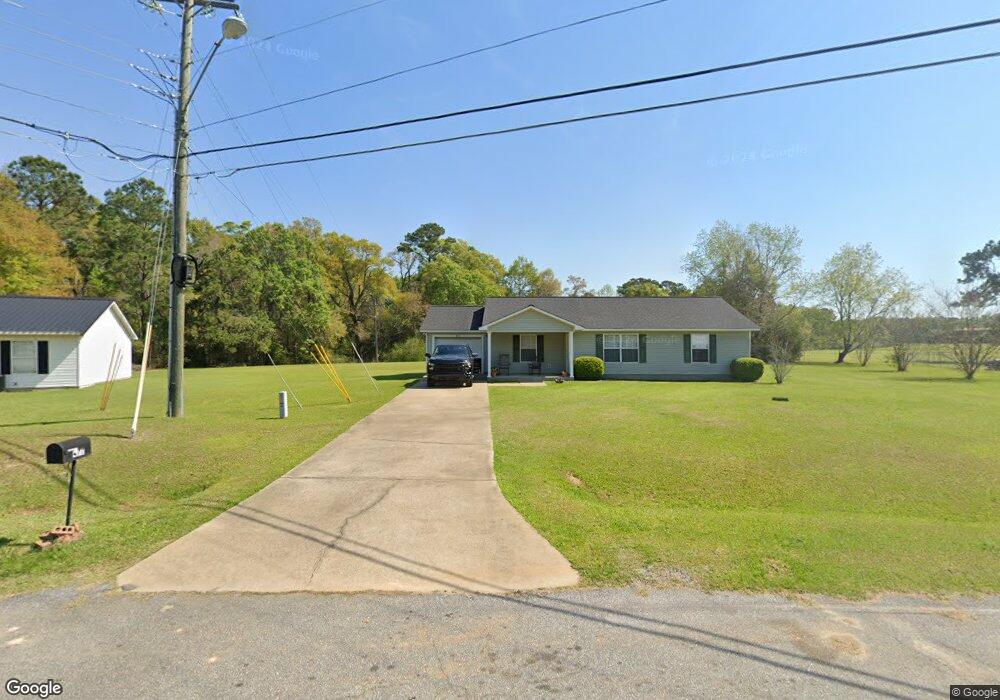
This home is located at 477 Bay Tree Rd, Cairo, GA 39828 and is currently estimated at $189,857, approximately $141 per square foot. 477 Bay Tree Rd is a home located in Grady County with nearby schools including Cairo High School.
Ownership History
Date
Name
Owned For
Owner Type
Purchase Details
Closed on
Feb 19, 2014
Sold by
Sec Of Housing & Urb
Bought by
Pizone Llc
Current Estimated Value
Purchase Details
Closed on
Sep 11, 2013
Sold by
Cruel Adrienne
Bought by
Bank Of America Na
Purchase Details
Closed on
Aug 6, 2013
Sold by
Bank Of America
Bought by
Sec Of Housing & Urban
Purchase Details
Closed on
Feb 25, 2008
Sold by
Bingham Dierdra G
Bought by
Cruel Adrienne
Home Financials for this Owner
Home Financials are based on the most recent Mortgage that was taken out on this home.
Original Mortgage
$92,547
Interest Rate
5.46%
Mortgage Type
FHA
Purchase Details
Closed on
Nov 27, 2001
Sold by
Wiregrass Homebuilders
Bought by
Bingham Diedra G
Purchase Details
Closed on
Dec 12, 1995
Sold by
Wiregrass Homebuilders
Bought by
Wiregrass Homebuilders
Purchase Details
Closed on
Mar 1, 1994
Bought by
Wiregrass Homebuilders
Create a Home Valuation Report for This Property
The Home Valuation Report is an in-depth analysis detailing your home's value as well as a comparison with similar homes in the area
Purchase History
| Date | Buyer | Sale Price | Title Company |
|---|---|---|---|
| Pizone Llc | $52,000 | -- | |
| Bank Of America Na | -- | -- | |
| Sec Of Housing & Urban | $47,580 | -- | |
| Bank Of America | $47,580 | -- | |
| Cruel Adrienne | $94,000 | -- | |
| Bingham Diedra G | -- | -- | |
| Wiregrass Homebuilders | -- | -- | |
| Wiregrass Homebuilders | -- | -- |
Source: Public Records
Mortgage History
| Date | Status | Borrower | Loan Amount |
|---|---|---|---|
| Previous Owner | Cruel Adrienne | $92,547 |
Source: Public Records
Tax History
| Year | Tax Paid | Tax Assessment Tax Assessment Total Assessment is a certain percentage of the fair market value that is determined by local assessors to be the total taxable value of land and additions on the property. | Land | Improvement |
|---|---|---|---|---|
| 2025 | $2,101 | $69,770 | $3,600 | $66,170 |
| 2024 | $2,101 | $62,780 | $3,600 | $59,180 |
| 2023 | $1,581 | $42,707 | $4,800 | $37,907 |
| 2022 | $1,644 | $42,707 | $4,800 | $37,907 |
| 2021 | $1,649 | $42,707 | $4,800 | $37,907 |
| 2020 | $1,653 | $42,707 | $4,800 | $37,907 |
| 2019 | $1,653 | $42,707 | $4,800 | $37,907 |
| 2018 | $1,583 | $43,039 | $4,800 | $38,239 |
| 2017 | $1,523 | $43,039 | $4,800 | $38,239 |
| 2016 | $1,318 | $36,422 | $4,800 | $31,622 |
| 2015 | $1,305 | $36,422 | $4,800 | $31,622 |
| 2014 | $1,305 | $36,422 | $4,800 | $31,622 |
| 2013 | -- | $32,154 | $4,800 | $27,354 |
Source: Public Records
Map
Nearby Homes
- 408 Bay Tree Rd NE
- 0 State Route 188
- 00 State Route 188
- 0 20th St NE
- 00 20th St NE
- 711 2nd Ave NE
- 66 22nd St NE
- 2690 U S 84
- 2975 U S 84
- 79 27th St NE
- 00 Blackberry Ln
- 00 Meridian Rd
- 00 Cuffhead Rd
- 00 Union Hill Rd
- 78.6 Ac Strickland Rd
- 21 24th St NE
- 4761 Hadley Ferry Rd
- 414 Woodland Rd
- 592 20th St SE
- 112 9th Ave NW
- 481 Bay Tree Rd NE
- 481 Bay Tree Rd
- 473 Bay Tree Rd
- 477 Bay Tree Rd NE
- 485 Bay Tree Rd
- 469 Bay Tree Rd
- 467 Bay Tree Rd
- 479 Bay Tree Rd
- 489 Bay Tree Rd
- 487 Bay Tree Rd NE
- 455 Bay Tree Rd
- 465 Bay Tree Rd
- 487 Bay Tree Rd
- 465 Bay Tree Rd NE
- 465 Bay Tree Rd NE
- 451 Bay Tree Rd
- 491 Bay Tree Rd
- 493 Bay Tree Rd
- 447 Bay Tree Rd
- 495 Bay Tree Rd
Your Personal Tour Guide
Ask me questions while you tour the home.