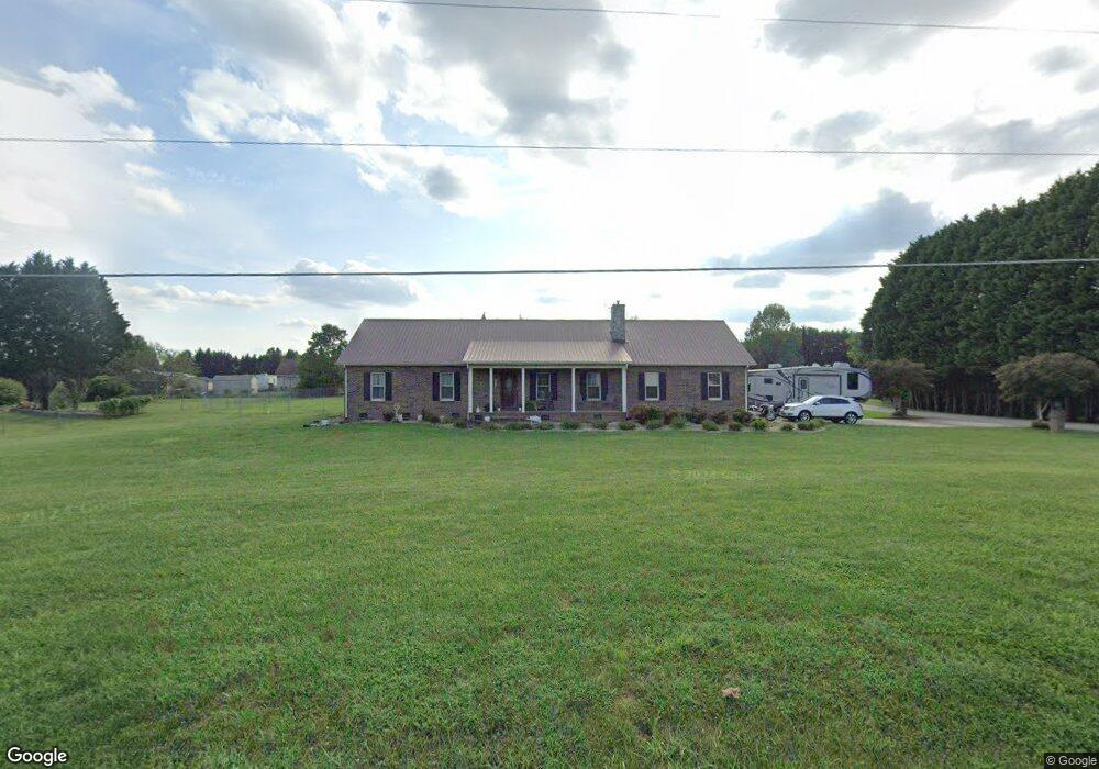
4787 Rifle Range Rd Conover, NC 28613
Estimated Value: $329,815 - $482,000
About This Home
This home is located at 4787 Rifle Range Rd, Conover, NC 28613 and is currently estimated at $387,204, approximately $226 per square foot. 4787 Rifle Range Rd is a home located in Catawba County with nearby schools including Lyle Creek Elementary School, River Bend Middle School, and Bunker Hill High School.
Ownership History
We collect this data history from publicly available records. To have your information removed, we recommend requesting removal directly through your county’s website.
Purchase Details
Purchase Details
Home Financials for this Owner
Home Financials are based on the most recent Mortgage that was taken out on this home.Purchase Details
Home Financials for this Owner
Home Financials are based on the most recent Mortgage that was taken out on this home.Purchase Details
Purchase Details
Home Financials for this Owner
Home Financials are based on the most recent Mortgage that was taken out on this home.Home Values in the Area
Average Home Value in this Area
Purchase History
We collect this data history from publicly available records. To have your information removed, we recommend requesting removal directly through your county’s website.
| Date | Buyer | Sale Price | Title Company |
|---|---|---|---|
| -- | None Listed On Document | ||
| $135,000 | None Available | ||
| $147,244 | None Available | ||
| -- | None Available | ||
| $155,000 | None Available |
Mortgage History
We collect this data history from publicly available records. To have your information removed, we recommend requesting removal directly through your county’s website.
| Date | Status | Borrower | Loan Amount |
|---|---|---|---|
| Previous Owner | $135,000 | ||
| Previous Owner | $139,500 |
Tax History
We collect this data history from publicly available records. To have your information removed, we recommend requesting removal directly through your county’s website.
| Year | Tax Paid | Tax Assessment Tax Assessment Total Assessment is a certain percentage of the fair market value that is determined by local assessors to be the total taxable value of land and additions on the property. | Land | Improvement |
|---|---|---|---|---|
| 2025 | $1,485 | $284,300 | $13,400 | $270,900 |
| 2024 | $1,485 | $284,300 | $13,400 | $270,900 |
| 2023 | $1,429 | $183,600 | $13,400 | $170,200 |
| 2022 | $1,276 | $183,600 | $13,400 | $170,200 |
| 2021 | $1,276 | $183,600 | $13,400 | $170,200 |
| 2020 | $1,276 | $183,600 | $13,400 | $170,200 |
| 2019 | $1,276 | $183,600 | $0 | $0 |
| 2018 | $1,143 | $164,500 | $13,300 | $151,200 |
| 2017 | $1,143 | $0 | $0 | $0 |
| 2016 | $1,143 | $0 | $0 | $0 |
| 2015 | $998 | $164,500 | $13,300 | $151,200 |
| 2014 | $998 | $166,300 | $13,300 | $153,000 |
Map
- 5069 W Piedmont Cir
- 4874 Stone Dr Unit 125
- 5208 W Piedmont Cir
- 1371 Millrace Dr
- 4932 Sandstone Dr
- 4548 Springs Rd
- 4531 Springs Rd
- 4543 Springs Rd
- 4829 County Home Rd
- 3951 Springs Rd
- 5126 Silver Tree Trail
- 3941 Springs Rd
- 4120 Village Blvd NW
- 3647 Charles St NW
- 3641 Charles St NW
- 3650 Charles St NW
- 3785 Pinecrest Dr NE Unit 155
- 3779 Pinecrest Dr NE Unit 154
- 3629 Charles St NW
- 3851 Maxwell Henry Ln NW
- 4778 Musket Way
- 4766 Musket Way
- 4763 Rifle Range Rd
- 4799 Rifle Range Rd
- 4752 Musket Way
- 4786 Rifle Range Rd
- 1124 Shoals Dr
- 4766 Rifle Range Rd
- 1133 Opal Creek Dr
- 4736 Musket Way
- 4769 Musket Way
- 4755 Rifle Range Rd
- 4777 Musket Way
- 4757 Musket Way
- 4798 Rifle Range Rd
- 1145 Opal Creek Dr
- 4776 Rifle Range Rd
- 4760 Rifle Range Rd
- 4749 Musket Way
- 1142 Shoals Dr
Ask me questions while you tour the home.