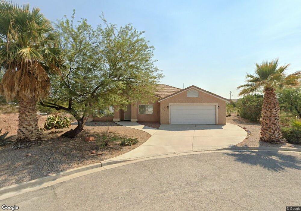
479 Rabee Ct Overton, NV 89040
Estimated Value: $315,000 - $388,000
3
Beds
2
Baths
1,587
Sq Ft
$222/Sq Ft
Est. Value
About This Home
This home is located at 479 Rabee Ct, Overton, NV 89040 and is currently estimated at $352,265, approximately $221 per square foot. 479 Rabee Ct is a home with nearby schools including Grant Bowler Elementary School, Mack Lyon Middle School, and Moapa Valley High School.
Ownership History
Date
Name
Owned For
Owner Type
Purchase Details
Closed on
Feb 15, 2007
Sold by
Holzer Howard
Bought by
Holzer Teresa
Current Estimated Value
Purchase Details
Closed on
Feb 14, 2007
Sold by
Hess Ulla E
Bought by
Holzer Teresa
Purchase Details
Closed on
Aug 9, 2002
Sold by
Pulsipher Kyle H and Pulsipher Sadie Lee
Bought by
Hess Albert B and Hess Ulla E
Home Financials for this Owner
Home Financials are based on the most recent Mortgage that was taken out on this home.
Original Mortgage
$136,800
Interest Rate
6.51%
Mortgage Type
Purchase Money Mortgage
Purchase Details
Closed on
Oct 5, 1999
Sold by
Pulsipher Kyle
Bought by
Pulsipher Kyle and Pulsipher Sadie Lee
Home Financials for this Owner
Home Financials are based on the most recent Mortgage that was taken out on this home.
Original Mortgage
$130,500
Interest Rate
7.76%
Mortgage Type
Purchase Money Mortgage
Create a Home Valuation Report for This Property
The Home Valuation Report is an in-depth analysis detailing your home's value as well as a comparison with similar homes in the area
Home Values in the Area
Average Home Value in this Area
Purchase History
| Date | Buyer | Sale Price | Title Company |
|---|---|---|---|
| Holzer Teresa | -- | Equity Title Of Nevada | |
| Holzer Teresa | $250,000 | Equity Title Of Nevada | |
| Hess Albert B | $144,000 | Fidelity National Title | |
| Pulsipher Kyle | -- | Fidelity National Title Agen |
Source: Public Records
Mortgage History
| Date | Status | Borrower | Loan Amount |
|---|---|---|---|
| Previous Owner | Hess Albert B | $136,800 | |
| Previous Owner | Pulsipher Kyle | $130,500 |
Source: Public Records
Tax History
| Year | Tax Paid | Tax Assessment Tax Assessment Total Assessment is a certain percentage of the fair market value that is determined by local assessors to be the total taxable value of land and additions on the property. | Land | Improvement |
|---|---|---|---|---|
| 2026 | $1,846 | $76,306 | $18,550 | $57,756 |
| 2025 | $1,846 | $75,612 | $16,940 | $58,672 |
| 2024 | $1,731 | $75,612 | $16,940 | $58,672 |
| 2023 | $1,731 | $69,782 | $14,000 | $55,782 |
| 2022 | $1,485 | $63,741 | $12,950 | $50,791 |
| 2021 | $1,444 | $61,338 | $12,950 | $48,388 |
| 2020 | $1,131 | $60,989 | $12,950 | $48,039 |
| 2019 | $1,060 | $60,359 | $12,950 | $47,409 |
| 2018 | $1,011 | $58,426 | $12,950 | $45,476 |
| 2017 | $1,405 | $55,597 | $9,625 | $45,972 |
| 2016 | $1,044 | $47,164 | $7,875 | $39,289 |
| 2015 | $1,090 | $36,193 | $7,875 | $28,318 |
| 2014 | $938 | $35,306 | $7,875 | $27,431 |
Source: Public Records
Map
Nearby Homes
- 467 Muddy Peak Ct
- 478 Muddy Peak Ct
- 2080 Lou St
- 0 Ryan Unit 2749414
- 0 W Shurtliff Ave
- 490 Kay Geng St
- 468 Adelle Ave
- 0 Adelle Ave
- 263 Trailzend Ave
- 478 W Ingram Ave
- 468 W Ingram Ave
- 0 Bryner Dr Unit 2653879
- 450 W Ingram Ave
- 768 Weiser Ridge St
- 0 N Moapa Valley Blvd and N Oliver St
- 203 Trailzend Ave
- 416 McDonald Ave
- 370 W McDonald Ave
- 516 White Domes Dr
- 683 W Ingram Ave
- 472 W Ryan Ave
- 467 Rabee Ct
- 466 Rabee Ct
- 478 Rabee Ct
- 479 Muddy Peak Ct
- 568 Lillian Condie Rd
- 580 Lillian Condie Rd
- 430 Rabee Ct
- 592 Lillian Condie Rd
- 420 W Ryan Ave
- 490 Muddy Peak Ct
- 466 Muddy Peak Ct
- 604 Lillian Condie Rd
- 575 Lou St
- 595 Lou St
- 616 Lillian Condie Rd
- 479 Corta Ave
- 530 L St
- 560 L St
- 769 Lou St
Your Personal Tour Guide
Ask me questions while you tour the home.