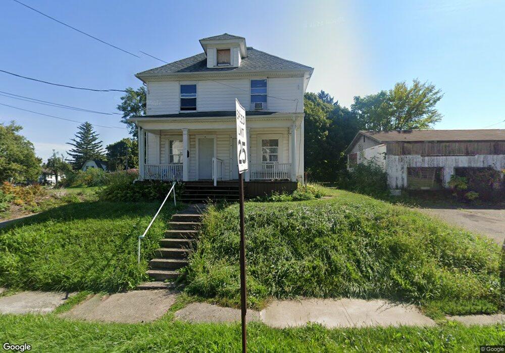
480 Bowman St Unit 482 Mansfield, OH 44903
Estimated Value: $73,000 - $88,000
4
Beds
2
Baths
1,716
Sq Ft
$47/Sq Ft
Est. Value
About This Home
This home is located at 480 Bowman St Unit 482, Mansfield, OH 44903 and is currently estimated at $80,595, approximately $46 per square foot. 480 Bowman St Unit 482 is a home located in Richland County with nearby schools including Goal Digital Academy, St. Peter's Elementary/Montessori School, and St. Peter's Junior High / High School.
Ownership History
Date
Name
Owned For
Owner Type
Purchase Details
Closed on
Jul 16, 2009
Sold by
Feagin Terry T and Feagin Terry
Bought by
B Woodruff Properties & Management Llc
Current Estimated Value
Purchase Details
Closed on
Oct 22, 2008
Sold by
Dawson Toni M and Hamilton Bart W
Bought by
Feagin Jerry
Purchase Details
Closed on
Aug 1, 1985
Create a Home Valuation Report for This Property
The Home Valuation Report is an in-depth analysis detailing your home's value as well as a comparison with similar homes in the area
Home Values in the Area
Average Home Value in this Area
Purchase History
| Date | Buyer | Sale Price | Title Company |
|---|---|---|---|
| B Woodruff Properties & Management Llc | $7,000 | Attorney | |
| Feagin Jerry | $2,800 | Chicago Title Agency Of Nort | |
| -- | $5,000 | -- |
Source: Public Records
Tax History
| Year | Tax Paid | Tax Assessment Tax Assessment Total Assessment is a certain percentage of the fair market value that is determined by local assessors to be the total taxable value of land and additions on the property. | Land | Improvement |
|---|---|---|---|---|
| 2025 | $486 | $10,150 | $1,290 | $8,860 |
| 2024 | $486 | $10,150 | $1,290 | $8,860 |
| 2023 | $486 | $10,150 | $1,290 | $8,860 |
| 2022 | $442 | $7,740 | $1,180 | $6,560 |
| 2021 | $548 | $7,740 | $1,180 | $6,560 |
| 2020 | $455 | $7,740 | $1,180 | $6,560 |
| 2019 | $505 | $7,740 | $1,180 | $6,560 |
| 2018 | $498 | $7,740 | $1,180 | $6,560 |
| 2017 | $505 | $7,740 | $1,180 | $6,560 |
| 2016 | $525 | $8,130 | $1,860 | $6,270 |
| 2015 | $501 | $8,130 | $1,860 | $6,270 |
| 2014 | $495 | $8,130 | $1,860 | $6,270 |
| 2012 | $399 | $8,560 | $1,960 | $6,600 |
Source: Public Records
Map
Nearby Homes
- 524 Lida St
- 580 N Mulberry St
- 118 Raymond Ave
- 375 Mcpherson St
- 0 Grant Rd Unit 5190994
- 319 Prescott St
- 0 Highway 30
- 368 W 6th St
- 447 Spayer Ln
- 444 W 6th St
- 219 W 5th St
- 344 W 5th St
- 572 France St
- 224 Atcheson Ave
- 245 W 4th St
- 0 State Route 314 Unit 9069650
- 688 Mcpherson St
- 346 Newman St
- 0 Lemley Ave Unit 9070540
- 604 W 4th St
Your Personal Tour Guide
Ask me questions while you tour the home.